
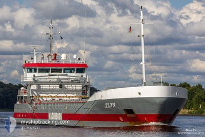
JOLYN
General Cargo
Current Trip
| Time Travelled | 1 day |
|---|---|
| Remaining Time | 1 day |
| Distance Travelled | 401.67 nm |
| Remaining Distance | 209.82 nm |
| AVG Speed | 8.4 Knots |
| MAX Speed | 12.7 Knots |
| AVG Wind | 11.2 knots |
| MAX Wind | 32.3 knots |
| MIN Temp | 5.4°C / 41.72°F |
| MAX Temp | 10.1°C / 50.18°F |
| Draught | 5.5 m |
| Position Received | Now |
Current Position
| Longitude | 4.70687° |
|---|---|
| Latitude | 53.47861° |
| Status | Under way using engine |
| Speed | 7.3 Knots |
| Course | 253.2° |
| Area | North Sea |
| Station | T-AIS |
| Position Received | Now |
Info
Information
The current position of JOLYN is in North Sea with coordinates 53.47861° / 4.70687° as reported on 2024-04-19 13:47 by AIS to our vessel tracker app. The vessel's current speed is 7.3 Knots and is heading at the port of TILBURY. The estimated time of arrival as calculated by MyShipTracking vessel tracking app is 2024-04-20 16:30 LT
The vessel JOLYN (IMO: 9374686, MMSI: 246544000) is a General Cargo that was built in 2007 ( 17 years old ). It's sailing under the flag of [NL] Netherlands.
In this page you can find informations about the vessels current position, last detected port calls, and current voyage information. If the vessels is not in coverage by AIS you will find the latest position.
The current position of JOLYN is detected by our AIS receivers and we are not responsible for the reliability of the data. The last position was recorded while the vessel was in Coverage by the Ais receivers of our vessel tracking app.
The current draught of JOLYN as reported by AIS is 5.5 meters
Weather
| Temperature | 7.4°C / 45.32°F |
|---|---|
| Wind Speed | 32 knots |
| Direction | 331° NNW |
| Pressure | 1008.1 hPa |
| Humidity | 81.3 % |
| Cloud Coverage | 12 % |
Featured Company
Last Port Calls
| Port | Arrival | Departure | Time In Port |
|---|---|---|---|
| 2024-04-13 10:58 | 2024-04-17 16:04 | 4 d | |
| 2024-04-11 04:14 | 2024-04-12 06:34 | 1 d | |
| 2024-04-08 12:37 | 2024-04-10 09:05 | 1 d | |
| 2024-03-26 05:47 | 2024-03-27 14:07 | 1 d | |
| 2024-03-17 15:33 | 2024-03-21 16:15 | 4 d | |
| 2024-03-13 18:25 | 2024-03-15 19:03 | 2 d | |
| 2024-03-12 20:08 | 2024-03-13 09:58 | 13 h | |
| 2024-03-11 11:53 | 2024-03-12 19:54 | 1 d | |
| 2024-02-28 22:15 | 2024-02-29 14:39 | 16 h | |
| 2024-02-26 18:04 | 2024-02-28 08:10 | 1 d |
Last Trips
| Origin | Departure | Destination | Arrival | Distance | |
|---|---|---|---|---|---|
| 2024-04-12 08:34 | 2024-04-13 12:58 | 266.52 nm | |||
| 2024-04-10 11:05 | 2024-04-11 06:14 | 177.47 nm | |||
| 2024-03-27 15:07 | 2024-04-08 14:37 | 1433.71 nm | |||
| 2024-03-21 17:15 | 2024-03-26 06:47 | 291.82 nm | |||
| 2024-03-15 20:03 | 2024-03-17 16:33 | 461.49 nm | |||
| 2024-03-13 10:58 | 2024-03-13 19:25 | 89.05 nm | |||
| 2024-03-12 20:54 | 2024-03-12 21:08 | 0.93 nm | |||
| 2024-02-29 15:39 | 2024-03-11 12:53 | 1934.72 nm | |||
| 2024-02-28 09:10 | 2024-02-28 23:15 | 160.37 nm | |||
| 2024-02-26 18:42 | 2024-02-26 19:04 | 1.43 nm |
Events
| Time | Event | Details | Position / Dest | Info |
|---|---|---|---|---|
| 2024-04-19 06:58 | Change Sea Area | Dutch part of the North Sea German part of the North Sea |
53.80197 / 6.27196
North Sea
|
Speed: 8.3 kn Course: 251.4° |
| 2024-04-19 00:49 | IN Coverage |
54.00796 / 7.60044
North Sea
|
Speed: 9.3 kn Course: 254.1° |
|
| 2024-04-18 21:33 | OUT of Coverage |
53.96899 / 8.57321
North Sea
|
Speed: 11 kn Course: 284° |
|
| 2024-04-18 18:49 | START Moving | 0.88 nm, South West of BRUNSBUETTEL |
53.89092 / 9.14566
GBTIL
|
Speed: 4.2 kn Course: 218° |
| 2024-04-18 18:41 | Detected in Sea | German part of the North Sea |
53.89246 / 9.14786
North Sea
|
Speed: Course: 214.2° |
| 2024-04-18 18:39 | STOP Moving | 0.76 nm, South West of BRUNSBUETTEL |
53.89249 / 9.14787
GBTIL
|
Speed: Course: 218° |
| 2024-04-18 14:36 | START Moving | 6.97 nm, North East of FISCHERHUTTE |
54.20048 / 9.55461
GBTIL
|
Speed: 4.1 kn Course: 232° |
| 2024-04-18 14:15 | STOP Moving | 7.11 nm, North East of FISCHERHUTTE |
54.20194 / 9.55795
GBTIL
|
Speed: 0.2 kn Course: 232° |
| 2024-04-18 09:28 | START Moving | 1.38 nm, South West of STICKENHΟRN SPORT |
54.36616 / 10.14099
GBTIL
|
Speed: 3.1 kn Course: 283° |
| 2024-04-18 08:55 | STOP Moving | 1.33 nm, South West of STICKENHΟRN SPORT |
54.36570 / 10.14408
GBTIL
|
Speed: 0.3 kn Course: 281° |