
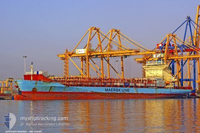
JEPPESEN MAERSK
Container Ship
Current Trip
| Time Travelled | 21 h, 24 mins |
|---|---|
| Remaining Time | --- |
| Distance Travelled | 6.68 nm |
| Remaining Distance | --- |
| AVG Speed | 10.7 Knots |
| MAX Speed | 11 Knots |
| AVG Wind | 10.1 knots |
| MAX Wind | 13.8 knots |
| MIN Temp | 26.4°C / 79.52°F |
| MAX Temp | 31.2°C / 88.16°F |
| Draught | 9.4 m |
| Position Received | 18 h, 25 m ago |
Current Position
| Longitude | -79.48926° |
|---|---|
| Latitude | 8.87233° |
| Status | At anchor |
| Speed | 0.4 Knots |
| Course | 16° |
| Area | North Pacific Ocean |
| Station | T-AIS |
| Position Received | 18 h, 25 m ago |
Info
Information
The current position of JEPPESEN MAERSK is in North Pacific Ocean with coordinates 8.87233° / -79.48926° as reported on 2024-04-24 23:05 by AIS to our vessel tracker app. The vessel's current speed is 0.4 Knots
The vessel JEPPESEN MAERSK (IMO: 9215165, MMSI: 219953000) is a Container Ship that was built in 2001 ( 23 years old ). It's sailing under the flag of [DK] Denmark.
In this page you can find informations about the vessels current position, last detected port calls, and current voyage information. If the vessels is not in coverage by AIS you will find the latest position.
The current position of JEPPESEN MAERSK is detected by our AIS receivers and we are not responsible for the reliability of the data. The last position was recorded while the vessel was in Coverage by the Ais receivers of our vessel tracking app.
The current draught of JEPPESEN MAERSK as reported by AIS is 9.4 meters
Weather
| Temperature | 27.5°C / 81.5°F |
|---|---|
| Wind Speed | 7 knots |
| Direction | 35° NE |
| Pressure | 1010.6 hPa |
| Humidity | 81.2 % |
| Cloud Coverage | 100 % |
Featured Company
Last Port Calls
| Port | Arrival | Departure | Time In Port |
|---|---|---|---|
| 2024-04-24 03:26 | 2024-04-24 20:06 | 16 h | |
| 2024-04-22 22:32 | 2024-04-22 22:46 | 14 m | |
| 2024-04-22 16:01 | 2024-04-22 22:18 | 6 h | |
| 2024-04-19 04:56 | 2024-04-19 20:43 | 15 h | |
| 2024-04-17 02:56 | 2024-04-17 17:21 | 14 h | |
| 2024-04-09 15:35 | 2024-04-11 05:38 | 1 d | |
| 2024-04-05 02:58 | 2024-04-05 19:03 | 16 h | |
| 2024-04-02 03:18 | 2024-04-02 23:02 | 19 h | |
| 2024-03-26 08:58 | 2024-03-27 16:53 | 1 d | |
| 2024-03-25 18:07 | 2024-03-26 08:37 | 14 h |
Most Visited Ports (Last year)
| Port | Arrivals | |
|---|---|---|
| 27 | ||
| 26 | ||
| 25 | ||
| 24 | ||
| 17 |
Last Trips
| Origin | Departure | Destination | Arrival | Distance | |
|---|---|---|---|---|---|
| 2024-04-22 17:46 | 2024-04-23 22:26 | 14.04 nm | |||
| 2024-04-22 17:18 | 2024-04-22 17:32 | 0.26 nm | |||
| 2024-04-19 15:43 | 2024-04-22 11:01 | 864.01 nm | |||
| 2024-04-17 12:21 | 2024-04-18 23:56 | 514.46 nm | |||
| 2024-04-11 00:38 | 2024-04-16 21:56 | 1648.98 nm | |||
| 2024-04-05 14:03 | 2024-04-09 10:35 | 866.76 nm | |||
| 2024-04-02 18:02 | 2024-04-04 21:58 | 523.18 nm | |||
| 2024-03-27 11:53 | 2024-04-01 22:18 | 1368.03 nm | |||
| 2024-03-26 03:37 | 2024-03-26 03:58 | 0.39 nm | |||
| 2024-03-22 20:49 | 2024-03-25 13:07 | 865.46 nm |
Events
| Time | Event | Details | Position / Dest | Info |
|---|---|---|---|---|
| 2024-04-25 17:18 | START Moving | 4.36 nm, North East of TABOGUILLA |
8.87359 / -79.48760
PABLB
|
Speed: 3.1 kn Course: 287° |
| 2024-04-24 23:14 | Status Changed | Default At anchor |
8.87233 / -79.48926
PABLB
|
Speed: 0.4 kn Course: 16° |
| 2024-04-24 23:05 | OUT of Coverage |
8.87233 / -79.48926
North Pacific Ocean
PABLB
|
Speed: 0.4 kn Course: 283.7° |
|
| 2024-04-24 22:59 | Status Changed | At anchor Default |
8.87233 / -79.48925
PABLB
|
Speed: 0.1 kn Course: 14° |
| 2024-04-24 22:17 | Status Changed | Default At anchor |
8.87234 / -79.48939
PABLB
|
Speed: 0.2 kn Course: 22° |
| 2024-04-24 22:11 | Status Changed | At anchor Default |
8.87235 / -79.48947
PABLB
|
Speed: 1.5 kn Course: 31° |
| 2024-04-24 22:05 | Status Changed | Default At anchor |
8.87245 / -79.48965
PABLB
|
Speed: 1.4 kn Course: 39° |
| 2024-04-24 21:59 | Status Changed | At anchor Default |
8.87276 / -79.48991
PABLB
|
Speed: 0.1 kn Course: 44° |
| 2024-04-24 21:59 | IN Coverage |
8.87276 / -79.48991
North Pacific Ocean
PABLB
|
Speed: 1.4 kn Course: 130.8° |
|
| 2024-04-24 20:47 | OUT of Coverage |
8.87577 / -79.49753
North Pacific Ocean
PABLB
|
Speed: 8.1 kn Course: 107.8° |