
JBU OPAL
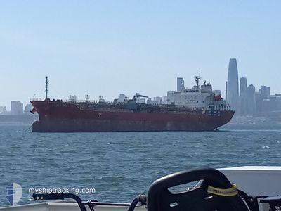
Oil/Chemical Tanker
Current Trip
KR ULS
| Time Travelled | 8 days |
|---|---|
| Remaining Time | --- |
| Distance Travelled | 1892.72 nm |
| Remaining Distance | --- |
| AVG Speed | 10.1 Knots |
| MAX Speed | 10.1 Knots |
| AVG Wind | 18 knots |
| MAX Wind | 32.8 knots |
| MIN Temp | 6.3°C / 43.34°F |
| MAX Temp | 20.4°C / 68.72°F |
| Draught | 6.1 m |
| Position Received | 5 d ago |
Current Position
| Longitude | -127.34758° |
|---|---|
| Latitude | 37.44525° |
| Status | Under way using engine |
| Speed | 10.8 Knots |
| Course | 285° |
| Area | North Pacific Ocean |
| Station | T-AIS |
| Position Received | 5 d ago |
Info
Information
The current position of JBU OPAL is in North Pacific Ocean with coordinates 37.44525° / -127.34758° as reported on 2024-04-11 16:33 by AIS to our vessel tracker app. The vessel's current speed is 10.8 Knots
The vessel JBU OPAL (IMO: 9400409, MMSI: 538005965) is a Oil/Chemical Tanker that was built in 2009 ( 15 years old ). It's sailing under the flag of [MH] Marshall Is.
In this page you can find informations about the vessels current position, last detected port calls, and current voyage information. If the vessels is not in coverage by AIS you will find the latest position.
The current position of JBU OPAL is detected by our AIS receivers and we are not responsible for the reliability of the data. The last position was recorded while the vessel was in Coverage by the Ais receivers of our vessel tracking app.
The current draught of JBU OPAL as reported by AIS is 6.1 meters
Weather
| Temperature | 9.5°C / 49.1°F |
|---|---|
| Wind Speed | 16 knots |
| Direction | 291° WNW |
| Pressure | 1013.9 hPa |
| Humidity | 77.8 % |
| Cloud Coverage | 90 % |
Featured Company
Last Port Calls
| Port | Arrival | Departure | Time In Port |
|---|---|---|---|
| 2024-04-07 01:24 | 2024-04-08 15:42 | 1 d | |
| 2024-03-13 16:11 | 2024-03-15 03:40 | 1 d | |
| 2024-03-11 02:03 | |||
| 2024-03-05 19:29 | 2024-03-06 14:41 | 19 h | |
| 2024-03-01 21:07 | 2024-03-02 22:15 | 1 d | |
| 2024-02-26 17:27 | 2024-02-27 07:30 | 14 h | |
| 2024-02-17 17:11 | 2024-02-21 07:02 | 3 d | |
| 2024-02-13 19:17 | 2024-02-14 21:44 | 1 d | |
| 2024-02-07 03:15 | 2024-02-10 19:02 | 3 d |
Most Visited Ports (Last year)
| Port | Arrivals | |
|---|---|---|
| 6 | ||
| 2 | ||
| 2 | ||
| 2 | ||
| 2 | ||
| 2 |
Last Trips
| Origin | Departure | Destination | Arrival | Distance | |
|---|---|---|---|---|---|
| 2024-03-14 23:40 | 2024-04-06 18:24 | 4873.13 nm | |||
| 2024-03-10 22:03 | 2024-03-13 12:11 | 718.54 nm | |||
| 2024-03-02 17:15 | 2024-03-05 14:29 | 33.03 nm | |||
| 2024-02-27 01:30 | 2024-03-01 16:07 | 615.88 nm | |||
| 2024-02-21 01:02 | 2024-02-26 11:27 | 1479.65 nm | |||
| 2024-02-14 15:44 | 2024-02-17 11:11 | 655.63 nm | |||
| 2024-02-10 13:02 | 2024-02-13 13:17 | 524.08 nm | |||
| 2024-01-08 18:47 | 2024-02-06 21:15 | 5195.59 nm |
Events
| Time | Event | Details | Position / Dest | Info |
|---|---|---|---|---|
| 2024-04-11 16:39 | Status Changed | Default Under way using engine |
37.45070 / -127.37202
KR ULS
|
Speed: 10.8 kn Course: 285° |
| 2024-04-11 16:33 | Status Changed | Under way using engine Default |
37.44525 / -127.34758
KR ULS
|
Speed: 10.7 kn Course: 283° |
| 2024-04-11 16:33 | OUT of Coverage |
37.44525 / -127.34758
North Pacific Ocean
KR ULS
|
Speed: 10.8 kn Course: 285° |
|
| 2024-04-11 16:02 | Status Changed | Default Under way using engine |
37.42043 / -127.23368
KR ULS
|
Speed: 11 kn Course: 289° |
| 2024-04-11 15:56 | Status Changed | Under way using engine Default |
37.41575 / -127.21392
KR ULS
|
Speed: 10.9 kn Course: 284° |
| 2024-04-11 15:47 | IN Coverage |
37.41575 / -127.21392
North Pacific Ocean
KR ULS
|
Speed: 11 kn Course: 289° |
|
| 2024-04-11 14:54 | Status Changed | Default Under way using engine |
37.36370 / -126.98123
KR ULS
|
Speed: 10.9 kn Course: 285° |
| 2024-04-11 14:49 | Status Changed | Under way using engine Default |
37.35995 / -126.96163
KR ULS
|
Speed: 10.5 kn Course: 284° |
| 2024-04-11 14:49 | OUT of Coverage |
37.35995 / -126.96163
North Pacific Ocean
KR ULS
|
Speed: 10.9 kn Course: 285° |
|
| 2024-04-11 14:35 | Status Changed | Default Under way using engine |
37.34947 / -126.91037
KR ULS
|
Speed: 11.2 kn Course: 283° |