
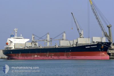
JAWAD
Bulk Carrier
Current Trip
BUYUT
| Time Travelled | 8 days |
|---|---|
| Remaining Time | --- |
| Distance Travelled | 1860.96 nm |
| Remaining Distance | --- |
| AVG Speed | 12.3 Knots |
| MAX Speed | 14.5 Knots |
| AVG Wind | 8.6 knots |
| MAX Wind | 20.5 knots |
| MIN Temp | 12.2°C / 53.96°F |
| MAX Temp | 30.1°C / 86.18°F |
| Draught | 6.4 m |
| Position Received | 3 d ago |
Current Position
| Longitude | 119.78067° |
|---|---|
| Latitude | 19.64700° |
| Status | Under way using engine |
| Speed | 13.4 Knots |
| Course | 178° |
| Area | South China Sea |
| Station | T-AIS |
| Position Received | 3 d ago |
Info
Information
The current position of JAWAD is in South China Sea with coordinates 19.64700° / 119.78067° as reported on 2024-04-20 07:37 by AIS to our vessel tracker app. The vessel's current speed is 13.4 Knots
The vessel JAWAD (IMO: 9405502, MMSI: 405000205) is a Bulk Carrier that was built in 2007 ( 17 years old ). It's sailing under the flag of [BD] Bangladesh.
In this page you can find informations about the vessels current position, last detected port calls, and current voyage information. If the vessels is not in coverage by AIS you will find the latest position.
The current position of JAWAD is detected by our AIS receivers and we are not responsible for the reliability of the data. The last position was recorded while the vessel was in Coverage by the Ais receivers of our vessel tracking app.
The current draught of JAWAD as reported by AIS is 6.4 meters
Weather
| Temperature | 29°C / 84.2°F |
|---|---|
| Wind Speed | 12 knots |
| Direction | 83° E |
| Pressure | 1008 hPa |
| Humidity | 81.8 % |
| Cloud Coverage | 57 % |
Featured Company
Last Port Calls
| Port | Arrival | Departure | Time In Port |
|---|---|---|---|
| 2024-04-11 07:44 | 2024-04-15 07:29 | 3 d | |
| 2024-03-01 07:09 | 2024-03-08 05:33 | 6 d | |
| 2024-02-11 13:19 | 2024-02-15 01:21 | 3 d |
Most Visited Ports (Last year)
| Port | Arrivals | |
|---|---|---|
| 2 | ||
| 2 | ||
| 1 | ||
| 1 | ||
| 1 | ||
| 1 |
Last Trips
| Origin | Departure | Destination | Arrival | Distance | |
|---|---|---|---|---|---|
| 2024-03-08 11:33 | 2024-04-11 15:44 | 4282.62 nm | |||
| 2024-02-15 08:21 | 2024-03-01 13:09 | 2141.00 nm | |||
| 2023-12-31 12:25 | 2024-02-11 20:19 | 6673.38 nm |
Events
| Time | Event | Details | Position / Dest | Info |
|---|---|---|---|---|
| 2024-04-20 07:42 | Status Changed | Default Under way using engine |
19.62768 / 119.78122
BUYUT
|
Speed: 13.4 kn Course: 178° |
| 2024-04-20 07:37 | Status Changed | Under way using engine Default |
19.64700 / 119.78067
BUYUT
|
Speed: 13.2 kn Course: 179° |
| 2024-04-20 07:37 | OUT of Coverage |
19.64700 / 119.78067
South China Sea
|
Speed: 13.4 kn Course: 178° |
|
| 2024-04-20 07:25 | Status Changed | Default Under way using engine |
19.68945 / 119.78087
BUYUT
|
Speed: 13.3 kn Course: 181° |
| 2024-04-20 06:53 | Change Sea Area | Philippines part of the South China Sea Taiwanese part of the South China Sea |
19.81353 / 119.78707
South China Sea
|
Speed: 13.6 kn Course: 183° |
| 2024-04-20 06:53 | Status Changed | Under way using engine Default |
19.81353 / 119.78707
BUYUT
|
Speed: 13 kn Course: 182° |
| 2024-04-20 06:40 | IN Coverage |
19.81353 / 119.78707
South China Sea
|
Speed: 13.6 kn Course: 183° |
|
| 2024-04-19 17:42 | Status Changed | Default Under way using engine |
22.72981 / 119.84515
BUYUT
|
Speed: 12.5 kn Course: 180° |
| 2024-04-19 17:35 | OUT of Coverage |
22.75418 / 119.84513
South China Sea
|
Speed: 12.5 kn Course: 180° |
|
| 2024-04-19 17:31 | Detected in Sea | Taiwanese part of the South China Sea |
22.76813 / 119.84515
South China Sea
|
Speed: 12.6 kn Course: 180° |