
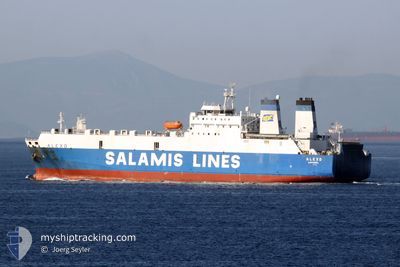
JABAL ALI 9
Ro-Ro Cargo
Current Trip
| Time Travelled | 7 days |
|---|---|
| Remaining Time | --- |
| Distance Travelled | 1239.56 nm |
| Remaining Distance | --- |
| AVG Speed | 10 Knots |
| MAX Speed | 12.3 Knots |
| AVG Wind | 11.1 knots |
| MAX Wind | 25.3 knots |
| MIN Temp | 20.5°C / 68.9°F |
| MAX Temp | 28°C / 82.4°F |
| Draught | 7 m |
| Position Received | 1 m ago |
Current Position
| Longitude | --- |
|---|---|
| Latitude | --- |
| Status | At anchor |
| Speed | 0.5 Knots |
| Course | 48° |
| Area | Persian Gulf |
| Station | T-AIS |
| Position Received | 1 m ago |
Info
Information
The current position of JABAL ALI 9 is in Persian Gulf with coordinates 25.11682° / 54.89843° as reported on 2024-12-11 22:35 by AIS to our vessel tracker app. The vessel's current speed is 0.5 Knots
The vessel JABAL ALI 9 (IMO: 8020604, MMSI: 341475000) is a Ro-Ro Cargo that was built in 1983 ( 41 years old ). It's sailing under the flag of [KN] St Kitts Nevis.
In this page you can find informations about the vessels current position, last detected port calls, and current voyage information. If the vessels is not in coverage by AIS you will find the latest position.
The current position of JABAL ALI 9 is detected by our AIS receivers and we are not responsible for the reliability of the data. The last position was recorded while the vessel was in Coverage by the Ais receivers of our vessel tracking app.
The current draught of JABAL ALI 9 as reported by AIS is 7 meters
Weather
| Temperature | 20.7°C / 69.26°F |
|---|---|
| Wind Speed | 13 knots |
| Direction | 85° E |
| Pressure | 1017.9 hPa |
| Humidity | 50.7 % |
| Cloud Coverage | --- |
Featured Company
Last Port Calls
| Port | Arrival | Departure | Time In Port |
|---|---|---|---|
| 2024-12-02 08:16 | 2024-12-04 12:53 | 2 d | |
| 2024-11-18 18:47 | 2024-11-24 12:59 | 5 d | |
| 2024-11-12 12:17 | 2024-11-13 12:51 | 1 d | |
| 2024-11-08 09:09 | 2024-11-08 14:15 | 5 h | |
| 2024-11-05 05:38 | 2024-11-06 07:15 | 1 d | |
| 2024-10-30 04:39 | 2024-10-31 12:56 | 1 d | |
| 2024-10-17 06:37 | 2024-10-25 12:04 | 8 d | |
| 2024-10-14 19:09 | 2024-10-15 14:13 | 19 h | |
| 2024-10-07 10:17 | 2024-10-08 19:18 | 1 d |
Last Trips
| Origin | Departure | Destination | Arrival | Distance | |
|---|---|---|---|---|---|
| 2024-11-24 16:59 | 2024-12-02 13:46 | 1315.99 nm | |||
| 2024-11-13 15:51 | 2024-11-18 22:47 | 342.86 nm | |||
| 2024-11-08 17:15 | 2024-11-12 15:17 | 310.70 nm | |||
| 2024-11-06 11:15 | 2024-11-08 12:09 | 489.58 nm | |||
| 2024-10-31 18:26 | 2024-11-05 09:38 | 1216.88 nm | |||
| 2024-10-25 16:04 | 2024-10-30 10:09 | 1216.90 nm | |||
| 2024-10-15 17:13 | 2024-10-17 10:37 | 333.69 nm | |||
| 2024-10-08 23:18 | 2024-10-14 22:09 | 331.54 nm | |||
| 2024-09-30 19:43 | 2024-10-07 14:17 | 1222.81 nm |
Events
| Time | Event | Details | Position / Dest | Info |
|---|---|---|---|---|
| 2024-12-11 22:02 | Status Changed | At anchor Default |
25.11709 / 54.89843
JEBEL ALI
|
Speed: 0.2 kn Course: 68° |
| 2024-12-11 21:56 | Status Changed | Default At anchor |
25.11656 / 54.89863
JEBEL ALI
|
Speed: 0.6 kn Course: 90° |
| 2024-12-11 17:59 | Status Changed | At anchor Default |
25.11682 / 54.89859
JEBEL ALI
|
Speed: 0.3 kn Course: 85° |
| 2024-12-11 17:50 | Status Changed | Default At anchor |
25.11745 / 54.89845
JEBEL ALI
|
Speed: 0.3 kn Course: 85° |
| 2024-12-11 15:02 | STOP Moving | 9.52 nm, North West of JEBEL ALI |
25.11671 / 54.89896
JEBEL ALI
|
Speed: 0.2 kn Course: 37° |
| 2024-12-11 14:52 | Status Changed | At anchor Under way using engine |
25.11727 / 54.90135
JEBEL ALI
|
Speed: 1 kn Course: 336° |
| 2024-12-11 14:25 | ETA Changed | 2024/12/11 19:00 2024/12/09 14:00 |
25.12224 / 54.89038
JEBEL ALI
|
Speed: 3.1 kn Course: 46° |
| 2024-12-11 14:24 | START Moving | 10.07 nm, North West of JEBEL ALI |
25.12141 / 54.89019
JEBEL ALI
|
Speed: 3.1 kn Course: 21° |
| 2024-12-11 14:19 | Status Changed | Under way using engine At anchor |
25.11971 / 54.89211
JEBEL ALI
|
Speed: 0.6 kn Course: 11° |
| 2024-12-11 13:16 | Status Changed | At anchor Default |
25.12034 / 54.89447
JEBEL ALI
|
Speed: 0.6 kn Course: 343° |