
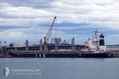
IVS SPARROWHAWK
Cargo
Current Trip
| Time Travelled | 3 days |
|---|---|
| Remaining Time | 4 h, 39 mins |
| Distance Travelled | 651.36 nm |
| Remaining Distance | 63.91 nm |
| AVG Speed | 12.4 Knots |
| MAX Speed | 13.9 Knots |
| AVG Wind | 11.2 knots |
| MAX Wind | 23.7 knots |
| MIN Temp | 14.3°C / 57.74°F |
| MAX Temp | 17.1°C / 62.78°F |
| Draught | 9.2 m |
| Position Received | 14 h, 42 m ago |
Current Position
| Longitude | 144.55263° |
|---|---|
| Latitude | -38.54592° |
| Status | Under way using engine |
| Speed | 0.8 Knots |
| Course | 326° |
| Area | Bass Strait |
| Station | T-AIS |
| Position Received | 14 h, 42 m ago |
Info
Information
The current position of IVS SPARROWHAWK is in Bass Strait with coordinates -38.54592° / 144.55263° as reported on 2024-04-18 03:54 by AIS to our vessel tracker app. The vessel's current speed is 0.8 Knots and is heading at the port of GEELONG. The estimated time of arrival as calculated by MyShipTracking vessel tracking app is 2024-04-18 23:15 LT
The vessel IVS SPARROWHAWK (IMO: 9712656, MMSI: 565583000) is a Cargo It's sailing under the flag of [SG] Singapore.
In this page you can find informations about the vessels current position, last detected port calls, and current voyage information. If the vessels is not in coverage by AIS you will find the latest position.
The current position of IVS SPARROWHAWK is detected by our AIS receivers and we are not responsible for the reliability of the data. The last position was recorded while the vessel was in Coverage by the Ais receivers of our vessel tracking app.
The current draught of IVS SPARROWHAWK as reported by AIS is 9.2 meters
Weather
| Temperature | 14.9°C / 58.82°F |
|---|---|
| Wind Speed | 19 knots |
| Direction | 188° S |
| Pressure | 1017.6 hPa |
| Humidity | 72.8 % |
| Cloud Coverage | 65 % |
Featured Company
Last Port Calls
| Port | Arrival | Departure | Time In Port |
|---|---|---|---|
| 2024-04-13 05:41 | 2024-04-15 12:21 | 2 d | |
| 2024-03-16 14:38 | 2024-03-21 05:03 | 4 d | |
| 2024-03-12 05:11 | 2024-03-12 21:46 | 16 h | |
| 2024-03-04 07:38 | 2024-03-11 10:52 | 7 d | |
| 2024-02-26 05:27 | 2024-02-27 05:14 | 23 h | |
| 2024-02-15 16:19 | 2024-02-16 14:43 | 22 h | |
| 2024-02-02 20:21 | 2024-02-03 11:03 | 14 h |
Last Trips
| Origin | Departure | Destination | Arrival | Distance | |
|---|---|---|---|---|---|
| 2024-03-21 09:03 | 2024-04-13 15:11 | 6535.39 nm | |||
| 2024-03-13 00:46 | 2024-03-16 18:38 | 358.83 nm | |||
| 2024-03-11 13:52 | 2024-03-12 08:11 | 121.57 nm | |||
| 2024-02-27 10:44 | 2024-03-04 10:38 | 1502.00 nm | |||
| 2024-02-16 22:43 | 2024-02-26 10:57 | 2380.61 nm | |||
| 2024-02-03 20:03 | 2024-02-16 00:19 | 2729.67 nm | |||
| 2024-01-31 07:27 | 2024-02-03 05:21 | 702.95 nm |
Events
| Time | Event | Details | Position / Dest | Info |
|---|---|---|---|---|
| 2024-04-18 08:13 | START Moving | 11.46 nm, South West of SORRENTO |
-38.50344 / 144.63054
AU GEX
|
Speed: 5.6 kn Course: 234° |
| 2024-04-18 04:00 | Status Changed | Default Under way using engine |
-38.54503 / 144.55411
AU GEX
|
Speed: 0.8 kn Course: 326° |
| 2024-04-18 03:54 | Status Changed | Under way using engine Default |
-38.54592 / 144.55263
AU GEX
|
Speed: 1.1 kn Course: 328° |
| 2024-04-18 03:54 | OUT of Coverage |
-38.54592 / 144.55263
Bass Strait
|
Speed: 0.8 kn Course: 51.6° |
|
| 2024-04-18 03:52 | IN Coverage |
-38.54592 / 144.55263
Bass Strait
|
Speed: 0.8 kn Course: 51.6° |
|
| 2024-04-18 02:08 | Status Changed | Default Under way using engine |
-38.56015 / 144.52959
AU GEX
|
Speed: 0.3 kn Course: 258° |
| 2024-04-18 02:07 | Status Changed | Under way using engine Default |
-38.56019 / 144.52945
AU GEX
|
Speed: Course: 255° |
| 2024-04-18 02:07 | OUT of Coverage |
-38.56019 / 144.52945
Bass Strait
|
Speed: 0.3 kn Course: 83° |
|
| 2024-04-18 02:04 | STOP Moving | 16.92 nm, South West of SORRENTO |
-38.56023 / 144.52928
AU GEX
|
Speed: Course: 255° |
| 2024-04-18 02:04 | IN Coverage |
-38.56019 / 144.52945
Bass Strait
|
Speed: 0.3 kn Course: 83° |