
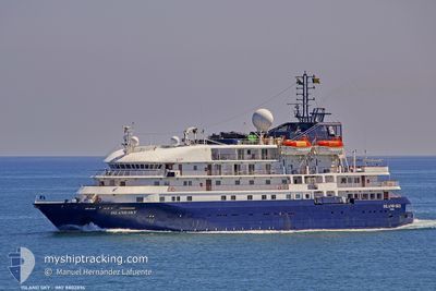
ISLAND SKY
Passengers Ship
Current Trip
CV MIN
| Time Travelled | 9 days |
|---|---|
| Remaining Time | --- |
| Distance Travelled | 3158.97 nm |
| Remaining Distance | --- |
| AVG Speed | 12.3 Knots |
| MAX Speed | 15.2 Knots |
| AVG Wind | 14.4 knots |
| MAX Wind | 24.2 knots |
| MIN Temp | 17°C / 62.6°F |
| MAX Temp | 27.3°C / 81.14°F |
| Draught | 4.3 m |
| Position Received | 2 d ago |
Current Position
| Longitude | --- |
|---|---|
| Latitude | --- |
| Status | Under way using engine |
| Speed | 14.8 Knots |
| Course | 200.7° |
| Area | South Atlantic Ocean |
| Station | T-AIS |
| Position Received | 2 d ago |
Info
Information
The current position of ISLAND SKY is in South Atlantic Ocean with coordinates -3.49422° / -32.83714° as reported on 2024-12-11 18:59 by AIS to our vessel tracker app. The vessel's current speed is 14.8 Knots
The vessel ISLAND SKY (IMO: 8802894, MMSI: 311743000) is a Passengers Ship that was built in 1992 ( 32 years old ). It's sailing under the flag of [BS] Bahamas.
In this page you can find informations about the vessels current position, last detected port calls, and current voyage information. If the vessels is not in coverage by AIS you will find the latest position.
The current position of ISLAND SKY is detected by our AIS receivers and we are not responsible for the reliability of the data. The last position was recorded while the vessel was in Coverage by the Ais receivers of our vessel tracking app.
The current draught of ISLAND SKY as reported by AIS is 4.3 meters
Weather
| Temperature | 26.2°C / 79.16°F |
|---|---|
| Wind Speed | 10 knots |
| Direction | 12° NNE |
| Pressure | 1012.1 hPa |
| Humidity | 82.3 % |
| Cloud Coverage | 100 % |
Featured Company
Last Port Calls
| Port | Arrival | Departure | Time In Port |
|---|---|---|---|
| 2024-11-05 06:51 | 2024-12-04 17:23 | 29 d | |
| 2024-11-04 07:39 | 2024-11-04 21:39 | 13 h | |
| 2024-11-02 06:23 | 2024-11-02 17:10 | 10 h | |
| 2024-11-01 11:26 | 2024-11-01 17:52 | 6 h | |
| 2024-10-31 05:26 | 2024-10-31 16:47 | 11 h | |
| 2024-10-30 08:27 | 2024-10-30 20:39 | 12 h | |
| 2024-10-29 07:50 | 2024-10-29 16:43 | 8 h | |
| 2024-10-26 05:57 | 2024-10-26 15:37 | 9 h | |
| 2024-10-25 05:52 | 2024-10-25 16:42 | 10 h | |
| 2024-10-24 05:34 | 2024-10-24 18:04 | 12 h |
Last Trips
| Origin | Departure | Destination | Arrival | Distance | |
|---|---|---|---|---|---|
| 2024-11-04 21:39 | 2024-11-05 06:51 | 53.08 nm | |||
| 2024-11-02 18:10 | 2024-11-04 07:39 | 433.46 nm | |||
| 2024-11-01 18:52 | 2024-11-02 07:23 | 150.57 nm | |||
| 2024-10-31 17:47 | 2024-11-01 12:26 | 198.45 nm | |||
| 2024-10-30 21:39 | 2024-10-31 06:26 | 65.72 nm | |||
| 2024-10-29 17:43 | 2024-10-30 09:27 | 200.51 nm | |||
| 2024-10-26 17:37 | 2024-10-29 08:50 | 577.06 nm | |||
| 2024-10-25 17:42 | 2024-10-26 07:57 | 158.02 nm | |||
| 2024-10-24 19:04 | 2024-10-25 06:52 | 136.71 nm | |||
| 2024-10-23 13:44 | 2024-10-24 06:34 | 199.96 nm |
Events
| Time | Event | Details | Position / Dest | Info |
|---|---|---|---|---|
| 2024-12-11 19:05 | Status Changed | Default Under way using engine |
-3.51691 / -32.84526
CV MIN
|
Speed: 14.8 kn Course: 200.7° |
| 2024-12-11 18:59 | OUT of Coverage |
-3.49422 / -32.83714
South Atlantic Ocean
|
Speed: 14.8 kn Course: 200.7° |
|
| 2024-12-11 18:39 | Status Changed | Under way using engine Default |
-3.41556 / -32.80963
CV MIN
|
Speed: 14.3 kn Course: 198° |
| 2024-12-11 18:36 | Status Changed | Default Under way using engine |
-3.40735 / -32.80671
CV MIN
|
Speed: 14.2 kn Course: 199.9° |
| 2024-12-11 18:02 | Status Changed | Under way using engine Default |
-3.28025 / -32.75923
CV MIN
|
Speed: 14.3 kn Course: 199° |
| 2024-12-11 17:56 | Status Changed | Default Under way using engine |
-3.25837 / -32.75048
CV MIN
|
Speed: 14.4 kn Course: 200.9° |
| 2024-12-11 17:45 | Detected in Sea | Brazilian part of the South Atlantic Ocean |
-3.21486 / -32.73310
South Atlantic Ocean
|
Speed: 14.7 kn Course: 201.3° |
| 2024-12-11 17:45 | Status Changed | Under way using engine Default |
-3.21486 / -32.73310
CV MIN
|
Speed: 14.8 kn Course: 203° |
| 2024-12-11 17:38 | IN Coverage |
-3.21486 / -32.73310
South Atlantic Ocean
|
Speed: 14.7 kn Course: 201.3° |
|
| 2024-12-07 20:12 | START Moving |
16.88557 / -25.00360
CV MIN
|
Speed: 4.7 kn Course: 250° |