
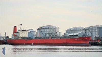
ISLA DE BIOKO
Tanker
Current Trip
| Time Travelled | 46 days |
|---|---|
| Remaining Time | 1 day |
| Distance Travelled | 9767.25 nm |
| Remaining Distance | 364.91 nm |
| AVG Speed | 11 Knots |
| MAX Speed | 14.9 Knots |
| AVG Wind | 14.4 knots |
| MAX Wind | 32 knots |
| MIN Temp | 9.4°C / 48.92°F |
| MAX Temp | 29.6°C / 85.28°F |
| Draught | 11.8 m |
| Position Received | 2 h, 24 m ago |
Current Position
| Longitude | -4.71098° |
|---|---|
| Latitude | 49.36516° |
| Status | Under way using engine |
| Speed | 11.9 Knots |
| Course | 66.9° |
| Area | English Channel |
| Station | T-AIS |
| Position Received | 2 h, 24 m ago |
Info
Information
The current position of ISLA DE BIOKO is in English Channel with coordinates 49.36516° / -4.71098° as reported on 2024-04-16 05:48 by AIS to our vessel tracker app. The vessel's current speed is 11.9 Knots and is heading at the port of ROTTERDAM. The estimated time of arrival as calculated by MyShipTracking vessel tracking app is 2024-04-17 14:29 LT
The vessel ISLA DE BIOKO (IMO: 9767235, MMSI: 374402000) is a Tanker It's sailing under the flag of [PA] Panama.
In this page you can find informations about the vessels current position, last detected port calls, and current voyage information. If the vessels is not in coverage by AIS you will find the latest position.
The current position of ISLA DE BIOKO is detected by our AIS receivers and we are not responsible for the reliability of the data. The last position was recorded while the vessel was in Coverage by the Ais receivers of our vessel tracking app.
The current draught of ISLA DE BIOKO as reported by AIS is 11.8 meters
Weather
| Temperature | 9.7°C / 49.46°F |
|---|---|
| Wind Speed | 22 knots |
| Direction | 318° NW |
| Pressure | 1019.3 hPa |
| Humidity | 75.1 % |
| Cloud Coverage | 100 % |
Featured Company
Last Port Calls
| Port | Arrival | Departure | Time In Port |
|---|---|---|---|
| 2024-03-01 03:45 | 2024-03-01 08:01 | 4 h | |
| 2024-02-29 23:34 | 2024-03-01 00:37 | 1 h | |
| 2024-02-12 06:08 | 2024-02-29 20:33 | 17 d | |
| 2024-02-11 20:08 | 2024-02-12 02:08 | 6 h | |
| 2024-02-04 20:03 | 2024-02-05 19:39 | 23 h | |
| 2024-02-01 14:49 |
Most Visited Ports (Last year)
| Port | Arrivals | |
|---|---|---|
| 10 | ||
| 7 | ||
| 5 | ||
| 3 | ||
| 1 | ||
| 1 |
Last Trips
| Origin | Departure | Destination | Arrival | Distance | |
|---|---|---|---|---|---|
| 2024-03-01 01:37 | 2024-03-01 04:45 | 16.59 nm | |||
| 2024-02-29 21:33 | 2024-03-01 00:34 | 1.23 nm | |||
| 2024-02-12 03:08 | 2024-02-12 07:08 | 1.91 nm | |||
| 2024-02-05 20:39 | 2024-02-11 21:08 | 1365.62 nm | |||
| 2024-02-01 15:49 | 2024-02-04 21:03 | 1010.23 nm |
Events
| Time | Event | Details | Position / Dest | Info |
|---|---|---|---|---|
| 2024-04-16 05:50 | Status Changed | Default Under way using engine |
49.36782 / -4.69983
NLRTM
|
Speed: 11.9 kn Course: 66.9° |
| 2024-04-16 05:48 | Status Changed | Under way using engine Default |
49.36516 / -4.71099
NLRTM
|
Speed: 11.9 kn Course: 70° |
| 2024-04-16 05:48 | OUT of Coverage |
49.36516 / -4.71099
English Channel
NLRTM
|
Speed: 11.9 kn Course: 66.9° |
|
| 2024-04-16 05:37 | Status Changed | Default Under way using engine |
49.35304 / -4.76047
NLRTM
|
Speed: 11.9 kn Course: 69.3° |
| 2024-04-16 05:30 | Status Changed | Under way using engine Default |
49.34452 / -4.79505
NLRTM
|
Speed: 11.9 kn Course: 67° |
| 2024-04-16 05:29 | Status Changed | Default Under way using engine |
49.34372 / -4.79810
NLRTM
|
Speed: 11.9 kn Course: 72.9° |
| 2024-04-16 05:21 | Detected in Sea | United Kingdom part of the English Channel |
49.33437 / -4.83653
English Channel
NLRTM
|
Speed: 11.9 kn Course: 72.9° |
| 2024-04-16 05:21 | Status Changed | Under way using engine Default |
49.33437 / -4.83653
NLRTM
|
Speed: 11.7 kn Course: 69° |
| 2024-04-16 05:17 | IN Coverage |
49.33437 / -4.83653
English Channel
NLRTM
|
Speed: 11.9 kn Course: 72.9° |
|
| 2024-04-16 03:39 | OUT of Coverage |
49.20581 / -5.28915
Celtic Sea
NLRTM
|
Speed: 11.3 kn Course: 66.5° |