
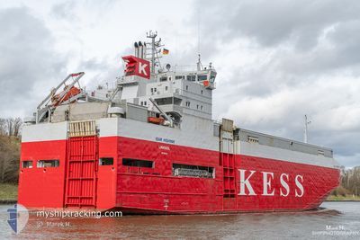
ISAR HIGHWAY
Vehicles Carrier
Current Trip
| Time Travelled | 7 h, 28 mins |
|---|---|
| Remaining Time | 20 h, 43 mins |
| Distance Travelled | 99.39 nm |
| Remaining Distance | 297.13 nm |
| AVG Speed | 12.7 Knots |
| MAX Speed | 14.6 Knots |
| AVG Wind | 11.8 knots |
| MAX Wind | 18.9 knots |
| MIN Temp | 4.9°C / 40.82°F |
| MAX Temp | 7.5°C / 45.5°F |
| Draught | 5.3 m |
| Position Received | Now |
Current Position
| Longitude | 14.28678° |
|---|---|
| Latitude | 55.14378° |
| Status | Under way using engine |
| Speed | 14.3 Knots |
| Course | 38.8° |
| Area | Kattegat |
| Station | T-AIS |
| Position Received | Now |
Info
Information
The current position of ISAR HIGHWAY is in Kattegat with coordinates 55.14378° / 14.28678° as reported on 2024-04-24 22:43 by AIS to our vessel tracker app. The vessel's current speed is 14.3 Knots and is heading at the port of SODERTALJE. The estimated time of arrival as calculated by MyShipTracking vessel tracking app is 2024-04-25 19:26 LT
The vessel ISAR HIGHWAY (IMO: 9195145, MMSI: 212949000) is a Vehicles Carrier that was built in 2000 ( 24 years old ). It's sailing under the flag of [CY] Cyprus.
In this page you can find informations about the vessels current position, last detected port calls, and current voyage information. If the vessels is not in coverage by AIS you will find the latest position.
The current position of ISAR HIGHWAY is detected by our AIS receivers and we are not responsible for the reliability of the data. The last position was recorded while the vessel was in Coverage by the Ais receivers of our vessel tracking app.
The current draught of ISAR HIGHWAY as reported by AIS is 5.3 meters
Weather
| Temperature | 4.4°C / 39.92°F |
|---|---|
| Wind Speed | 11 knots |
| Direction | 91° E |
| Pressure | 1006.6 hPa |
| Humidity | 77.2 % |
| Cloud Coverage | 7 % |
Featured Company
Last Port Calls
| Port | Arrival | Departure | Time In Port |
|---|---|---|---|
| 2024-04-24 05:40 | 2024-04-24 15:15 | 9 h | |
| 2024-04-23 09:25 | 2024-04-23 20:06 | 10 h | |
| 2024-04-22 02:04 | 2024-04-22 09:05 | 7 h | |
| 2024-04-21 02:20 | 2024-04-21 03:06 | 45 m | |
| 2024-04-20 14:30 | 2024-04-20 14:54 | 23 m | |
| 2024-04-18 10:44 | 2024-04-18 20:06 | 9 h | |
| 2024-04-17 03:02 | 2024-04-17 12:37 | 9 h | |
| 2024-04-13 10:53 | 2024-04-13 20:08 | 9 h | |
| 2024-04-12 04:34 | 2024-04-12 12:03 | 7 h | |
| 2024-04-10 21:51 | 2024-04-11 11:50 | 13 h |
Last Trips
| Origin | Departure | Destination | Arrival | Distance | |
|---|---|---|---|---|---|
| 2024-04-23 22:06 | 2024-04-24 07:40 | 97.79 nm | |||
| 2024-04-22 11:05 | 2024-04-23 11:25 | 228.12 nm | |||
| 2024-04-21 04:06 | 2024-04-22 04:04 | 325.73 nm | |||
| 2024-04-20 15:54 | 2024-04-21 03:20 | 0.97 nm | |||
| 2024-04-18 22:06 | 2024-04-20 15:30 | 310.92 nm | |||
| 2024-04-17 13:37 | 2024-04-18 12:44 | 313.55 nm | |||
| 2024-04-13 22:08 | 2024-04-17 04:02 | 808.97 nm | |||
| 2024-04-12 14:03 | 2024-04-13 12:53 | 337.48 nm | |||
| 2024-04-11 13:50 | 2024-04-12 06:34 | 167.11 nm | |||
| 2024-04-10 16:12 | 2024-04-10 23:51 | 101.87 nm |
Events
| Time | Event | Details | Position / Dest | Info |
|---|---|---|---|---|
| 2024-04-24 21:59 | Change Sea Area | Danish part of the Kattegat Swedish part of the Baltic Sea |
55.02120 / 14.07970
Kattegat
SODERTALJE
|
Speed: 14 kn Course: 70.2° |
| 2024-04-24 21:35 | Change Sea Area | Swedish part of the Baltic Sea German part of the Baltic Sea |
54.98988 / 13.92528
Baltic Sea
SODERTALJE
|
Speed: 14.2 kn Course: 70.7° |
| 2024-04-24 15:31 | Status Changed | Under way using engine Moored |
54.22878 / 12.08635
SODERTALJE
|
Speed: 7.4 kn Course: 0.6° |
| 2024-04-24 15:28 | ETA Changed | 2024/04/25 21:00 2024/04/26 00:00 |
54.22063 / 12.08622
SODERTALJE
|
Speed: 7.5 kn Course: 0.6° |
| 2024-04-24 15:15 | PORT DEPARTURE |
|
54.19032 / 12.08787
SODERTALJE
|
Speed: 9 kn Course: 343° |
| 2024-04-24 14:51 | START Moving |
54.14708 / 12.10265
[DE] ROSTOCK
|
Speed: 5.2 kn Course: 7° |
|
| 2024-04-24 13:46 | Draught Changed | 5.3 5.1 |
54.14523 / 12.10250
[DE] ROSTOCK
|
Speed: Course: 353° |
| 2024-04-24 10:07 | Destination Changed | SODERTALJE ROSTOCK |
54.14523 / 12.10247
[DE] ROSTOCK
|
Speed: Course: 354° |
| 2024-04-24 10:00 | ETA Changed | 2024/04/26 00:00 2024/04/24 05:30 |
54.14523 / 12.10247
[DE] ROSTOCK
|
Speed: Course: 353° |
| 2024-04-24 08:57 | Status Changed | Moored Default |
54.14523 / 12.10248
[DE] ROSTOCK
|
Speed: Course: 353° |