
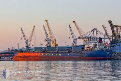
ISADORA
Bulk Carrier
Current Trip
| Trip Time | 5 days |
|---|---|
| Trip Distance | 1557.08 nm |
| AVG Speed | 11.5 Knots |
| MAX Speed | 13.7 Knots |
| Draught | 10.9 m |
| AVG Wind | 13.6 knots |
| MAX Wind | 25 knots |
| MIN Temp | 24.1°C / 75.38°F |
| MAX Temp | 27.4°C / 81.32°F |
| Position Received | 8 d ago |
Current Position
| Longitude | -92.79068° |
|---|---|
| Latitude | 20.57572° |
| Status | Under way using engine |
| Speed | 12 Knots |
| Course | 30.9° |
| Area | Gulf of Mexico |
| Station | T-AIS |
| Position Received | 8 d ago |
Info
Information
The current position of ISADORA is in Gulf of Mexico with coordinates 20.57572° / -92.79068° as reported on 2024-04-16 07:18 by AIS to our vessel tracker app. The vessel's current speed is 12 Knots and is currently inside the port of BARAHONA.
The vessel ISADORA (IMO: 9180372, MMSI: 212836000) is a Bulk Carrier that was built in 1999 ( 25 years old ). It's sailing under the flag of [CY] Cyprus.
In this page you can find informations about the vessels current position, last detected port calls, and current voyage information. If the vessels is not in coverage by AIS you will find the latest position.
The current position of ISADORA is detected by our AIS receivers and we are not responsible for the reliability of the data. The last position was recorded while the vessel was in Coverage by the Ais receivers of our vessel tracking app.
The current draught of ISADORA as reported by AIS is 10.9 meters
Weather
| Temperature | 25.2°C / 77.36°F |
|---|---|
| Wind Speed | 7 knots |
| Direction | 268° W |
| Pressure | 1015.5 hPa |
| Humidity | 83 % |
| Cloud Coverage | 74 % |
Featured Company
Last Port Calls
| Port | Arrival | Departure | Time In Port |
|---|---|---|---|
| 2024-04-21 13:17 | |||
| 2024-03-23 19:47 | 2024-04-15 17:09 | 22 d | |
| 2024-03-09 22:41 | 2024-03-20 14:50 | 10 d | |
| 2024-02-29 12:32 | |||
| 2024-02-10 06:07 | 2024-02-25 23:49 | 15 d | |
| 2024-02-03 22:56 | 2024-02-04 04:16 | 5 h | |
| 2024-02-01 00:51 | 2024-02-03 00:24 | 1 d |
Most Visited Ports (Last year)
| Port | Arrivals | |
|---|---|---|
| 5 | ||
| 3 | ||
| 3 | ||
| 2 | ||
| 2 | ||
| 2 |
Last Trips
| Origin | Departure | Destination | Arrival | Distance | |
|---|---|---|---|---|---|
| 2024-04-15 12:09 | 2024-04-21 09:17 | 1557.08 nm | |||
| 2024-03-20 09:50 | 2024-03-23 13:47 | 800.01 nm | |||
| 2024-02-25 17:49 | 2024-02-29 06:32 | 808.30 nm | |||
| 2024-02-03 22:16 | 2024-02-10 00:07 | 142.68 nm | |||
| 2024-02-02 18:24 | 2024-02-03 16:56 | 234.56 nm | |||
| 2024-01-26 12:59 | 2024-01-31 18:51 | 1252.05 nm |
Events
| Time | Event | Details | Position / Dest | Info |
|---|---|---|---|---|
| 2024-04-21 13:17 | STOP Moving |
18.20817 / -71.08754
[DO] BARAHONA
|
Speed: 0.2 kn Course: 242° |
|
| 2024-04-21 13:17 | PORT ARRIVAL |
|
18.20817 / -71.08754
[DO] BARAHONA
|
Speed: 3.9 kn Course: 246° |
| 2024-04-21 12:47 | START Moving | 1.83 nm, North East of BARAHONA |
18.22168 / -71.05967
MXCOA
|
Speed: 6 kn Course: 256° |
| 2024-04-21 12:32 | STOP Moving | 2.31 nm, East of BARAHONA |
18.22295 / -71.05106
MXCOA
|
Speed: 0.3 kn Course: 263° |
| 2024-04-21 11:49 | START Moving | 5.47 nm, East of BARAHONA |
18.19833 / -70.99333
MXCOA
|
Speed: 4 kn Course: -1° |
| 2024-04-21 07:52 | STOP Moving | 8.2 nm, East of BARAHONA |
18.20333 / -70.94500
MXCOA
|
Speed: Course: -1° |
| 2024-04-21 07:01 | START Moving | 8.77 nm, East of BARAHONA |
18.20500 / -70.93500
MXCOA
|
Speed: 4 kn Course: -1° |
| 2024-04-21 03:26 | STOP Moving | 8.48 nm, East of BARAHONA |
18.19311 / -70.94096
MXCOA
|
Speed: 0.2 kn Course: 171° |
| 2024-04-21 02:53 | START Moving | 7.35 nm, East of BARAHONA |
18.20420 / -70.95998
MXCOA
|
Speed: 3.5 kn Course: 63° |
| 2024-04-21 01:52 | STOP Moving | 8.07 nm, East of BARAHONA |
18.19167 / -70.94833
MXCOA
|
Speed: Course: -1° |