
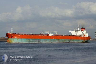
AFRAGOLD
Crude Oil Tanker
Current Trip
| Time Travelled | --- |
|---|---|
| Remaining Time | --- |
| Distance Travelled | 972.03 nm |
| Remaining Distance | --- |
| AVG Speed | 10.3 Knots |
| MAX Speed | 15.6 Knots |
| AVG Wind | 9.9 knots |
| MAX Wind | 22.8 knots |
| MIN Temp | 20°C / 68°F |
| MAX Temp | 31.7°C / 89.06°F |
| Draught | 8.5 m |
| Position Received | 4 h, 9 m ago |
Current Position
| Longitude | 56.64943° |
|---|---|
| Latitude | 24.77720° |
| Status | Under way using engine |
| Speed | 12.5 Knots |
| Course | 182° |
| Area | Gulf of Oman |
| Station | T-AIS |
| Position Received | 4 h, 9 m ago |
Info
Information
The current position of AFRAGOLD is in Gulf of Oman with coordinates 24.77720° / 56.64943° as reported on 2024-04-18 02:36 by AIS to our vessel tracker app. The vessel's current speed is 12.5 Knots
The vessel AFRAGOLD (IMO: 9436018, MMSI: 636017796) is a Crude Oil Tanker that was built in 2009 ( 15 years old ). It's sailing under the flag of [LR] Liberia.
In this page you can find informations about the vessels current position, last detected port calls, and current voyage information. If the vessels is not in coverage by AIS you will find the latest position.
The current position of AFRAGOLD is detected by our AIS receivers and we are not responsible for the reliability of the data. The last position was recorded while the vessel was in Coverage by the Ais receivers of our vessel tracking app.
The current draught of AFRAGOLD as reported by AIS is 8.5 meters
Weather
| Temperature | 25.7°C / 78.26°F |
|---|---|
| Wind Speed | 8 knots |
| Direction | 264° W |
| Pressure | 1011.1 hPa |
| Humidity | 51.2 % |
| Cloud Coverage | --- |
Featured Company
Last Port Calls
| Port | Arrival | Departure | Time In Port |
|---|---|---|---|
| 2024-02-19 11:57 | 2024-02-19 15:59 | 4 h | |
| 2024-02-01 04:08 |
Last Trips
| Origin | Departure | Destination | Arrival | Distance | |
|---|---|---|---|---|---|
| 2024-02-01 07:08 | 2024-02-19 13:57 | 4861.13 nm |
Events
| Time | Event | Details | Position / Dest | Info |
|---|---|---|---|---|
| 2024-04-18 04:09 | STOP Moving | 6.22 nm, North East of SOHAR |
24.59173 / 56.69488
OMSOH
|
Speed: 0.3 kn Course: 190° |
| 2024-04-18 02:40 | Status Changed | Default Under way using engine |
24.76038 / 56.65057
OMSOH
|
Speed: 12.5 kn Course: 182° |
| 2024-04-18 02:36 | Status Changed | Under way using engine Default |
24.77720 / 56.64943
OMSOH
|
Speed: 12.5 kn Course: 180° |
| 2024-04-18 02:36 | OUT of Coverage |
24.77720 / 56.64943
Gulf of Oman
OMSOH
|
Speed: 12.5 kn Course: 182° |
|
| 2024-04-18 02:29 | Status Changed | Default Under way using engine |
24.80052 / 56.64932
OMSOH
|
Speed: 12.4 kn Course: 173° |
| 2024-04-18 02:26 | Status Changed | Under way using engine Default |
24.81250 / 56.64792
OMSOH
|
Speed: 12.5 kn Course: 173° |
| 2024-04-18 02:13 | Status Changed | Default Under way using engine |
24.85838 / 56.64212
OMSOH
|
Speed: 12.3 kn Course: 173° |
| 2024-04-18 01:29 | Change Sea Area | Omani part of the Gulf of Oman United Arab Emirates part of the Gulf of Oman |
25.01443 / 56.62072
Gulf of Oman
OMSOH
|
Speed: 12.2 kn Course: 172° |
| 2024-04-17 23:59 | START Moving | 9.9 nm, East of FUJAIRAH |
25.20000 / 56.53728
OMSOH
|
Speed: 3.1 kn Course: 51° |
| 2024-04-17 23:52 | Status Changed | Under way using engine At anchor |
25.19542 / 56.53953
OMSOH
|
Speed: 0.2 kn Course: 276° |