
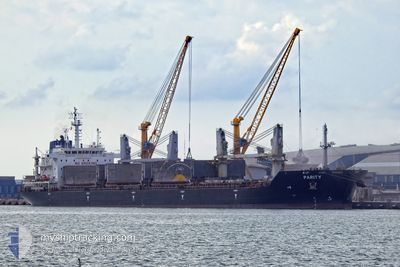
PARITY
Bulk Carrier
Current Trip
| Time Travelled | 11 days |
|---|---|
| Remaining Time | --- |
| Distance Travelled | 2833.89 nm |
| Remaining Distance | --- |
| AVG Speed | 10.2 Knots |
| MAX Speed | 12.2 Knots |
| AVG Wind | 12.1 knots |
| MAX Wind | 21 knots |
| MIN Temp | 19.5°C / 67.1°F |
| MAX Temp | 29.7°C / 85.46°F |
| Draught | 9.5 m |
| Position Received | 17 m ago |
Current Position
| Longitude | -12.41434° |
|---|---|
| Latitude | 29.42720° |
| Status | Under way using engine |
| Speed | 8.6 Knots |
| Course | 32.6° |
| Area | North Atlantic Ocean |
| Station | T-AIS |
| Position Received | 17 m ago |
Info
Information
The current position of PARITY is in North Atlantic Ocean with coordinates 29.42720° / -12.41434° as reported on 2024-04-24 17:40 by AIS to our vessel tracker app. The vessel's current speed is 8.6 Knots and is heading at the port of RAVENNA. The estimated time of arrival as calculated by MyShipTracking vessel tracking app is 2024-05-02 17:00 LT
The vessel PARITY (IMO: 9486594, MMSI: 538004178) is a Bulk Carrier that was built in 2012 ( 12 years old ). It's sailing under the flag of [MH] Marshall Is.
In this page you can find informations about the vessels current position, last detected port calls, and current voyage information. If the vessels is not in coverage by AIS you will find the latest position.
The current position of PARITY is detected by our AIS receivers and we are not responsible for the reliability of the data. The last position was recorded while the vessel was in Coverage by the Ais receivers of our vessel tracking app.
The current draught of PARITY as reported by AIS is 9.5 meters
Weather
| Temperature | 19.6°C / 67.28°F |
|---|---|
| Wind Speed | 17 knots |
| Direction | 7° N |
| Pressure | 1014.3 hPa |
| Humidity | 77.9 % |
| Cloud Coverage | 3 % |
Featured Company
Most Visited Ports (Last year)
| Port | Arrivals | |
|---|---|---|
| 1 | ||
| 1 | ||
| 1 | ||
| 1 | ||
| 1 | ||
| 1 |
Last Trips
| Origin | Departure | Destination | Arrival | Distance | |
|---|---|---|---|---|---|
| 2024-03-21 22:33 | 2024-04-07 13:20 | 3153.96 nm | |||
| 2024-02-12 04:18 | 2024-02-14 18:35 | 250.89 nm | |||
| 2024-02-07 22:33 | 2024-02-08 06:43 | 88.42 nm | |||
| 2024-01-06 00:30 | 2024-02-04 03:33 | 7262.22 nm |
Events
| Time | Event | Details | Position / Dest | Info |
|---|---|---|---|---|
| 2024-04-24 17:46 | Status Changed | Default Under way using engine |
29.43847 / -12.40593
RAVENNA
|
Speed: 8.6 kn Course: 32.6° |
| 2024-04-24 17:34 | Detected in Sea | Spanish (Canary Islands) part of the North Atlantic Ocean |
29.41334 / -12.42454
North Atlantic Ocean
RAVENNA
|
Speed: 8.5 kn Course: 33° |
| 2024-04-24 17:33 | Status Changed | Under way using engine Default |
29.41199 / -12.42552
RAVENNA
|
Speed: 8.3 kn Course: 32° |
| 2024-04-24 17:14 | IN Coverage |
29.41334 / -12.42454
North Atlantic Ocean
RAVENNA
|
Speed: 8.5 kn Course: 33° |
|
| 2024-04-24 08:06 | Status Changed | Default Under way using engine |
28.24333 / -13.34500
RAVENNA
|
Speed: 9.2 kn Course: 33.1° |
| 2024-04-24 07:59 | Change Sea Area | Moroccan part of the North Atlantic Ocean Spanish (Canary Islands) part of the North Atlantic Ocean |
28.22877 / -13.35706
North Atlantic Ocean
RAVENNA
|
Speed: 9.2 kn Course: 33.1° |
| 2024-04-24 07:59 | Status Changed | Under way using engine Default |
28.22877 / -13.35706
RAVENNA
|
Speed: 9.2 kn Course: 32° |
| 2024-04-24 07:59 | OUT of Coverage |
28.22877 / -13.35706
North Atlantic Ocean
RAVENNA
|
Speed: 9.2 kn Course: 33.1° |
|
| 2024-04-24 07:27 | Status Changed | Default Under way using engine |
28.15493 / -13.40179
RAVENNA
|
Speed: 9.1 kn Course: 34.8° |
| 2024-04-24 07:19 | Status Changed | Under way using engine Default |
28.13914 / -13.41404
RAVENNA
|
Speed: 9.2 kn Course: 35° |