
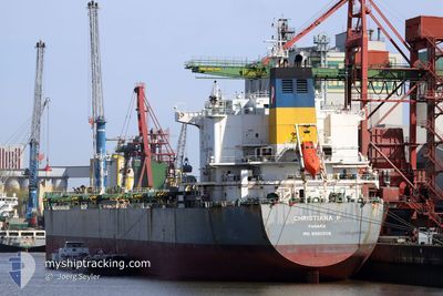
CHRISTIANA P
Bulk Carrier
Current Trip
| Time Travelled | 25 days |
|---|---|
| Remaining Time | --- |
| Distance Travelled | 6980.19 nm |
| Remaining Distance | --- |
| AVG Speed | 11.6 Knots |
| MAX Speed | 16.5 Knots |
| AVG Wind | 15.2 knots |
| MAX Wind | 28.8 knots |
| MIN Temp | 17.4°C / 63.32°F |
| MAX Temp | 29.9°C / 85.82°F |
| Draught | 7.7 m |
| Position Received | 9 d ago |
Current Position
| Longitude | 18.18768° |
|---|---|
| Latitude | -34.62454° |
| Status | Under way using engine |
| Speed | 12.6 Knots |
| Course | 296.2° |
| Area | South Atlantic Ocean |
| Station | T-AIS |
| Position Received | 9 d ago |
Info
Information
The current position of CHRISTIANA P is in South Atlantic Ocean with coordinates -34.62454° / 18.18768° as reported on 2024-04-10 10:19 by AIS to our vessel tracker app. The vessel's current speed is 12.6 Knots and is heading at the port of SANTOS. The estimated time of arrival as calculated by MyShipTracking vessel tracking app is 2024-04-21 09:00 LT
The vessel CHRISTIANA P (IMO: 9580508, MMSI: 352559000) is a Bulk Carrier that was built in 2011 ( 13 years old ). It's sailing under the flag of [PA] Panama.
In this page you can find informations about the vessels current position, last detected port calls, and current voyage information. If the vessels is not in coverage by AIS you will find the latest position.
The current position of CHRISTIANA P is detected by our AIS receivers and we are not responsible for the reliability of the data. The last position was recorded while the vessel was in Coverage by the Ais receivers of our vessel tracking app.
The current draught of CHRISTIANA P as reported by AIS is 7.7 meters
Weather
| Temperature | 21.3°C / 70.34°F |
|---|---|
| Wind Speed | 10 knots |
| Direction | 5° N |
| Pressure | 1016.6 hPa |
| Humidity | 89.9 % |
| Cloud Coverage | 100 % |
Featured Company
Events
| Time | Event | Details | Position / Dest | Info |
|---|---|---|---|---|
| 2024-04-10 10:31 | Status Changed | Default Under way using engine |
-34.61549 / 18.14164
BRSSZ
|
Speed: 12.6 kn Course: 296.2° |
| 2024-04-10 10:19 | OUT of Coverage |
-34.62454 / 18.18768
South Atlantic Ocean
BRSSZ
|
Speed: 12.6 kn Course: 296.2° |
|
| 2024-04-10 10:08 | Status Changed | Under way using engine Default |
-34.64024 / 18.23160
BRSSZ
|
Speed: 12.2 kn Course: 294° |
| 2024-04-10 09:51 | IN Coverage |
-34.63917 / 18.22850
South Atlantic Ocean
BRSSZ
|
Speed: 12.4 kn Course: 291.9° |
|
| 2024-04-10 06:00 | Status Changed | Default Under way using engine |
-34.85130 / 19.18695
BRSSZ
|
Speed: 11.9 kn Course: 284.9° |
| 2024-04-10 05:54 | OUT of Coverage |
-34.85508 / 19.20701
South Atlantic Ocean
BRSSZ
|
Speed: 11.9 kn Course: 284.9° |
|
| 2024-04-10 05:50 | Status Changed | Under way using engine Default |
-34.85812 / 19.22261
BRSSZ
|
Speed: 11.8 kn Course: 282° |
| 2024-04-10 05:47 | Status Changed | Default Under way using engine |
-34.86080 / 19.23669
BRSSZ
|
Speed: 11.7 kn Course: 277.6° |
| 2024-04-10 05:37 | Change Sea Area | South African part of the South Atlantic Ocean Indian part of the Laccadive Sea |
-34.86594 / 19.27431
South Atlantic Ocean
BRSSZ
|
Speed: 11.7 kn Course: 276.4° |
| 2024-04-10 05:36 | Status Changed | Under way using engine Default |
-34.86608 / 19.27706
BRSSZ
|
Speed: 11.5 kn Course: 274° |