
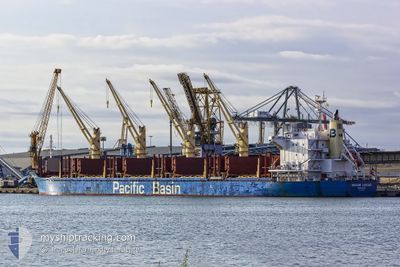
IMABARI LOGGER
Bulk Carrier
Current Trip
| Time Travelled | 20 days |
|---|---|
| Remaining Time | --- |
| Distance Travelled | 5539.51 nm |
| Remaining Distance | 0.69 nm |
| AVG Speed | 11 Knots |
| MAX Speed | 13.3 Knots |
| AVG Wind | 9.8 knots |
| MAX Wind | 27 knots |
| MIN Temp | 12.2°C / 53.96°F |
| MAX Temp | 29.4°C / 84.92°F |
| Draught | 9.6 m |
| Position Received | 1 m ago |
Current Position
| Longitude | -5.36931° |
|---|---|
| Latitude | 36.13464° |
| Status | At anchor |
| Speed | 0.1 Knots |
| Course | 346° |
| Area | Strait of Gibraltar |
| Station | T-AIS |
| Position Received | 1 m ago |
Info
Information
The current position of IMABARI LOGGER is in Strait of Gibraltar with coordinates 36.13464° / -5.36931° as reported on 2024-04-25 07:28 by AIS to our vessel tracker app. The vessel's current speed is 0.1 Knots and is heading at the port of GIBRALTAR. The estimated time of arrival as calculated by MyShipTracking vessel tracking app is 2024-04-25 05:00 LT
The vessel IMABARI LOGGER (IMO: 9663855, MMSI: 477300100) is a Bulk Carrier that was built in 2014 ( 10 years old ). It's sailing under the flag of [HK] Hong Kong.
In this page you can find informations about the vessels current position, last detected port calls, and current voyage information. If the vessels is not in coverage by AIS you will find the latest position.
The current position of IMABARI LOGGER is detected by our AIS receivers and we are not responsible for the reliability of the data. The last position was recorded while the vessel was in Coverage by the Ais receivers of our vessel tracking app.
The current draught of IMABARI LOGGER as reported by AIS is 9.6 meters
Weather
| Temperature | 15.5°C / 59.9°F |
|---|---|
| Wind Speed | 4 knots |
| Direction | 269° W |
| Pressure | 1011.3 hPa |
| Humidity | 73.8 % |
| Cloud Coverage | 100 % |
Featured Company
Last Port Calls
| Port | Arrival | Departure | Time In Port |
|---|---|---|---|
| 2024-04-01 17:26 | 2024-04-04 18:06 | 3 d | |
| 2024-03-09 04:27 | 2024-03-15 08:23 | 6 d |
Most Visited Ports (Last year)
| Port | Arrivals | |
|---|---|---|
| 3 | ||
| 2 | ||
| 1 | ||
| 1 | ||
| 1 | ||
| 1 |
Last Trips
| Origin | Departure | Destination | Arrival | Distance | |
|---|---|---|---|---|---|
| 2024-03-15 05:23 | 2024-04-01 14:26 | 3233.86 nm | |||
| 2024-01-30 15:50 | 2024-03-09 01:27 | 6768.64 nm |
Events
| Time | Event | Details | Position / Dest | Info |
|---|---|---|---|---|
| 2024-04-25 04:52 | Status Changed | At anchor Default |
36.13453 / -5.36977
GI GIB
|
Speed: Course: 359° |
| 2024-04-25 04:46 | Status Changed | Default At anchor |
36.13451 / -5.36966
GI GIB
|
Speed: Course: 358° |
| 2024-04-25 04:34 | Status Changed | At anchor Default |
36.13457 / -5.36966
GI GIB
|
Speed: 0.1 kn Course: 3° |
| 2024-04-25 04:28 | Status Changed | Default At anchor |
36.13453 / -5.36973
GI GIB
|
Speed: 0.1 kn Course: 359° |
| 2024-04-25 03:19 | Status Changed | At anchor Under way using engine |
36.13548 / -5.37065
GI GIB
|
Speed: Course: 31° |
| 2024-04-25 03:10 | STOP Moving | 0.81 nm, South West of GIBRALTAR |
36.13528 / -5.37000
GI GIB
|
Speed: 0.3 kn Course: 334° |
| 2024-04-25 02:11 | Change Sea Area | Gibraltarian part of the Strait of Gibraltar Spanish part of the Strait of Gibraltar |
36.04330 / -5.34877
Strait of Gibraltar
GI GIB
|
Speed: 8.2 kn Course: 349.8° |
| 2024-04-25 01:32 | Change Sea Area | Spanish part of the Strait of Gibraltar Moroccan part of the Strait of Gibraltar |
35.97540 / -5.37415
Strait of Gibraltar
GI GIB
|
Speed: 6.2 kn Course: 74.1° |
| 2024-04-24 22:29 | Status Changed | Under way using engine Default |
35.89583 / -5.87153
GI GIB
|
Speed: 8.1 kn Course: 89° |
| 2024-04-24 22:06 | Status Changed | Default Under way using engine |
35.89595 / -5.91765
GI GIB
|
Speed: 6.8 kn Course: 89° |