
ILMA
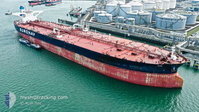
Crude Oil Tanker
Current Trip
| Time Travelled | 4 days |
|---|---|
| Remaining Time | 4 days |
| Distance Travelled | 1469.57 nm |
| Remaining Distance | 1213.91 nm |
| AVG Speed | 12.6 Knots |
| MAX Speed | 14.9 Knots |
| AVG Wind | 9.1 knots |
| MAX Wind | 16.4 knots |
| MIN Temp | 14.3°C / 57.74°F |
| MAX Temp | 27.7°C / 81.86°F |
| Draught | 11.2 m |
| Position Received | 1 d ago |
Current Position
| Longitude | -105.62990° |
|---|---|
| Latitude | 19.29905° |
| Status | Under way using engine |
| Speed | 11.9 Knots |
| Course | 122° |
| Area | North Pacific Ocean |
| Station | T-AIS |
| Position Received | 1 d ago |
Info
Information
The current position of ILMA is in North Pacific Ocean with coordinates 19.29905° / -105.62990° as reported on 2024-04-22 16:26 by AIS to our vessel tracker app. The vessel's current speed is 11.9 Knots and is heading at the port of PUERTO ARMUELLES. The estimated time of arrival as calculated by MyShipTracking vessel tracking app is 2024-04-28 10:49 LT
The vessel ILMA (IMO: 9588392, MMSI: 205657000) is a Crude Oil Tanker that was built in 2012 ( 12 years old ). It's sailing under the flag of [BE] Belgium.
In this page you can find informations about the vessels current position, last detected port calls, and current voyage information. If the vessels is not in coverage by AIS you will find the latest position.
The current position of ILMA is detected by our AIS receivers and we are not responsible for the reliability of the data. The last position was recorded while the vessel was in Coverage by the Ais receivers of our vessel tracking app.
The current draught of ILMA as reported by AIS is 11.2 meters
Weather
| Temperature | 27.6°C / 81.68°F |
|---|---|
| Wind Speed | 7 knots |
| Direction | 259° W |
| Pressure | 1011.6 hPa |
| Humidity | 61.2 % |
| Cloud Coverage | 100 % |
Featured Company
Last Port Calls
| Port | Arrival | Departure | Time In Port |
|---|---|---|---|
| 2024-04-17 19:02 | 2024-04-18 22:24 | 1 d |
Most Visited Ports (Last year)
| Port | Arrivals | |
|---|---|---|
| 2 | ||
| 1 | ||
| 1 |
Last Trips
| Origin | Departure | Destination | Arrival | Distance |
|---|
Events
| Time | Event | Details | Position / Dest | Info |
|---|---|---|---|---|
| 2024-04-22 16:29 | Status Changed | Default Under way using engine |
19.29409 / -105.62148
PAAML
|
Speed: 11.9 kn Course: 122° |
| 2024-04-22 16:26 | OUT of Coverage |
19.29905 / -105.62990
North Pacific Ocean
PAAML
|
Speed: 11.9 kn Course: 122° |
|
| 2024-04-22 16:02 | Status Changed | Under way using engine Default |
19.34223 / -105.70359
PAAML
|
Speed: 11.9 kn Course: 122° |
| 2024-04-22 15:57 | Status Changed | Default Under way using engine |
19.35070 / -105.71793
PAAML
|
Speed: 11.9 kn Course: 123.5° |
| 2024-04-22 05:08 | Status Changed | Under way using engine Default |
20.62292 / -107.64444
PAAML
|
Speed: 12.1 kn Course: 128° |
| 2024-04-22 05:04 | Status Changed | Default Under way using engine |
20.63035 / -107.65485
PAAML
|
Speed: 12.1 kn Course: 128° |
| 2024-04-22 03:46 | Status Changed | Under way using engine Default |
20.78628 / -107.87361
PAAML
|
Speed: 12 kn Course: 124° |
| 2024-04-22 03:26 | Status Changed | Default Under way using engine |
20.82455 / -107.93507
PAAML
|
Speed: 12.1 kn Course: 123.5° |
| 2024-04-22 02:46 | Status Changed | Under way using engine Default |
20.89719 / -108.05398
PAAML
|
Speed: 12.3 kn Course: 122° |
| 2024-04-22 02:21 | Status Changed | Default Under way using engine |
20.94536 / -108.13030
PAAML
|
Speed: 11.8 kn Course: 130° |