
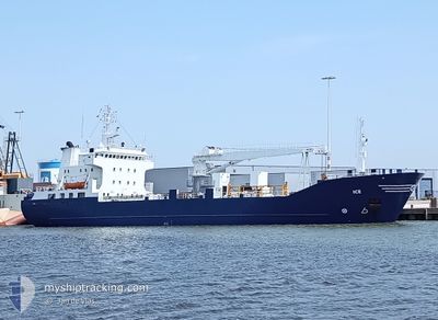
ICE
Reefer
Current Trip
| Time Travelled | 6 h, 7 mins |
|---|---|
| Remaining Time | 8 h, 36 mins |
| Distance Travelled | 60.70 nm |
| Remaining Distance | 97.61 nm |
| AVG Speed | 10.6 Knots |
| MAX Speed | 11.3 Knots |
| AVG Wind | 3.7 knots |
| MAX Wind | 8 knots |
| MIN Temp | 4.4°C / 39.92°F |
| MAX Temp | 6.5°C / 43.7°F |
| Draught | 6.2 m |
| Position Received | 6 d ago |
Current Position
| Longitude | -6.95466° |
|---|---|
| Latitude | 55.86803° |
| Status | Under way using engine |
| Speed | 6.6 Knots |
| Course | 317.2° |
| Area | Inner Seas off the West Coast of Scotland |
| Station | T-AIS |
| Position Received | 6 d ago |
Info
Information
The current position of ICE is in Inner Seas off the West Coast of Scotland with coordinates 55.86803° / -6.95466° as reported on 2024-04-16 14:44 by AIS to our vessel tracker app. The vessel's current speed is 6.6 Knots and is heading at the port of HERJOLFUR. The estimated time of arrival as calculated by MyShipTracking vessel tracking app is 2024-04-23 16:47 LT
The vessel ICE (IMO: 8412699, MMSI: 257737000) is a Reefer that was built in 1985 ( 39 years old ). It's sailing under the flag of [NO] Norway.
In this page you can find informations about the vessels current position, last detected port calls, and current voyage information. If the vessels is not in coverage by AIS you will find the latest position.
The current position of ICE is detected by our AIS receivers and we are not responsible for the reliability of the data. The last position was recorded while the vessel was in Coverage by the Ais receivers of our vessel tracking app.
The current draught of ICE as reported by AIS is 6.2 meters
Weather
| Temperature | 6.1°C / 42.98°F |
|---|---|
| Wind Speed | 8 knots |
| Direction | 128° SE |
| Pressure | 1031.5 hPa |
| Humidity | 68.4 % |
| Cloud Coverage | 98 % |
Featured Company
Last Port Calls
| Port | Arrival | Departure | Time In Port |
|---|---|---|---|
| 2024-04-22 16:10 | 2024-04-23 02:04 | 9 h | |
| 2024-04-20 11:04 | 2024-04-22 06:30 | 1 d | |
| 2024-04-12 06:30 | 2024-04-12 15:47 | 9 h | |
| 2024-04-08 05:33 | 2024-04-08 16:52 | 11 h | |
| 2024-04-06 01:06 | 2024-04-06 01:50 | 44 m | |
| 2024-04-02 14:32 | 2024-04-05 16:31 | 3 d | |
| 2024-03-30 21:19 | 2024-03-31 18:30 | 21 h | |
| 2024-03-28 00:08 | 2024-03-28 19:40 | 19 h | |
| 2024-03-23 07:49 | 2024-03-25 15:05 | 2 d | |
| 2024-03-22 11:25 | 2024-03-22 14:27 | 3 h |
Last Trips
| Origin | Departure | Destination | Arrival | Distance | |
|---|---|---|---|---|---|
| 2024-04-22 06:30 | 2024-04-22 16:10 | 96.96 nm | |||
| 2024-04-12 17:47 | 2024-04-20 11:04 | 1346.98 nm | |||
| 2024-04-08 17:52 | 2024-04-12 08:30 | 798.25 nm | |||
| 2024-04-06 03:50 | 2024-04-08 06:33 | 431.39 nm | |||
| 2024-04-05 18:31 | 2024-04-06 03:06 | 84.30 nm | |||
| 2024-03-31 20:30 | 2024-04-02 16:32 | 348.60 nm | |||
| 2024-03-28 20:40 | 2024-03-30 22:19 | 538.32 nm | |||
| 2024-03-25 16:05 | 2024-03-28 01:08 | 620.96 nm | |||
| 2024-03-22 15:27 | 2024-03-23 08:49 | 156.21 nm | |||
| 2024-03-20 15:03 | 2024-03-22 12:25 | 472.32 nm |
Events
| Time | Event | Details | Position / Dest | Info |
|---|---|---|---|---|
| 2024-04-23 02:16 | START Moving | 2.44 nm, South West of GRUNDARTANGI |
64.32316 / -21.82434
THORLAKSHOFN
|
Speed: 10.7 kn Course: 230° |
| 2024-04-23 02:04 | PORT DEPARTURE |
|
64.32316 / -21.82434
THORLAKSHOFN
|
Speed: 2.7 kn Course: 97° |
| 2024-04-22 16:27 | STOP Moving |
64.35352 / -21.78072
[IS] GRUNDARTANGI
|
Speed: Course: 33° |
|
| 2024-04-22 16:10 | PORT ARRIVAL |
|
64.35309 / -21.78089
[IS] GRUNDARTANGI
|
Speed: 11 kn Course: 33° |
| 2024-04-22 06:30 | START Moving | 0.34 nm, North East of HERJOLFUR |
63.86224 / -21.35695
THORLAKSHOFN
|
Speed: 5.8 kn Course: 120° |
| 2024-04-22 06:30 | PORT DEPARTURE |
|
63.86224 / -21.35695
THORLAKSHOFN
|
Speed: 1 kn Course: -1° |
| 2024-04-20 11:27 | STOP Moving |
63.86095 / -21.37126
[IS] HERJOLFUR
|
Speed: Course: 116° |
|
| 2024-04-20 11:04 | PORT ARRIVAL |
|
63.85833 / -21.36500
[IS] HERJOLFUR
|
Speed: 4.6 kn Course: 232° |
| 2024-04-16 14:48 | Status Changed | Default Under way using engine |
55.87316 / -6.96258
THORLAKSHOFN
|
Speed: 6.6 kn Course: 317.2° |
| 2024-04-16 14:44 | OUT of Coverage |
55.86803 / -6.95466
Inner Seas off the West Coast of Scotland
THORLAKSHOFN
|
Speed: 6.6 kn Course: 317.2° |