
IAN H
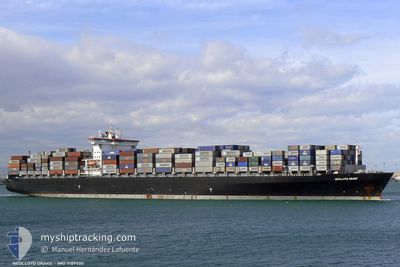
Container Ship
Current Trip
| Time Travelled | --- |
|---|---|
| Remaining Time | 1 day |
| Distance Travelled | --- |
| Remaining Distance | 592.35 nm |
| AVG Speed | --- |
| MAX Speed | --- |
| AVG Wind | --- |
| MAX Wind | --- |
| MIN Temp | --- |
| MAX Temp | --- |
| Draught | 12.1 m |
| Position Received | 5 d ago |
Current Position
| Longitude | 104.11285° |
|---|---|
| Latitude | 1.24195° |
| Status | Under way using engine |
| Speed | 17.5 Knots |
| Course | 83.8° |
| Area | Singapore Strait |
| Station | T-AIS |
| Position Received | 5 d ago |
Info
Information
The current position of IAN H is in Singapore Strait with coordinates 1.24195° / 104.11285° as reported on 2024-04-19 05:35 by AIS to our vessel tracker app. The vessel's current speed is 17.5 Knots and is heading at the port of QINGDAO. The estimated time of arrival as calculated by MyShipTracking vessel tracking app is 2024-04-25 08:36 LT
The vessel IAN H (IMO: 9189500, MMSI: 636016980) is a Container Ship that was built in 2000 ( 24 years old ). It's sailing under the flag of [LR] Liberia.
In this page you can find informations about the vessels current position, last detected port calls, and current voyage information. If the vessels is not in coverage by AIS you will find the latest position.
The current position of IAN H is detected by our AIS receivers and we are not responsible for the reliability of the data. The last position was recorded while the vessel was in Coverage by the Ais receivers of our vessel tracking app.
The current draught of IAN H as reported by AIS is 12.1 meters
Weather
| Temperature | 17.4°C / 63.32°F |
|---|---|
| Wind Speed | 9 knots |
| Direction | 4° N |
| Pressure | 1013.3 hPa |
| Humidity | 75.8 % |
| Cloud Coverage | 79 % |
Featured Company
Last Port Calls
| Port | Arrival | Departure | Time In Port |
|---|---|---|---|
| 2024-04-17 15:53 | |||
| 2024-04-06 19:23 | 2024-04-07 20:52 | 1 d | |
| 2024-04-04 14:51 | 2024-04-05 13:59 | 23 h | |
| 2024-03-29 03:13 | 2024-03-29 17:05 | 13 h | |
| 2024-03-18 04:38 | 2024-03-18 15:13 | 10 h | |
| 2024-03-14 02:11 | 2024-03-14 22:02 | 19 h | |
| 2024-03-13 02:31 | 2024-03-13 15:07 | 12 h | |
| 2024-03-10 15:52 | 2024-03-11 15:05 | 23 h | |
| 2024-03-06 03:17 | 2024-03-07 00:40 | 21 h | |
| 2024-02-29 17:22 | 2024-03-01 10:24 | 17 h |
Most Visited Ports (Last year)
| Port | Arrivals | |
|---|---|---|
| 13 | ||
| 9 | ||
| 7 | ||
| 7 | ||
| 7 | ||
| 5 |
Last Trips
| Origin | Departure | Destination | Arrival | Distance | |
|---|---|---|---|---|---|
| 2024-04-08 02:22 | 2024-04-17 23:53 | 3023.23 nm | |||
| 2024-04-05 19:29 | 2024-04-07 00:53 | 434.68 nm | |||
| 2024-03-30 01:05 | 2024-04-04 20:21 | 2310.17 nm | |||
| 2024-03-18 23:13 | 2024-03-29 11:13 | 2445.78 nm | |||
| 2024-03-15 07:02 | 2024-03-18 12:38 | 495.62 nm | |||
| 2024-03-14 00:07 | 2024-03-14 11:11 | 96.89 nm | |||
| 2024-03-11 23:05 | 2024-03-13 11:31 | 463.69 nm | |||
| 2024-03-07 08:40 | 2024-03-10 23:52 | 1166.25 nm | |||
| 2024-03-01 18:24 | 2024-03-06 11:17 | 1649.24 nm | |||
| 2024-02-18 21:03 | 2024-03-01 01:22 | 2983.19 nm |
Events
| Time | Event | Details | Position / Dest | Info |
|---|---|---|---|---|
| 2024-04-19 05:35 | OUT of Coverage |
1.24195 / 104.11285
Singapore Strait
CNQDG
|
Speed: 17.5 kn Course: 83.8° |
|
| 2024-04-19 04:05 | Draught Changed | 12.1 13.4 |
1.10291 / 103.74670
CNQDG
|
Speed: 14 kn Course: 43.3° |
| 2024-04-19 04:05 | Destination Changed | CNQDG MYPKL |
1.10291 / 103.74670
CNQDG
|
Speed: 14 kn Course: 43.3° |
| 2024-04-19 04:05 | ETA Changed | 2024/04/25 15:00 2024/04/17 04:00 |
1.10291 / 103.74670
CNQDG
|
Speed: 14 kn Course: 43.3° |
| 2024-04-19 03:10 | Change Sea Area | Indonesian part of the Singapore Strait Indian part of the Laccadive Sea |
1.10465 / 103.53177
Singapore Strait
|
Speed: 15.4 kn Course: 117.3° |
| 2024-04-19 03:08 | IN Coverage |
1.10465 / 103.53177
Singapore Strait
|
Speed: 15.4 kn Course: 117.3° |
|
| 2024-04-17 16:52 | STOP Moving |
3.03472 / 101.35690
[MY] PORT KLANG
|
Speed: 0.2 kn Course: 358° |
|
| 2024-04-17 15:53 | PORT ARRIVAL |
|
2.91055 / 101.27354
[MY] PORT KLANG
|
Speed: 14 kn Course: 7° |
| 2024-04-17 14:49 | START Moving | 15.72 nm, South West of PORT KLANG |
2.78936 / 101.18804
MYPKL
|
Speed: 3.7 kn Course: 130° |
| 2024-04-17 09:08 | STOP Moving | 14.69 nm, South West of PORT KLANG |
2.79027 / 101.21709
MYPKL
|
Speed: 0.3 kn Course: 169° |