
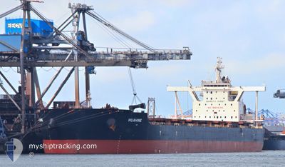
HUAHINE
Cargo
Current Trip
PORT DE BOKE
| Time Travelled | 33 days |
|---|---|
| Remaining Time | --- |
| Distance Travelled | 9823.21 nm |
| Remaining Distance | --- |
| AVG Speed | 12.3 Knots |
| MAX Speed | 15.3 Knots |
| AVG Wind | 12.4 knots |
| MAX Wind | 24.8 knots |
| MIN Temp | 14.7°C / 58.46°F |
| MAX Temp | 28.6°C / 83.48°F |
| Draught | 11.1 m |
| Position Received | 2 d ago |
Current Position
| Longitude | --- |
|---|---|
| Latitude | --- |
| Status | Under way using engine |
| Speed | 12.6 Knots |
| Course | 327° |
| Area | South Atlantic Ocean |
| Station | T-AIS |
| Position Received | 2 d ago |
Info
Information
The current position of HUAHINE is in South Atlantic Ocean with coordinates -24.20871° / 9.45098° as reported on 2024-12-12 16:46 by AIS to our vessel tracker app. The vessel's current speed is 12.6 Knots
The vessel HUAHINE (IMO: 9587257, MMSI: 229387000) is a Cargo It's sailing under the flag of [MT] Malta.
In this page you can find informations about the vessels current position, last detected port calls, and current voyage information. If the vessels is not in coverage by AIS you will find the latest position.
The current position of HUAHINE is detected by our AIS receivers and we are not responsible for the reliability of the data. The last position was recorded while the vessel was in Coverage by the Ais receivers of our vessel tracking app.
The current draught of HUAHINE as reported by AIS is 11.1 meters
Weather
| Temperature | 21.1°C / 69.98°F |
|---|---|
| Wind Speed | 14 knots |
| Direction | 135° SE |
| Pressure | 1015.3 hPa |
| Humidity | 81.8 % |
| Cloud Coverage | 70 % |
Featured Company
Most Visited Ports (Last year)
| Port | Arrivals | |
|---|---|---|
| 1 | ||
| 1 | ||
| 1 | ||
| 1 |
Last Trips
| Origin | Departure | Destination | Arrival | Distance |
|---|
Events
| Time | Event | Details | Position / Dest | Info |
|---|---|---|---|---|
| 2024-12-12 16:51 | Status Changed | Default Under way using engine |
-24.19363 / 9.43918
PORT DE BOKE
|
Speed: 12.6 kn Course: 327° |
| 2024-12-12 16:46 | OUT of Coverage |
-24.20871 / 9.45098
South Atlantic Ocean
PORT DE BOKE
|
Speed: 12.6 kn Course: 327° |
|
| 2024-12-12 16:39 | Status Changed | Under way using engine Default |
-24.22849 / 9.46650
PORT DE BOKE
|
Speed: 12.4 kn Course: 325° |
| 2024-12-12 16:34 | Status Changed | Default Under way using engine |
-24.24159 / 9.47670
PORT DE BOKE
|
Speed: 12.2 kn Course: 321° |
| 2024-12-12 16:30 | Detected in Sea | High seas of the South Atlantic Ocean |
-24.25305 / 9.48619
South Atlantic Ocean
PORT DE BOKE
|
Speed: 12.2 kn Course: 321° |
| 2024-12-12 16:29 | Status Changed | Under way using engine Default |
-24.25448 / 9.48738
PORT DE BOKE
|
Speed: 12.4 kn Course: 327° |
| 2024-12-12 16:29 | IN Coverage |
-24.25305 / 9.48619
South Atlantic Ocean
PORT DE BOKE
|
Speed: 12.2 kn Course: 321° |
|
| 2024-12-10 06:55 | Status Changed | Default Under way using engine |
-33.82065 / 17.59372
PORT DE BOKE
|
Speed: 12.2 kn Course: 322.6° |
| 2024-12-10 06:49 | OUT of Coverage |
-33.83909 / 17.60879
South Atlantic Ocean
PORT DE BOKE
|
Speed: 12.2 kn Course: 322.6° |
|
| 2024-12-10 06:17 | Status Changed | Under way using engine Default |
-33.92765 / 17.67993
PORT DE BOKE
|
Speed: 12.4 kn Course: 330° |