
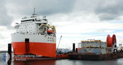
HUA XING LONG
Other Type
Current Trip
GUANG ZHOU 13ZH
| Time Travelled | 3 days |
|---|---|
| Remaining Time | --- |
| Distance Travelled | 865.63 nm |
| Remaining Distance | --- |
| AVG Speed | 10.1 Knots |
| MAX Speed | 12 Knots |
| AVG Wind | 11.5 knots |
| MAX Wind | 28.8 knots |
| MIN Temp | 13.4°C / 56.12°F |
| MAX Temp | 26.5°C / 79.7°F |
| Draught | 6.6 m |
| Position Received | 2 d ago |
Current Position
| Longitude | 118.03333° |
|---|---|
| Latitude | 23.57167° |
| Status | Under way using engine |
| Speed | 11 Knots |
| Course | 48° |
| Area | South China Sea |
| Station | T-AIS |
| Position Received | 2 d ago |
Info
Information
The current position of HUA XING LONG is in South China Sea with coordinates 23.57167° / 118.03333° as reported on 2024-04-23 10:32 by AIS to our vessel tracker app. The vessel's current speed is 11 Knots
The vessel HUA XING LONG (IMO: 9808182, MMSI: 413054710) is a Other Type It's sailing under the flag of [CN] China.
In this page you can find informations about the vessels current position, last detected port calls, and current voyage information. If the vessels is not in coverage by AIS you will find the latest position.
The current position of HUA XING LONG is detected by our AIS receivers and we are not responsible for the reliability of the data. The last position was recorded while the vessel was in Coverage by the Ais receivers of our vessel tracking app.
The current draught of HUA XING LONG as reported by AIS is 6.6 meters
Weather
| Temperature | 13.4°C / 56.12°F |
|---|---|
| Wind Speed | 10 knots |
| Direction | 172° S |
| Pressure | 1009.9 hPa |
| Humidity | 93.2 % |
| Cloud Coverage | 100 % |
Featured Company
Most Visited Ports (Last year)
| Port | Arrivals | |
|---|---|---|
| 2 | ||
| 1 | ||
| 1 | ||
| 1 | ||
| 1 | ||
| 1 |
Events
| Time | Event | Details | Position / Dest | Info |
|---|---|---|---|---|
| 2024-04-23 10:46 | Status Changed | Default Under way using engine |
23.60420 / 118.07289
GUANG ZHOU 13ZH
|
Speed: 11 kn Course: 48° |
| 2024-04-23 10:32 | OUT of Coverage |
23.57167 / 118.03333
South China Sea
|
Speed: 11 kn Course: 48° |
|
| 2024-04-23 09:53 | Status Changed | Under way using engine Default |
23.49000 / 117.93333
GUANG ZHOU 13ZH
|
Speed: 10 kn Course: 41° |
| 2024-04-23 09:53 | IN Coverage |
23.49000 / 117.93333
South China Sea
|
Speed: 10 kn Course: 48° |
|
| 2024-04-22 05:37 | PORT DEPARTURE |
|
21.90167 / 113.20834
GUANG ZHOU 13ZH
|
Speed: 7 kn Course: 165° |
| 2024-04-22 05:01 | START Moving |
21.96808 / 113.16823
[CN] ZHUHAI
|
Speed: 7 kn Course: 142° |
|
| 2024-04-18 02:48 | START Moving |
20.82639 / 115.72695
GUANG ZHOU 13ZH
|
Speed: 4 kn Course: 319° |
|
| 2024-04-17 19:25 | STOP Moving |
20.81833 / 115.73500
GUANG ZHOU 13ZH
|
Speed: Course: -1° |
|
| 2024-04-17 18:49 | START Moving |
20.81667 / 115.75667
GUANG ZHOU 13ZH
|
Speed: 6 kn Course: 290° |
|
| 2024-04-17 18:28 | STOP Moving |
20.82333 / 115.76334
GUANG ZHOU 13ZH
|
Speed: Course: -1° |