
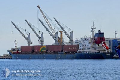
HORIZON
Bulk Carrier
Current Trip
TRIST
| Time Travelled | 18 h, 12 mins |
|---|---|
| Remaining Time | --- |
| Distance Travelled | 199.01 nm |
| Remaining Distance | --- |
| AVG Speed | 11.3 Knots |
| MAX Speed | 12.3 Knots |
| AVG Wind | 10.3 knots |
| MAX Wind | 19.8 knots |
| MIN Temp | 15.1°C / 59.18°F |
| MAX Temp | 23.4°C / 74.12°F |
| Draught | 10 m |
| Position Received | 1 m ago |
Current Position
| Longitude | 25.39481° |
|---|---|
| Latitude | 39.45823° |
| Status | Not under command |
| Speed | 11.6 Knots |
| Course | 216.2° |
| Area | Aegean Sea |
| Station | T-AIS |
| Position Received | 1 m ago |
Info
Information
The current position of HORIZON is in Aegean Sea with coordinates 39.45823° / 25.39481° as reported on 2024-04-18 07:04 by AIS to our vessel tracker app. The vessel's current speed is 11.6 Knots
The vessel HORIZON (IMO: 9323637, MMSI: 636016487) is a Bulk Carrier that was built in 2007 ( 17 years old ). It's sailing under the flag of [LR] Liberia.
In this page you can find informations about the vessels current position, last detected port calls, and current voyage information. If the vessels is not in coverage by AIS you will find the latest position.
The current position of HORIZON is detected by our AIS receivers and we are not responsible for the reliability of the data. The last position was recorded while the vessel was in Coverage by the Ais receivers of our vessel tracking app.
The current draught of HORIZON as reported by AIS is 10 meters
Weather
| Temperature | 17.2°C / 62.96°F |
|---|---|
| Wind Speed | 14 knots |
| Direction | 277° W |
| Pressure | 1003.7 hPa |
| Humidity | 72.8 % |
| Cloud Coverage | 94 % |
Featured Company
Most Visited Ports (Last year)
| Port | Arrivals | |
|---|---|---|
| 3 | ||
| 3 | ||
| 2 | ||
| 2 | ||
| 1 | ||
| 1 |
Last Trips
| Origin | Departure | Destination | Arrival | Distance | |
|---|---|---|---|---|---|
| 2024-04-14 23:38 | 2024-04-17 14:35 | 172.59 nm | |||
| 2024-04-04 20:40 | 2024-04-12 03:19 | 1147.96 nm | |||
| 2024-03-06 18:27 | 2024-03-28 23:00 | 5718.54 nm | |||
| 2024-02-14 21:49 | 2024-02-22 18:31 | 1853.87 nm | |||
| 2024-01-24 11:55 | 2024-02-08 14:14 | 1988.10 nm |
Events
| Time | Event | Details | Position / Dest | Info |
|---|---|---|---|---|
| 2024-04-18 04:17 | Status Changed | Not under command Default |
39.87109 / 25.82412
TRIST
|
Speed: 11.5 kn Course: 216° |
| 2024-04-18 04:09 | Status Changed | Default Not under command |
39.89152 / 25.84403
TRIST
|
Speed: 11.6 kn Course: 218.1° |
| 2024-04-18 04:05 | Change Sea Area | Greek part of the Aegean Sea Turkish part of the Aegean Sea |
39.90222 / 25.85565
Aegean Sea
|
Speed: 11.6 kn Course: 218.1° |
| 2024-04-18 03:56 | Status Changed | Not under command Default |
39.92390 / 25.88123
TRIST
|
Speed: 12.1 kn Course: 226° |
| 2024-04-18 03:56 | IN Coverage |
39.92390 / 25.88123
Aegean Sea
|
Speed: 11.9 kn Course: 227.6° |
|
| 2024-04-18 02:51 | Status Changed | Default Not under command |
40.02175 / 26.11090
TRIST
|
Speed: 11.3 kn Course: 268° |
| 2024-04-18 02:47 | Change Sea Area | Turkish part of the Aegean Sea Turkish part of the Sea of Marmara |
40.02234 / 26.12740
Aegean Sea
|
Speed: 11.3 kn Course: 268° |
| 2024-04-18 02:47 | Status Changed | Not under command Default |
40.02234 / 26.12740
TRIST
|
Speed: 10.5 kn Course: 261° |
| 2024-04-18 02:47 | OUT of Coverage |
40.02234 / 26.12740
Aegean Sea
|
Speed: 11.3 kn Course: 268° |
|
| 2024-04-18 02:08 | Status Changed | Default Not under command |
40.04133 / 26.25197
TRIST
|
Speed: 11.6 kn Course: 224.2° |