
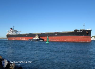
HOKURIKU MARU
Cargo
Current Trip
| Time Travelled | 7 days |
|---|---|
| Remaining Time | 9 days |
| Distance Travelled | 2015.20 nm |
| Remaining Distance | 2852.58 nm |
| AVG Speed | 11.5 Knots |
| MAX Speed | 13.3 Knots |
| AVG Wind | 6.7 knots |
| MAX Wind | 17 knots |
| MIN Temp | 20°C / 68°F |
| MAX Temp | 29.7°C / 85.46°F |
| Draught | 12.8 m |
| Position Received | 5 d ago |
Current Position
| Longitude | 153.73331° |
|---|---|
| Latitude | -26.95586° |
| Status | Under way using engine |
| Speed | 11.9 Knots |
| Course | 6.4° |
| Area | Coral Sea |
| Station | T-AIS |
| Position Received | 5 d ago |
Info
Information
The current position of HOKURIKU MARU is in Coral Sea with coordinates -26.95586° / 153.73331° as reported on 2024-04-18 07:25 by AIS to our vessel tracker app. The vessel's current speed is 11.9 Knots and is heading at the port of TSURUGA. The estimated time of arrival as calculated by MyShipTracking vessel tracking app is 2024-05-03 13:43 LT
The vessel HOKURIKU MARU (IMO: 9658939, MMSI: 432957000) is a Cargo It's sailing under the flag of [JP] Japan.
In this page you can find informations about the vessels current position, last detected port calls, and current voyage information. If the vessels is not in coverage by AIS you will find the latest position.
The current position of HOKURIKU MARU is detected by our AIS receivers and we are not responsible for the reliability of the data. The last position was recorded while the vessel was in Coverage by the Ais receivers of our vessel tracking app.
The current draught of HOKURIKU MARU as reported by AIS is 12.8 meters
Weather
| Temperature | 29.2°C / 84.56°F |
|---|---|
| Wind Speed | 7 knots |
| Direction | 94° E |
| Pressure | 1009.6 hPa |
| Humidity | 72.1 % |
| Cloud Coverage | 64 % |
Featured Company
Events
| Time | Event | Details | Position / Dest | Info |
|---|---|---|---|---|
| 2024-04-18 07:34 | Status Changed | Default Under way using engine |
-26.92714 / 153.73730
JP TRG
|
Speed: 11.9 kn Course: 6.4° |
| 2024-04-18 07:25 | OUT of Coverage |
-26.95586 / 153.73331
Coral Sea
JP TRG
|
Speed: 11.9 kn Course: 6.4° |
|
| 2024-04-18 07:24 | Status Changed | Under way using engine Default |
-26.95974 / 153.73283
JP TRG
|
Speed: 11.8 kn Course: 6° |
| 2024-04-18 07:10 | Status Changed | Default Under way using engine |
-27.00529 / 153.72739
JP TRG
|
Speed: 11.9 kn Course: 359.5° |
| 2024-04-18 06:11 | Status Changed | Under way using engine Default |
-27.20291 / 153.73472
JP TRG
|
Speed: 11.8 kn Course: 357° |
| 2024-04-18 06:10 | Status Changed | Default Under way using engine |
-27.20667 / 153.73486
JP TRG
|
Speed: 11.9 kn Course: 356.2° |
| 2024-04-18 03:30 | ETA Changed | 2024/05/04 00:00 2024/05/04 23:00 |
-27.70413 / 153.76771
JP TRG
|
Speed: 10.5 kn Course: 356.9° |
| 2024-04-18 02:38 | Status Changed | Under way using engine Default |
-27.85549 / 153.79027
JP TRG
|
Speed: 10.5 kn Course: 355° |
| 2024-04-18 02:24 | Status Changed | Default Under way using engine |
-27.89600 / 153.79318
JP TRG
|
Speed: 10.4 kn Course: 355.8° |
| 2024-04-18 02:13 | Status Changed | Under way using engine Default |
-27.92900 / 153.79568
JP TRG
|
Speed: 10.5 kn Course: 356° |