
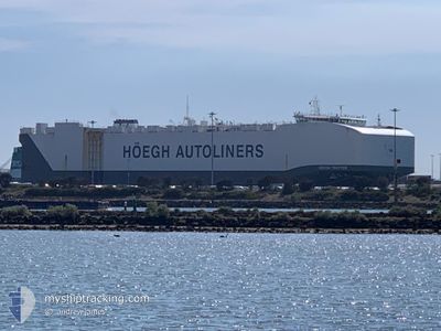
HOEGH TROTTER
Cargo
Current Trip
| Time Travelled | 15 days |
|---|---|
| Remaining Time | --- |
| Distance Travelled | 5487.47 nm |
| Remaining Distance | --- |
| AVG Speed | 14.5 Knots |
| MAX Speed | 18.3 Knots |
| AVG Wind | 9.9 knots |
| MAX Wind | 20.5 knots |
| MIN Temp | 15.5°C / 59.9°F |
| MAX Temp | 31.3°C / 88.34°F |
| Draught | 9.6 m |
| Position Received | 6 d ago |
Current Position
| Longitude | 103.49019° |
|---|---|
| Latitude | 1.20749° |
| Status | Under way using engine |
| Speed | 17.5 Knots |
| Course | 285.5° |
| Area | Singapore Strait |
| Station | T-AIS |
| Position Received | 6 d ago |
Info
Information
The current position of HOEGH TROTTER is in Singapore Strait with coordinates 1.20749° / 103.49019° as reported on 2024-04-12 23:28 by AIS to our vessel tracker app. The vessel's current speed is 17.5 Knots and is heading at the port of VALLETTA. The estimated time of arrival as calculated by MyShipTracking vessel tracking app is 2024-05-12 21:00 LT
The vessel HOEGH TROTTER (IMO: 9710749, MMSI: 259274000) is a Cargo It's sailing under the flag of [NO] Norway.
In this page you can find informations about the vessels current position, last detected port calls, and current voyage information. If the vessels is not in coverage by AIS you will find the latest position.
The current position of HOEGH TROTTER is detected by our AIS receivers and we are not responsible for the reliability of the data. The last position was recorded while the vessel was in Coverage by the Ais receivers of our vessel tracking app.
The current draught of HOEGH TROTTER as reported by AIS is 9.6 meters
Weather
| Temperature | 28.2°C / 82.76°F |
|---|---|
| Wind Speed | 15 knots |
| Direction | 91° E |
| Pressure | 1012.4 hPa |
| Humidity | 74.2 % |
| Cloud Coverage | 41 % |
Featured Company
Last Port Calls
| Port | Arrival | Departure | Time In Port |
|---|---|---|---|
| 2024-04-03 04:29 | 2024-04-04 09:25 | 1 d | |
| 2024-03-28 23:23 | 2024-03-30 04:17 | 1 d | |
| 2024-03-24 21:36 | 2024-03-25 17:18 | 19 h | |
| 2024-03-23 21:41 | 2024-03-24 08:21 | 10 h | |
| 2024-03-22 21:39 | 2024-03-23 09:21 | 11 h | |
| 2024-03-21 23:19 | 2024-03-22 08:49 | 9 h | |
| 2024-03-11 00:03 | 2024-03-11 10:23 | 10 h | |
| 2024-03-07 17:25 | 2024-03-08 07:54 | 14 h | |
| 2024-03-02 04:59 | 2024-03-03 11:34 | 1 d | |
| 2024-02-24 15:55 | 2024-02-28 08:19 | 3 d |
Most Visited Ports (Last year)
| Port | Arrivals | |
|---|---|---|
| 3 | ||
| 3 | ||
| 2 | ||
| 2 | ||
| 2 | ||
| 2 |
Last Trips
| Origin | Departure | Destination | Arrival | Distance | |
|---|---|---|---|---|---|
| 2024-03-30 13:17 | 2024-04-03 13:29 | 780.97 nm | |||
| 2024-03-26 02:18 | 2024-03-29 08:23 | 751.37 nm | |||
| 2024-03-24 17:21 | 2024-03-25 06:36 | 125.79 nm | |||
| 2024-03-23 18:21 | 2024-03-24 06:41 | 113.10 nm | |||
| 2024-03-22 17:49 | 2024-03-23 06:39 | 43.31 nm | |||
| 2024-03-11 21:23 | 2024-03-22 08:19 | 3931.97 nm | |||
| 2024-03-08 20:54 | 2024-03-11 11:03 | 1010.87 nm | |||
| 2024-03-03 22:34 | 2024-03-08 06:25 | 1389.77 nm | |||
| 2024-02-28 19:19 | 2024-03-02 15:59 | 646.45 nm | |||
| 2024-01-22 17:11 | 2024-02-25 02:55 | 6931.75 nm |
Events
| Time | Event | Details | Position / Dest | Info |
|---|---|---|---|---|
| 2024-04-12 23:34 | Status Changed | Default Under way using engine |
1.21542 / 103.46062
SG SIN PEBGA>MT MLA
|
Speed: 17.5 kn Course: 285.5° |
| 2024-04-12 23:28 | OUT of Coverage |
1.20750 / 103.49019
Singapore Strait
SG SIN PEBGA>MT MLA
|
Speed: 17.5 kn Course: 285.5° |
|
| 2024-04-12 23:08 | Change Sea Area | Malaysian part of the Singapore Strait Indonesian part of the Singapore Strait |
1.18792 / 103.58175
Singapore Strait
SG SIN PEBGA>MT MLA
|
Speed: 16 kn Course: 275.2° |
| 2024-04-12 22:44 | Change Sea Area | Indonesian part of the Singapore Strait Singaporean part of the Singapore Strait |
1.17483 / 103.67708
Singapore Strait
SG SIN PEBGA>MT MLA
|
Speed: 13.4 kn Course: 302.9° |
| 2024-04-12 22:39 | ETA Changed | 2024/05/12 21:00 2024/04/12 21:00 |
1.16446 / 103.69229
SG SIN PEBGA>MT MLA
|
Speed: 11.9 kn Course: 310.3° |
| 2024-04-12 22:38 | Change Sea Area | Singaporean part of the Singapore Strait Indonesian part of the Singapore Strait |
1.16307 / 103.69389
Singapore Strait
SG SIN PEBGA>MT MLA
|
Speed: 12 kn Course: 311.1° |
| 2024-04-12 22:38 | ETA Changed | 2024/04/12 21:00 2024/04/12 03:00 |
1.16267 / 103.69435
SG SIN PEBGA>MT MLA
|
Speed: 12 kn Course: 311.2° |
| 2024-04-12 22:31 | Change Sea Area | Indonesian part of the Singapore Strait Singaporean part of the Singapore Strait |
1.15045 / 103.71066
Singapore Strait
|
Speed: 11.7 kn Course: 300.7° |
| 2024-04-12 21:10 | START Moving | 1.42 nm, South East of SINGAPORE |
1.24200 / 103.87248
SG SIN PEBGA>MT MLA
|
Speed: 3.2 kn Course: 198° |
| 2024-04-12 21:09 | Status Changed | Under way using engine At anchor |
1.24272 / 103.87274
SG SIN PEBGA>MT MLA
|
Speed: 0.7 kn Course: 250° |