
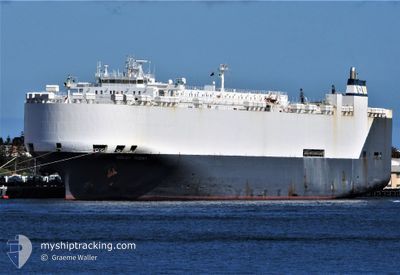
HOEGH TRIDENT
Vehicles Carrier
Current Trip
| Time Travelled | 4 days |
|---|---|
| Remaining Time | --- |
| Distance Travelled | 1285.80 nm |
| Remaining Distance | --- |
| AVG Speed | 12.6 Knots |
| MAX Speed | 17.1 Knots |
| AVG Wind | 13.3 knots |
| MAX Wind | 23 knots |
| MIN Temp | 18.6°C / 65.48°F |
| MAX Temp | 27.9°C / 82.22°F |
| Draught | 9 m |
| Position Received | 7 d ago |
Current Position
| Longitude | -79.90735° |
|---|---|
| Latitude | 9.82378° |
| Status | Under way using engine |
| Speed | 14 Knots |
| Course | 18.4° |
| Area | Caribbean Sea |
| Station | T-AIS |
| Position Received | 7 d ago |
Info
Information
The current position of HOEGH TRIDENT is in Caribbean Sea with coordinates 9.82378° / -79.90735° as reported on 2024-04-16 00:15 by AIS to our vessel tracker app. The vessel's current speed is 14 Knots and is heading at the port of BALBOA. The estimated time of arrival as calculated by MyShipTracking vessel tracking app is 2024-04-15 01:00 LT
The vessel HOEGH TRIDENT (IMO: 9075709, MMSI: 257713000) is a Vehicles Carrier that was built in 1995 ( 29 years old ). It's sailing under the flag of [NO] Norway.
In this page you can find informations about the vessels current position, last detected port calls, and current voyage information. If the vessels is not in coverage by AIS you will find the latest position.
The current position of HOEGH TRIDENT is detected by our AIS receivers and we are not responsible for the reliability of the data. The last position was recorded while the vessel was in Coverage by the Ais receivers of our vessel tracking app.
The current draught of HOEGH TRIDENT as reported by AIS is 9 meters
Weather
| Temperature | 20.3°C / 68.54°F |
|---|---|
| Wind Speed | 10 knots |
| Direction | 156° SSE |
| Pressure | 1018.3 hPa |
| Humidity | 69.1 % |
| Cloud Coverage | 1 % |
Featured Company
Last Port Calls
| Port | Arrival | Departure | Time In Port |
|---|---|---|---|
| 2024-04-18 02:07 | 2024-04-18 19:49 | 17 h | |
| 2024-03-23 07:41 | 2024-03-23 15:55 | 8 h | |
| 2024-03-20 22:23 | 2024-03-22 05:04 | 1 d | |
| 2024-03-12 19:28 | 2024-03-13 04:02 | 8 h | |
| 2024-03-04 02:51 | |||
| 2024-02-22 11:41 | 2024-02-23 08:25 | 20 h | |
| 2024-02-21 01:46 | 2024-02-21 15:06 | 13 h | |
| 2024-02-16 16:45 | 2024-02-17 09:53 | 17 h | |
| 2024-02-14 05:14 | 2024-02-14 19:49 | 14 h | |
| 2024-02-03 09:22 | 2024-02-03 21:59 | 12 h |
Last Trips
| Origin | Departure | Destination | Arrival | Distance | |
|---|---|---|---|---|---|
| 2024-03-24 00:55 | 2024-04-17 21:07 | 8597.15 nm | |||
| 2024-03-22 14:04 | 2024-03-23 16:41 | 365.90 nm | |||
| 2024-03-13 12:02 | 2024-03-21 07:23 | 2710.13 nm | |||
| 2024-02-23 10:25 | 2024-03-04 08:21 | 3871.97 nm | |||
| 2024-02-21 17:06 | 2024-02-22 13:41 | 334.66 nm | |||
| 2024-02-17 12:53 | 2024-02-21 03:46 | 1427.98 nm | |||
| 2024-02-14 22:49 | 2024-02-16 19:45 | 245.33 nm | |||
| 2024-02-04 05:59 | 2024-02-14 08:14 | 4098.14 nm | |||
| 2024-01-28 23:25 | 2024-02-03 17:22 | 2273.93 nm |
Events
| Time | Event | Details | Position / Dest | Info |
|---|---|---|---|---|
| 2024-04-23 11:46 | START Moving | 8.68 nm, South East of FREEPORT (TX) |
28.87090 / -95.18648
JPKWS>PABLB
|
Speed: 7.4 kn Course: 254° |
| 2024-04-22 23:27 | STOP Moving | 8.99 nm, South East of FREEPORT (TX) |
28.87056 / -95.17998
JPKWS>PABLB
|
Speed: 0.2 kn Course: 72° |
| 2024-04-18 19:57 | START Moving | 1.36 nm, North of PORT ROYAL |
17.96264 / -76.84476
JPKWS>PABLB
|
Speed: 11.5 kn Course: 226° |
| 2024-04-18 19:49 | PORT DEPARTURE |
|
17.96264 / -76.84476
JPKWS>PABLB
|
Speed: Course: 312° |
| 2024-04-18 02:35 | STOP Moving |
17.98177 / -76.82764
[JM] KINGSTON (JM)
|
Speed: Course: 314° |
|
| 2024-04-18 02:07 | PORT ARRIVAL |
|
17.96657 / -76.83422
[JM] KINGSTON (JM)
|
Speed: 7.1 kn Course: 65° |
| 2024-04-16 00:26 | Status Changed | Default Under way using engine |
9.86537 / -79.89195
JPKWS>PABLB
|
Speed: 14 kn Course: 18.4° |
| 2024-04-16 00:15 | Status Changed | Under way using engine Default |
9.82378 / -79.90735
JPKWS>PABLB
|
Speed: 14 kn Course: 20° |
| 2024-04-16 00:15 | OUT of Coverage |
9.82378 / -79.90735
Caribbean Sea
|
Speed: 14 kn Course: 18.4° |
|
| 2024-04-16 00:12 | Status Changed | Default Under way using engine |
9.81108 / -79.91187
JPKWS>PABLB
|
Speed: 14.5 kn Course: 19.8° |