
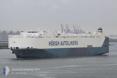
HOEGH TRADER
Vehicles Carrier
Current Trip
| Time Travelled | 18 days |
|---|---|
| Remaining Time | 30 mins |
| Distance Travelled | 6045.83 nm |
| Remaining Distance | 11.45 nm |
| AVG Speed | 13.8 Knots |
| MAX Speed | 20.3 Knots |
| AVG Wind | 13 knots |
| MAX Wind | 30.3 knots |
| MIN Temp | 6.1°C / 42.98°F |
| MAX Temp | 24.4°C / 75.92°F |
| Draught | 7.1 m |
| Position Received | Now |
Current Position
| Longitude | 8.35161° |
|---|---|
| Latitude | 53.68649° |
| Status | Under way using engine |
| Speed | 14.8 Knots |
| Course | 140.3° |
| Area | North Sea |
| Station | T-AIS |
| Position Received | Now |
Info
Information
The current position of HOEGH TRADER is in North Sea with coordinates 53.68649° / 8.35161° as reported on 2024-04-23 11:30 by AIS to our vessel tracker app. The vessel's current speed is 14.8 Knots and is heading at the port of BREMERHAVEN. The estimated time of arrival as calculated by MyShipTracking vessel tracking app is 2024-04-23 12:01 LT
The vessel HOEGH TRADER (IMO: 9171280, MMSI: 258882000) is a Vehicles Carrier that was built in 1998 ( 26 years old ). It's sailing under the flag of [NO] Norway.
In this page you can find informations about the vessels current position, last detected port calls, and current voyage information. If the vessels is not in coverage by AIS you will find the latest position.
The current position of HOEGH TRADER is detected by our AIS receivers and we are not responsible for the reliability of the data. The last position was recorded while the vessel was in Coverage by the Ais receivers of our vessel tracking app.
The current draught of HOEGH TRADER as reported by AIS is 7.1 meters
Weather
| Temperature | 7.5°C / 45.5°F |
|---|---|
| Wind Speed | 12 knots |
| Direction | 274° W |
| Pressure | 1018.2 hPa |
| Humidity | 54.4 % |
| Cloud Coverage | 32 % |
Featured Company
Last Port Calls
| Port | Arrival | Departure | Time In Port |
|---|---|---|---|
| 2024-04-03 13:19 | 2024-04-05 01:38 | 1 d | |
| 2024-03-30 13:03 | 2024-03-31 02:15 | 13 h | |
| 2024-03-03 22:27 | 2024-03-05 07:09 | 1 d | |
| 2024-03-01 21:42 | 2024-03-02 15:19 | 17 h | |
| 2024-02-28 22:08 | 2024-02-29 06:18 | 8 h | |
| 2024-02-27 10:24 | |||
| 2024-02-19 05:48 | 2024-02-19 14:35 | 8 h | |
| 2024-02-05 21:15 | 2024-02-08 09:51 | 2 d | |
| 2024-02-03 12:39 | 2024-02-04 23:16 | 1 d | |
| 2024-02-01 04:59 | 2024-02-02 10:27 | 1 d |
Last Trips
| Origin | Departure | Destination | Arrival | Distance | |
|---|---|---|---|---|---|
| 2024-03-30 21:15 | 2024-04-03 08:19 | 1287.12 nm | |||
| 2024-03-05 16:09 | 2024-03-30 08:03 | 9061.39 nm | |||
| 2024-03-03 00:19 | 2024-03-04 07:27 | 284.14 nm | |||
| 2024-02-29 15:18 | 2024-03-02 06:42 | 490.91 nm | |||
| 2024-02-27 19:24 | 2024-02-29 07:08 | 302.75 nm | |||
| 2024-02-08 12:51 | 2024-02-19 13:48 | 3921.31 nm | |||
| 2024-02-05 03:16 | 2024-02-06 00:15 | 323.06 nm | |||
| 2024-02-02 14:27 | 2024-02-03 16:39 | 114.27 nm | |||
| 2023-12-22 07:40 | 2024-02-01 08:59 | 11845.72 nm |
Events
| Time | Event | Details | Position / Dest | Info |
|---|---|---|---|---|
| 2024-04-23 07:46 | Status Changed | Under way using engine Default |
53.86012 / 7.22846
DEBRV
|
Speed: 11.7 kn Course: 80° |
| 2024-04-23 07:44 | Status Changed | Default Under way using engine |
53.85917 / 7.22046
DEBRV
|
Speed: 11.6 kn Course: 81° |
| 2024-04-23 06:24 | Draught Changed | 7.1 7.3 |
53.81305 / 6.80101
DEBRV
|
Speed: 11.1 kn Course: 75.6° |
| 2024-04-23 06:09 | Detected in Sea | German part of the North Sea |
53.80242 / 6.73083
North Sea
DEBRV
|
Speed: 10.8 kn Course: 77.2° |
| 2024-04-23 06:09 | Status Changed | Under way using engine Default |
53.80242 / 6.73083
DEBRV
|
Speed: 10.8 kn Course: 75° |
| 2024-04-23 06:04 | IN Coverage |
53.80242 / 6.73083
North Sea
DEBRV
|
Speed: 10.8 kn Course: 77.2° |
|
| 2024-04-23 04:18 | Status Changed | Default Under way using engine |
53.72051 / 6.19425
DEBRV
|
Speed: 11 kn Course: 71.8° |
| 2024-04-23 04:15 | OUT of Coverage |
53.71793 / 6.17935
North Sea
DEBRV
|
Speed: 11 kn Course: 71.8° |
|
| 2024-04-23 04:12 | Status Changed | Under way using engine Default |
53.71551 / 6.16539
DEBRV
|
Speed: 11 kn Course: 71° |
| 2024-04-23 04:08 | Status Changed | Default Under way using engine |
53.71235 / 6.14809
DEBRV
|
Speed: 10.9 kn Course: 73° |