
RCC AFRICA
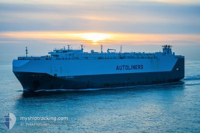
Vehicles Carrier
Current Trip
| Time Travelled | 1 day |
|---|---|
| Remaining Time | --- |
| Distance Travelled | 628.43 nm |
| Remaining Distance | --- |
| AVG Speed | 14.9 Knots |
| MAX Speed | 18.4 Knots |
| AVG Wind | 5.6 knots |
| MAX Wind | 21 knots |
| MIN Temp | 3.1°C / 37.58°F |
| MAX Temp | 9.3°C / 48.74°F |
| Draught | 8 m |
| Position Received | 19 h, 56 m ago |
Current Position
| Longitude | -130.49051° |
|---|---|
| Latitude | 48.44030° |
| Status | Under way using engine |
| Speed | 14.5 Knots |
| Course | 270.9° |
| Area | North Pacific Ocean |
| Station | T-AIS |
| Position Received | 19 h, 56 m ago |
Info
Information
The current position of RCC AFRICA is in North Pacific Ocean with coordinates 48.44030° / -130.49051° as reported on 2024-04-18 04:54 by AIS to our vessel tracker app. The vessel's current speed is 14.5 Knots and is heading at the port of ZHOUSHAN. The estimated time of arrival as calculated by MyShipTracking vessel tracking app is 2024-05-01 22:00 LT
The vessel RCC AFRICA (IMO: 9277814, MMSI: 311594000) is a Vehicles Carrier that was built in 2004 ( 20 years old ). It's sailing under the flag of [BS] Bahamas.
In this page you can find informations about the vessels current position, last detected port calls, and current voyage information. If the vessels is not in coverage by AIS you will find the latest position.
The current position of RCC AFRICA is detected by our AIS receivers and we are not responsible for the reliability of the data. The last position was recorded while the vessel was in Coverage by the Ais receivers of our vessel tracking app.
The current draught of RCC AFRICA as reported by AIS is 8 meters
Weather
| Temperature | 7.5°C / 45.5°F |
|---|---|
| Wind Speed | 22 knots |
| Direction | 139° SE |
| Pressure | 1022.4 hPa |
| Humidity | 84.3 % |
| Cloud Coverage | 100 % |
Featured Company
Last Port Calls
| Port | Arrival | Departure | Time In Port |
|---|---|---|---|
| 2024-04-16 10:22 | 2024-04-17 03:30 | 17 h | |
| 2024-04-14 08:34 | 2024-04-15 03:05 | 18 h | |
| 2024-04-06 11:16 | 2024-04-07 07:04 | 19 h | |
| 2024-03-18 23:38 | 2024-03-20 04:44 | 1 d | |
| 2024-03-15 13:32 | 2024-03-17 04:26 | 1 d | |
| 2024-03-08 23:10 | 2024-03-09 05:59 | 6 h | |
| 2024-03-06 20:48 | 2024-03-07 03:01 | 6 h | |
| 2024-03-02 21:11 | 2024-03-04 07:58 | 1 d | |
| 2024-02-10 10:36 | 2024-02-11 07:16 | 20 h | |
| 2024-02-07 13:32 | 2024-02-07 22:12 | 8 h |
Most Visited Ports (Last year)
| Port | Arrivals | |
|---|---|---|
| 9 | ||
| 7 | ||
| 4 | ||
| 4 | ||
| 4 | ||
| 3 |
Last Trips
| Origin | Departure | Destination | Arrival | Distance | |
|---|---|---|---|---|---|
| 2024-04-14 20:05 | 2024-04-16 03:22 | 41.90 nm | |||
| 2024-04-07 00:04 | 2024-04-14 01:34 | 215.26 nm | |||
| 2024-03-20 13:44 | 2024-04-06 04:16 | 5239.70 nm | |||
| 2024-03-17 13:26 | 2024-03-19 08:38 | 415.25 nm | |||
| 2024-03-09 13:59 | 2024-03-15 22:32 | 1597.67 nm | |||
| 2024-03-07 12:01 | 2024-03-09 07:10 | 453.21 nm | |||
| 2024-03-04 16:58 | 2024-03-07 05:48 | 611.02 nm | |||
| 2024-02-10 23:16 | 2024-03-03 06:11 | 5862.91 nm | |||
| 2024-02-07 14:12 | 2024-02-10 02:36 | 427.35 nm | |||
| 2024-02-06 16:09 | 2024-02-07 05:32 | 147.28 nm |
Events
| Time | Event | Details | Position / Dest | Info |
|---|---|---|---|---|
| 2024-04-18 05:02 | Status Changed | Default Under way using engine |
48.44088 / -130.53889
CN ZOS
|
Speed: 14.5 kn Course: 270.9° |
| 2024-04-18 04:54 | OUT of Coverage |
48.44030 / -130.49051
North Pacific Ocean
CN ZOS
|
Speed: 14.5 kn Course: 270.9° |
|
| 2024-04-18 03:34 | Status Changed | Under way using engine Default |
48.43715 / -130.01354
CN ZOS
|
Speed: 14 kn Course: 271° |
| 2024-04-18 03:18 | IN Coverage |
48.43715 / -130.01354
North Pacific Ocean
CN ZOS
|
Speed: 14.3 kn Course: 270.6° |
|
| 2024-04-17 19:00 | Status Changed | Default Under way using engine |
48.46055 / -126.98892
CN ZOS
|
Speed: 14.2 kn Course: 267.8° |
| 2024-04-17 18:54 | OUT of Coverage |
48.46146 / -126.95160
North Pacific Ocean
CN ZOS
|
Speed: 14.2 kn Course: 267.8° |
|
| 2024-04-17 18:47 | Status Changed | Under way using engine Default |
48.46281 / -126.91171
CN ZOS
|
Speed: 14 kn Course: 268° |
| 2024-04-17 18:36 | Status Changed | Default Under way using engine |
48.46333 / -126.84333
CN ZOS
|
Speed: 14.6 kn Course: 269.5° |
| 2024-04-17 14:46 | Draught Changed | 8 8.1 |
48.49817 / -125.44794
CN ZOS
|
Speed: 14.3 kn Course: 264.8° |
| 2024-04-17 13:59 | Status Changed | Under way using engine Default |
48.51718 / -125.16748
CN ZOS
|
Speed: 14.7 kn Course: 265° |