
NLD WARSHIP
Military ops
Current Trip
Unknown
| Time Travelled | --- |
|---|---|
| Remaining Time | --- |
| Distance Travelled | --- |
| Remaining Distance | --- |
| AVG Speed | --- |
| MAX Speed | --- |
| AVG Wind | --- |
| MAX Wind | --- |
| MIN Temp | --- |
| MAX Temp | --- |
| Draught | 0 m |
| Position Received | 1 d ago |
Current Position
| Longitude | 4.57836° |
|---|---|
| Latitude | 52.86760° |
| Status | Under way using engine |
| Speed | 13.4 Knots |
| Course | 247.6° |
| Area | North Sea |
| Station | T-AIS |
| Position Received | 1 d ago |
Info
Information
The current position of NLD WARSHIP is in North Sea with coordinates 52.86760° / 4.57836° as reported on 2024-04-16 18:43 by AIS to our vessel tracker app. The vessel's current speed is 13.4 Knots
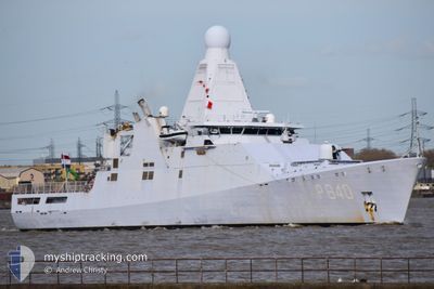
The vessel NLD WARSHIP (IMO: 4601058, MMSI: 244522000) is a Military ops It's sailing under the flag of [NL] Netherlands.
In this page you can find informations about the vessels current position, last detected port calls, and current voyage information. If the vessels is not in coverage by AIS you will find the latest position.
The current position of NLD WARSHIP is detected by our AIS receivers and we are not responsible for the reliability of the data. The last position was recorded while the vessel was in Coverage by the Ais receivers of our vessel tracking app.
Weather
| Temperature | 8.7°C / 47.66°F |
|---|---|
| Wind Speed | 18 knots |
| Direction | 360° N |
| Pressure | 1009.7 hPa |
| Humidity | 67.2 % |
| Cloud Coverage | 51 % |
Featured Company
Last Port Calls
| Port | Arrival | Departure | Time In Port |
|---|---|---|---|
| 2024-04-12 17:03 | |||
| 2024-02-07 09:03 | 2024-03-31 16:44 | ||
| 2024-02-03 17:11 |
Most Visited Ports (Last year)
| Port | Arrivals | |
|---|---|---|
| 11 | ||
| 1 | ||
| 1 | ||
| 1 | ||
| 1 | ||
| 1 |
Last Trips
| Origin | Departure | Destination | Arrival | Distance | |
|---|---|---|---|---|---|
| 2024-03-31 18:44 | 2024-04-12 18:03 | 747.34 nm | |||
| 2024-02-03 17:11 | 2024-02-07 10:03 | 1084.80 nm |
Events
| Time | Event | Details | Position / Dest | Info |
|---|---|---|---|---|
| 2024-04-16 18:43 | OUT of Coverage |
52.86760 / 4.57836
North Sea
|
Speed: 13.4 kn Course: 247.6° |
|
| 2024-04-16 18:07 | START Moving | 1.69 nm, North West of DEN HELDER |
52.98425 / 4.76620
|
Speed: 6.3 kn Course: 165.2° |
| 2024-04-16 18:03 | Status Changed | Under way using engine At anchor |
52.98547 / 4.76459
|
Speed: 0.5 kn Course: 37° |
| 2024-04-16 12:03 | Status Changed | At anchor Default |
52.98515 / 4.76611
|
Speed: 0.3 kn Course: 305° |
| 2024-04-16 11:57 | Status Changed | Default At anchor |
52.98561 / 4.76662
|
Speed: 0.2 kn Course: 306° |
| 2024-04-16 10:00 | Status Changed | At anchor Under way using engine |
52.98609 / 4.76768
|
Speed: 0.4 kn Course: 275° |
| 2024-04-16 09:58 | STOP Moving | 1.77 nm, North West of DEN HELDER |
52.98596 / 4.76771
|
Speed: 0.3 kn Course: 262° |
| 2024-04-16 09:08 | Change Sea Area | Dutch part of the North Sea United Kingdom part of the North Sea |
52.90253 / 4.64621
North Sea
|
Speed: 17.1 kn Course: 30.5° |
| 2024-04-16 09:05 | IN Coverage |
52.90253 / 4.64621
North Sea
|
Speed: 17.1 kn Course: 30.5° |
|
| 2024-04-12 17:12 | OUT of Coverage |
51.50675 / -.08125
North Sea
[GB] LONDON
|
Speed: Course: 285.2° |