
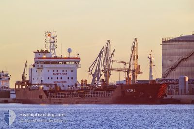
HITRA
Oil/Chemical Tanker
Current Trip
| Time Travelled | 1 day |
|---|---|
| Remaining Time | --- |
| Distance Travelled | 224.12 nm |
| Remaining Distance | --- |
| AVG Speed | 8.9 Knots |
| MAX Speed | 14.6 Knots |
| AVG Wind | 9.4 knots |
| MAX Wind | 14.3 knots |
| MIN Temp | 14.8°C / 58.64°F |
| MAX Temp | 21.9°C / 71.42°F |
| Draught | 5 m |
| Position Received | 1 m ago |
Current Position
| Longitude | 25.39062° |
|---|---|
| Latitude | 39.63382° |
| Status | Under way using engine |
| Speed | 9.1 Knots |
| Course | 232° |
| Area | Aegean Sea |
| Station | T-AIS |
| Position Received | 1 m ago |
Info
Information
The current position of HITRA is in Aegean Sea with coordinates 39.63382° / 25.39062° as reported on 2024-04-24 18:05 by AIS to our vessel tracker app. The vessel's current speed is 9.1 Knots and is heading at the port of ACHLADI. The estimated time of arrival as calculated by MyShipTracking vessel tracking app is 2024-04-25 06:00 LT
The vessel HITRA (IMO: 9413652, MMSI: 249421000) is a Oil/Chemical Tanker that was built in 2009 ( 15 years old ). It's sailing under the flag of [MT] Malta.
In this page you can find informations about the vessels current position, last detected port calls, and current voyage information. If the vessels is not in coverage by AIS you will find the latest position.
The current position of HITRA is detected by our AIS receivers and we are not responsible for the reliability of the data. The last position was recorded while the vessel was in Coverage by the Ais receivers of our vessel tracking app.
The current draught of HITRA as reported by AIS is 5 meters
Weather
| Temperature | 17.7°C / 63.86°F |
|---|---|
| Wind Speed | 8 knots |
| Direction | 180° S |
| Pressure | 1005.1 hPa |
| Humidity | 81.2 % |
| Cloud Coverage | 100 % |
Featured Company
Last Port Calls
| Port | Arrival | Departure | Time In Port |
|---|---|---|---|
| 2024-03-16 07:21 | 2024-04-23 06:36 | ||
| 2024-03-06 12:07 | 2024-03-07 20:15 | 1 d | |
| 2024-02-27 07:53 | 2024-02-29 07:01 | 1 d | |
| 2024-02-25 12:06 | 2024-02-26 12:55 | 1 d | |
| 2024-02-19 07:53 | 2024-02-20 13:22 | 1 d | |
| 2024-02-14 11:16 | 2024-02-14 19:28 | 8 h | |
| 2024-02-13 02:21 | 2024-02-14 08:57 | 1 d | |
| 2024-02-11 21:23 | 2024-02-12 10:58 | 13 h | |
| 2024-02-07 22:58 | 2024-02-08 21:10 | 22 h | |
| 2024-02-03 18:38 | 2024-02-05 15:57 | 1 d |
Most Visited Ports (Last year)
| Port | Arrivals | |
|---|---|---|
| 18 | ||
| 14 | ||
| 10 | ||
| 6 | ||
| 3 | ||
| 3 |
Last Trips
| Origin | Departure | Destination | Arrival | Distance | |
|---|---|---|---|---|---|
| 2024-03-07 22:15 | 2024-03-16 10:21 | 249.13 nm | |||
| 2024-02-29 09:01 | 2024-03-06 14:07 | 1087.34 nm | |||
| 2024-02-26 14:55 | 2024-02-27 09:53 | 14.86 nm | |||
| 2024-02-20 14:22 | 2024-02-25 14:06 | 958.84 nm | |||
| 2024-02-14 20:28 | 2024-02-19 08:53 | 888.05 nm | |||
| 2024-02-14 09:57 | 2024-02-14 12:16 | 17.77 nm | |||
| 2024-02-12 11:58 | 2024-02-13 03:21 | 159.74 nm | |||
| 2024-02-08 22:10 | 2024-02-11 22:23 | 560.74 nm | |||
| 2024-02-05 16:57 | 2024-02-07 23:58 | 546.72 nm | |||
| 2024-01-26 21:46 | 2024-02-03 19:38 | 192.76 nm |
Events
| Time | Event | Details | Position / Dest | Info |
|---|---|---|---|---|
| 2024-04-24 13:40 | Change Sea Area | Greek part of the Aegean Sea Turkish part of the Aegean Sea |
39.90917 / 25.82583
Aegean Sea
GRACL
|
Speed: 11.5 kn Course: 230° |
| 2024-04-24 13:25 | Status Changed | Under way using engine Default |
39.93973 / 25.87550
GRACL
|
Speed: 11.7 kn Course: 229° |
| 2024-04-24 12:53 | Status Changed | Default Under way using engine |
40.00757 / 25.98013
GRACL
|
Speed: 11.7 kn Course: 263° |
| 2024-04-24 12:07 | Change Sea Area | Turkish part of the Aegean Sea Turkish part of the Sea of Marmara |
40.02962 / 26.17700
Aegean Sea
GRACL
|
Speed: 13.5 kn Course: 264° |
| 2024-04-24 09:37 | Status Changed | Under way using engine Default |
40.35905 / 26.65015
GRACL
|
Speed: 11.4 kn Course: 232° |
| 2024-04-24 09:37 | IN Coverage |
40.35905 / 26.65015
Sea of Marmara
GRACL
|
Speed: 12.4 kn Course: 213° |
|
| 2024-04-24 07:50 | Status Changed | Default Under way using engine |
40.53330 / 27.00697
GRACL
|
Speed: 11 kn Course: 242° |
| 2024-04-24 07:37 | OUT of Coverage |
40.55053 / 27.05360
Sea of Marmara
GRACL
|
Speed: 11 kn Course: 242° |
|
| 2024-04-24 00:16 | START Moving | 2.9 nm, West of YESILKOY |
40.94215 / 28.76448
GRACL
|
Speed: 4.4 kn Course: 225° |
| 2024-04-24 00:08 | Status Changed | Under way using engine At anchor |
40.94360 / 28.76557
GRACL
|
Speed: 0.4 kn Course: 316° |