
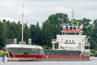
HESTIA
General Cargo
Current Trip
| Time Travelled | 5 days |
|---|---|
| Remaining Time | 18 h, 6 mins |
| Distance Travelled | 1220.29 nm |
| Remaining Distance | 174.34 nm |
| AVG Speed | 8.4 Knots |
| MAX Speed | 12.9 Knots |
| AVG Wind | 12.4 knots |
| MAX Wind | 29.4 knots |
| MIN Temp | 1.8°C / 35.24°F |
| MAX Temp | 20.9°C / 69.62°F |
| Draught | 5.5 m |
| Position Received | Now |
Current Position
| Longitude | 11.19468° |
|---|---|
| Latitude | 54.56430° |
| Status | Under way using engine |
| Speed | 9.1 Knots |
| Course | 111.4° |
| Area | Baltic Sea |
| Station | T-AIS |
| Position Received | Now |
Info
Information
The current position of HESTIA is in Baltic Sea with coordinates 54.56430° / 11.19468° as reported on 2024-04-24 16:45 by AIS to our vessel tracker app. The vessel's current speed is 9.1 Knots and is heading at the port of SZCZECIN. The estimated time of arrival as calculated by MyShipTracking vessel tracking app is 2024-04-25 10:51 LT
The vessel HESTIA (IMO: 9411783, MMSI: 246827000) is a General Cargo that was built in 2011 ( 13 years old ). It's sailing under the flag of [NL] Netherlands.
In this page you can find informations about the vessels current position, last detected port calls, and current voyage information. If the vessels is not in coverage by AIS you will find the latest position.
The current position of HESTIA is detected by our AIS receivers and we are not responsible for the reliability of the data. The last position was recorded while the vessel was in Coverage by the Ais receivers of our vessel tracking app.
The current draught of HESTIA as reported by AIS is 5.5 meters
Weather
| Temperature | 6.4°C / 43.52°F |
|---|---|
| Wind Speed | 13 knots |
| Direction | 97° E |
| Pressure | 1004.6 hPa |
| Humidity | 76.4 % |
| Cloud Coverage | 42 % |
Featured Company
Last Port Calls
| Port | Arrival | Departure | Time In Port |
|---|---|---|---|
| 2024-04-16 22:37 | 2024-04-18 17:12 | 1 d | |
| 2024-04-11 18:11 | 2024-04-11 19:14 | 1 h | |
| 2024-04-08 18:55 | 2024-04-10 18:12 | 1 d | |
| 2024-04-06 13:29 | 2024-04-06 14:14 | 45 m | |
| 2024-03-29 21:38 | 2024-04-05 14:49 | 6 d | |
| 2024-03-23 00:13 | 2024-03-26 20:02 | 3 d | |
| 2024-03-16 09:42 | 2024-03-19 19:48 | 3 d | |
| 2024-03-12 06:23 | 2024-03-13 08:26 | 1 d | |
| 2024-03-10 19:42 | 2024-03-11 05:47 | 10 h | |
| 2024-03-07 07:10 | 2024-03-08 06:15 | 23 h |
Last Trips
| Origin | Departure | Destination | Arrival | Distance | |
|---|---|---|---|---|---|
| 2024-04-11 21:14 | 2024-04-17 00:37 | 952.47 nm | |||
| 2024-04-10 19:12 | 2024-04-11 20:11 | 223.94 nm | |||
| 2024-04-06 16:14 | 2024-04-08 19:55 | 426.48 nm | |||
| 2024-04-05 16:49 | 2024-04-06 15:29 | 217.42 nm | |||
| 2024-03-26 20:02 | 2024-03-29 22:38 | 649.25 nm | |||
| 2024-03-19 19:48 | 2024-03-23 00:13 | 131.56 nm | |||
| 2024-03-13 09:26 | 2024-03-16 09:42 | 601.53 nm | |||
| 2024-03-11 06:47 | 2024-03-12 07:23 | 191.66 nm | |||
| 2024-03-08 07:15 | 2024-03-10 20:42 | 412.92 nm | |||
| 2024-03-06 01:39 | 2024-03-07 08:10 | 267.92 nm |
Events
| Time | Event | Details | Position / Dest | Info |
|---|---|---|---|---|
| 2024-04-24 15:19 | START Moving | 13.24 nm, North West of HEILIGENHAFEN |
54.55709 / 10.79949
PL SZZ
|
Speed: 10.1 kn Course: 81.8° |
| 2024-04-24 15:18 | STOP Moving | 13.29 nm, North West of HEILIGENHAFEN |
54.55682 / 10.79621
PL SZZ
|
Speed: Course: 0° |
| 2024-04-24 15:10 | START Moving | 13.99 nm, North West of HEILIGENHAFEN |
54.55409 / 10.75609
PL SZZ
|
Speed: 10 kn Course: 83.5° |
| 2024-04-24 15:09 | STOP Moving | 14.07 nm, North West of HEILIGENHAFEN |
54.55385 / 10.75216
PL SZZ
|
Speed: Course: 0° |
| 2024-04-24 15:08 | Detected in Sea | German part of the Baltic Sea |
54.55346 / 10.74587
Baltic Sea
PL SZZ
|
Speed: 9.9 kn Course: 84.1° |
| 2024-04-24 15:01 | START Moving | 14.84 nm, North West of HEILIGENHAFEN |
54.55145 / 10.71454
PL SZZ
|
Speed: 9.9 kn Course: 84.5° |
| 2024-04-24 15:00 | STOP Moving | 14.96 nm, North West of HEILIGENHAFEN |
54.55117 / 10.70906
PL SZZ
|
Speed: Course: 0° |
| 2024-04-24 15:00 | START Moving | 14.96 nm, North West of HEILIGENHAFEN |
54.55117 / 10.70906
PL SZZ
|
Speed: 9.9 kn Course: 84.5° |
| 2024-04-24 14:59 | STOP Moving | 15.04 nm, North West of HEILIGENHAFEN |
54.55100 / 10.70586
PL SZZ
|
Speed: Course: 0° |
| 2024-04-24 14:55 | START Moving | 15.5 nm, North West of HEILIGENHAFEN |
54.54994 / 10.68575
PL SZZ
|
Speed: 9.8 kn Course: 84.5° |