
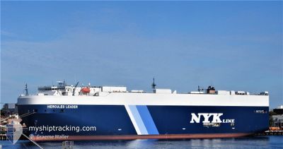
HERCULES LEADER
Vehicles Carrier
Current Trip
LK HBA
| Time Travelled | 20 days |
|---|---|
| Remaining Time | --- |
| Distance Travelled | 8121.11 nm |
| Remaining Distance | --- |
| AVG Speed | 16.2 Knots |
| MAX Speed | 21.4 Knots |
| AVG Wind | 10.7 knots |
| MAX Wind | 24 knots |
| MIN Temp | 17.7°C / 63.86°F |
| MAX Temp | 29.8°C / 85.64°F |
| Draught | 9.1 m |
| Position Received | 4 d ago |
Current Position
| Longitude | -2.20493° |
|---|---|
| Latitude | -12.08626° |
| Status | Under way using engine |
| Speed | 17.8 Knots |
| Course | 324.9° |
| Area | South Atlantic Ocean |
| Station | T-AIS |
| Position Received | 4 d ago |
Info
Information
The current position of HERCULES LEADER is in South Atlantic Ocean with coordinates -12.08626° / -2.20493° as reported on 2024-04-20 14:20 by AIS to our vessel tracker app. The vessel's current speed is 17.8 Knots
The vessel HERCULES LEADER (IMO: 9531753, MMSI: 432803000) is a Vehicles Carrier that was built in 2011 ( 13 years old ). It's sailing under the flag of [JP] Japan.
In this page you can find informations about the vessels current position, last detected port calls, and current voyage information. If the vessels is not in coverage by AIS you will find the latest position.
The current position of HERCULES LEADER is detected by our AIS receivers and we are not responsible for the reliability of the data. The last position was recorded while the vessel was in Coverage by the Ais receivers of our vessel tracking app.
The current draught of HERCULES LEADER as reported by AIS is 9.1 meters
Weather
| Temperature | 23.2°C / 73.76°F |
|---|---|
| Wind Speed | 12 knots |
| Direction | 340° NNW |
| Pressure | 1009.7 hPa |
| Humidity | 79 % |
| Cloud Coverage | 29 % |
Featured Company
Last Port Calls
| Port | Arrival | Departure | Time In Port |
|---|---|---|---|
| 2024-04-04 01:33 | 2024-04-04 11:14 | 9 h | |
| 2024-03-30 15:00 | 2024-03-31 09:46 | 18 h | |
| 2024-03-24 14:52 | 2024-03-24 16:28 | 1 h | |
| 2024-03-22 06:47 | 2024-03-22 11:52 | 5 h | |
| 2024-03-14 09:30 | 2024-03-16 07:47 | 1 d | |
| 2024-03-13 20:36 | 2024-03-14 08:30 | 11 h | |
| 2024-02-25 00:58 | 2024-03-03 06:37 | 7 d |
Most Visited Ports (Last year)
| Port | Arrivals | |
|---|---|---|
| 3 | ||
| 3 | ||
| 2 | ||
| 2 | ||
| 2 | ||
| 1 |
Last Trips
| Origin | Departure | Destination | Arrival | Distance | |
|---|---|---|---|---|---|
| 2024-03-31 17:46 | 2024-04-04 07:03 | 1458.59 nm | |||
| 2024-03-25 00:28 | 2024-03-30 23:00 | 2288.41 nm | |||
| 2024-03-22 19:52 | 2024-03-24 22:52 | 452.96 nm | |||
| 2024-03-16 16:47 | 2024-03-22 14:47 | 1499.46 nm | |||
| 2024-03-14 17:30 | 2024-03-14 18:30 | 6.23 nm | |||
| 2024-03-03 14:37 | 2024-03-14 05:36 | 1383.11 nm | |||
| 2024-01-21 16:27 | 2024-02-25 08:58 | 9173.05 nm |
Events
| Time | Event | Details | Position / Dest | Info |
|---|---|---|---|---|
| 2024-04-23 08:01 | START Moving |
4.22833 / -13.32667
LK HBA
|
Speed: 4 kn Course: -1° |
|
| 2024-04-23 07:46 | STOP Moving |
4.22333 / -13.32167
LK HBA
|
Speed: Course: -1° |
|
| 2024-04-20 14:24 | Status Changed | Default Under way using engine |
-12.06500 / -2.21833
LK HBA
|
Speed: 17.8 kn Course: 324.9° |
| 2024-04-20 14:20 | OUT of Coverage |
-12.08626 / -2.20493
South Atlantic Ocean
|
Speed: 17.8 kn Course: 324.9° |
|
| 2024-04-20 14:17 | Status Changed | Under way using engine Default |
-12.09766 / -2.19682
LK HBA
|
Speed: 17 kn Course: 326° |
| 2024-04-20 13:49 | Status Changed | Default Under way using engine |
-12.21333 / -2.11833
LK HBA
|
Speed: 17.4 kn Course: 327.3° |
| 2024-04-20 13:34 | Status Changed | Under way using engine Default |
-12.27197 / -2.08113
LK HBA
|
Speed: 17.6 kn Course: 327° |
| 2024-04-20 13:15 | Status Changed | Default Under way using engine |
-12.35202 / -2.02852
LK HBA
|
Speed: 17.7 kn Course: 325.7° |
| 2024-04-20 13:10 | Status Changed | Under way using engine Default |
-12.37307 / -2.01432
LK HBA
|
Speed: 17.7 kn Course: 327° |
| 2024-04-20 12:52 | IN Coverage |
-12.37307 / -2.01432
South Atlantic Ocean
|
Speed: 17.6 kn Course: 326.1° |