
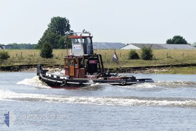
HENDRIK
Cargo
Current Trip
WEURT
Unknown Port
ETA*
2025-03-01 15:45 UTC
| Time Travelled | 1 day |
|---|---|
| Remaining Time | --- |
| Distance Travelled | 51.76 nm |
| Remaining Distance | --- |
| AVG Speed | 4.5 Knots |
| MAX Speed | 6 Knots |
| AVG Wind | 5.2 knots |
| MAX Wind | 10.3 knots |
| MIN Temp | 2.1°C / 35.78°F |
| MAX Temp | 8.4°C / 47.12°F |
| Draught | 0 m |
| Position Received | 1 m ago |
Current Position
| Longitude | 5.75895° |
|---|---|
| Latitude | 50.97348° |
| Status | Under way using engine |
| Speed | |
| Course | --- |
| Area | North Sea |
| Station | T-AIS |
| Position Received | 1 m ago |
Info
info
Information
The current position of HENDRIK is in North Sea with coordinates 50.97348° / 5.75895° as reported on 2024-04-23 16:08 by AIS to our vessel tracker app. The vessel's current speed is 0 Knots
The vessel HENDRIK (MMSI: 244750451) is a Cargo It's sailing under the flag of [NL] Netherlands.
In this page you can find informations about the vessels current position, last detected port calls, and current voyage information. If the vessels is not in coverage by AIS you will find the latest position.
The current position of HENDRIK is detected by our AIS receivers and we are not responsible for the reliability of the data. The last position was recorded while the vessel was in Coverage by the Ais receivers of our vessel tracking app.
Weather
| Temperature | 10.4°C / 50.72°F |
|---|---|
| Wind Speed | 9 knots |
| Direction | 294° WNW |
| Pressure | 1016.4 hPa |
| Humidity | 41.9 % |
| Cloud Coverage | 100 % |
Featured Company
Limited time offer - Install a base station receiver to your area and list your company on MyShipTracking Free forever!
Last Port Calls
| Port | Arrival | Departure | Time In Port |
|---|---|---|---|
| 2024-04-22 04:24 | 2024-04-22 04:55 | 30 m | |
| 2024-04-22 04:15 | 2024-04-22 04:21 | 5 m | |
| 2024-04-17 11:48 | 2024-04-22 04:10 | 4 d | |
| 2024-04-17 11:16 | 2024-04-17 11:46 | 29 m | |
| 2024-04-16 13:40 | 2024-04-17 11:11 | 21 h | |
| 2024-04-16 13:26 | 2024-04-16 13:39 | 12 m | |
| 2024-04-12 16:56 | 2024-04-16 11:02 | 3 d | |
| 2024-04-12 11:44 | 2024-04-12 13:50 | 2 h | |
| 2024-04-12 09:12 | 2024-04-12 10:11 | 59 m | |
| 2024-04-12 05:57 | 2024-04-12 07:26 | 1 h |
Last Trips
| Origin | Departure | Destination | Arrival | Distance | |
|---|---|---|---|---|---|
| 2024-04-22 06:21 | 2024-04-22 06:24 | 0.29 nm | |||
| 2024-04-22 06:10 | 2024-04-22 06:15 | 0.31 nm | |||
| 2024-04-17 13:46 | 2024-04-17 13:48 | 0.14 nm | |||
| 2024-04-17 13:11 | 2024-04-17 13:16 | 0.33 nm | |||
| 2024-04-16 15:39 | 2024-04-16 15:40 | 0.12 nm | |||
| 2024-04-16 13:02 | 2024-04-16 15:26 | 15.10 nm | |||
| 2024-04-12 15:50 | 2024-04-12 18:56 | 24.53 nm | |||
| 2024-04-12 12:11 | 2024-04-12 13:44 | 9.56 nm | |||
| 2024-04-12 09:26 | 2024-04-12 11:12 | 9.30 nm | |||
| 2024-04-12 07:06 | 2024-04-12 07:57 | 6.73 nm |
Events
| Time | Event | Details | Position / Dest | Info |
|---|---|---|---|---|
| 2024-04-22 19:24 | STOP Moving | 4.4 nm, North of ITTEREN |
50.97376 / 5.75763
WEURT
|
Speed: 0.3 kn Course: 511° |
| 2024-04-22 18:39 | START Moving | 2.41 nm, South West of BARGE TERMINAL BORN |
51.02314 / 5.78967
WEURT
|
Speed: 3.6 kn Course: 202.2° |
| 2024-04-22 18:36 | STOP Moving | 2.3 nm, South West of BARGE TERMINAL BORN |
51.02473 / 5.79111
WEURT
|
Speed: 0.3 kn Course: 511° |
| 2024-04-22 18:22 | START Moving | 1.69 nm, South of BARGE TERMINAL BORN |
51.03383 / 5.79822
WEURT
|
Speed: 4.9 kn Course: 200.7° |
| 2024-04-22 18:05 | STOP Moving | 1.58 nm, South of BARGE TERMINAL BORN |
51.03556 / 5.79917
WEURT
|
Speed: 0.3 kn Course: 511° |
| 2024-04-22 16:50 | START Moving | 0.76 nm, South West of MAASBRACHT |
51.13634 / 5.87297
WEURT
|
Speed: 5.8 kn Course: 198.4° |
| 2024-04-22 16:45 | STOP Moving | 0.46 nm, South West of MAASBRACHT |
51.14160 / 5.87694
WEURT
|
Speed: Course: 511° |
| 2024-04-22 16:03 | IN Coverage |
51.16949 / 5.91291
North Sea
|
Speed: 5.4 kn Course: 226.7° |
|
| 2024-04-22 07:59 | OUT of Coverage |
51.60189 / 6.02356
North Sea
|
Speed: 4.2 kn Course: 175° |
|
| 2024-04-22 07:23 | START Moving | 2.14 nm, South East of BOXMEER |
51.63840 / 5.98698
WEURT
|
Speed: 5.6 kn Course: 119.8° |