
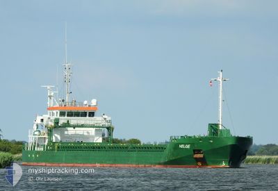
HELGE
General Cargo
Current Trip
| Time Travelled | 14 h, 37 mins |
|---|---|
| Remaining Time | 6 h, 56 mins |
| Distance Travelled | 154.35 nm |
| Remaining Distance | 79.01 nm |
| AVG Speed | 11 Knots |
| MAX Speed | 11.4 Knots |
| AVG Wind | 7.9 knots |
| MAX Wind | 14.7 knots |
| MIN Temp | 3.4°C / 38.12°F |
| MAX Temp | 6.8°C / 44.24°F |
| Draught | 6.3 m |
| Position Received | 1 h, 35 m ago |
Current Position
| Longitude | 17.63691° |
|---|---|
| Latitude | 56.43642° |
| Status | Under way using engine |
| Speed | 11 Knots |
| Course | 49.8° |
| Area | Baltic Sea |
| Station | T-AIS |
| Position Received | 1 h, 35 m ago |
Info
Information
The current position of HELGE is in Baltic Sea with coordinates 56.43642° / 17.63691° as reported on 2024-04-16 02:25 by AIS to our vessel tracker app. The vessel's current speed is 11 Knots and is heading at the port of SLITE. The estimated time of arrival as calculated by MyShipTracking vessel tracking app is 2024-04-16 10:56 LT
The vessel HELGE (IMO: 9677404, MMSI: 244750397) is a General Cargo that was built in 2013 ( 11 years old ). It's sailing under the flag of [NL] Netherlands.
In this page you can find informations about the vessels current position, last detected port calls, and current voyage information. If the vessels is not in coverage by AIS you will find the latest position.
The current position of HELGE is detected by our AIS receivers and we are not responsible for the reliability of the data. The last position was recorded while the vessel was in Coverage by the Ais receivers of our vessel tracking app.
The current draught of HELGE as reported by AIS is 6.3 meters
Weather
| Temperature | 3.6°C / 38.48°F |
|---|---|
| Wind Speed | 12 knots |
| Direction | 86° E |
| Pressure | 996.8 hPa |
| Humidity | 84.1 % |
| Cloud Coverage | 100 % |
Featured Company
Last Port Calls
| Port | Arrival | Departure | Time In Port |
|---|---|---|---|
| 2024-04-13 17:30 | 2024-04-15 13:23 | 1 d | |
| 2024-04-09 19:50 | 2024-04-12 08:44 | 2 d | |
| 2024-04-06 08:19 | 2024-04-08 21:24 | 2 d | |
| 2024-04-05 05:21 | 2024-04-05 18:56 | 13 h | |
| 2024-04-03 06:30 | 2024-04-04 17:02 | 1 d | |
| 2024-03-31 18:02 | 2024-04-01 14:37 | 20 h | |
| 2024-03-27 05:02 | 2024-03-28 18:58 | 1 d | |
| 2024-03-24 05:30 | 2024-03-24 23:57 | 18 h | |
| 2024-03-20 07:06 | 2024-03-23 14:20 | 3 d | |
| 2024-03-17 15:52 | 2024-03-18 12:34 | 20 h |
Last Trips
| Origin | Departure | Destination | Arrival | Distance | |
|---|---|---|---|---|---|
| 2024-04-12 10:44 | 2024-04-13 19:30 | 226.56 nm | |||
| 2024-04-08 23:24 | 2024-04-09 21:50 | 185.06 nm | |||
| 2024-04-05 20:56 | 2024-04-06 10:19 | 113.68 nm | |||
| 2024-04-04 19:02 | 2024-04-05 07:21 | 2.51 nm | |||
| 2024-04-01 16:37 | 2024-04-03 08:30 | 164.38 nm | |||
| 2024-03-28 19:58 | 2024-03-31 20:02 | 315.43 nm | |||
| 2024-03-25 00:57 | 2024-03-27 06:02 | 167.91 nm | |||
| 2024-03-23 15:20 | 2024-03-24 06:30 | 126.94 nm | |||
| 2024-03-18 13:34 | 2024-03-20 08:06 | 260.03 nm | |||
| 2024-03-16 03:41 | 2024-03-17 16:52 | 327.92 nm |
Events
| Time | Event | Details | Position / Dest | Info |
|---|---|---|---|---|
| 2024-04-16 02:31 | Status Changed | Default Under way using engine |
56.44912 / 17.66337
SLITE
|
Speed: 11 kn Course: 49.8° |
| 2024-04-16 02:25 | OUT of Coverage |
56.43642 / 17.63691
Baltic Sea
SLITE
|
Speed: 11 kn Course: 49.8° |
|
| 2024-04-16 02:15 | Status Changed | Under way using engine Default |
56.41721 / 17.59614
SLITE
|
Speed: 11.1 kn Course: 50° |
| 2024-04-16 01:39 | Status Changed | Default Under way using engine |
56.34543 / 17.44384
SLITE
|
Speed: 11 kn Course: 55.8° |
| 2024-04-16 01:14 | Status Changed | Under way using engine Default |
56.30153 / 17.32888
SLITE
|
Speed: 11 kn Course: 52° |
| 2024-04-16 01:11 | Status Changed | Default Under way using engine |
56.29681 / 17.31807
SLITE
|
Speed: 10.9 kn Course: 52° |
| 2024-04-15 18:11 | Change Sea Area | Swedish part of the Baltic Sea Danish part of the Kattegat |
55.61424 / 15.41079
Baltic Sea
SLITE
|
Speed: 11.5 kn Course: 57.2° |
| 2024-04-15 13:23 | PORT DEPARTURE |
|
55.09348 / 14.67790
SLITE
|
Speed: 8.4 kn Course: 251° |
| 2024-04-15 13:19 | START Moving |
55.09647 / 14.69042
[DK] ROENNE
|
Speed: 3.2 kn Course: 246° |
|
| 2024-04-15 12:59 | Status Changed | Under way using engine Moored |
55.09884 / 14.68787
[DK] ROENNE
|
Speed: Course: 8° |