
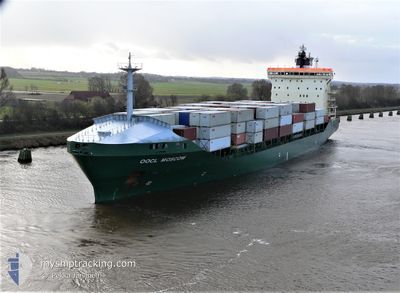
HARRISON
Container Ship
Current Trip
| Trip Time | 1 day |
|---|---|
| Trip Distance | 447.07 nm |
| AVG Speed | 11.1 Knots |
| MAX Speed | 17.1 Knots |
| Draught | 8.7 m |
| AVG Wind | 9.3 knots |
| MAX Wind | 24.8 knots |
| MIN Temp | 2.9°C / 37.22°F |
| MAX Temp | 11.4°C / 52.52°F |
| Position Received | 1 m ago |
Current Position
| Longitude | 18.50246° |
|---|---|
| Latitude | 54.54469° |
| Status | Moored |
| Speed | |
| Course | 120° |
| Area | Baltic Sea |
| Station | T-AIS |
| Position Received | 1 m ago |
Info
Information
The current position of HARRISON is in Baltic Sea with coordinates 54.54469° / 18.50246° as reported on 2024-04-16 12:12 by AIS to our vessel tracker app. The vessel's current speed is 0 Knots and is currently inside the port of GDYNIA.
The vessel HARRISON (IMO: 9220079, MMSI: 538001652) is a Container Ship that was built in 2002 ( 22 years old ). It's sailing under the flag of [MH] Marshall Is.
In this page you can find informations about the vessels current position, last detected port calls, and current voyage information. If the vessels is not in coverage by AIS you will find the latest position.
The current position of HARRISON is detected by our AIS receivers and we are not responsible for the reliability of the data. The last position was recorded while the vessel was in Coverage by the Ais receivers of our vessel tracking app.
The current draught of HARRISON as reported by AIS is 8.7 meters
Weather
| Temperature | 5.2°C / 41.36°F |
|---|---|
| Wind Speed | 9 knots |
| Direction | 257° WSW |
| Pressure | 995.3 hPa |
| Humidity | 90 % |
| Cloud Coverage | 100 % |
Featured Company
Last Port Calls
| Port | Arrival | Departure | Time In Port |
|---|---|---|---|
| 2024-04-16 11:20 | |||
| 2024-04-13 11:52 | 2024-04-14 22:21 | 1 d | |
| 2024-04-12 11:57 | 2024-04-13 02:36 | 14 h | |
| 2024-04-08 11:02 | 2024-04-09 14:41 | 1 d | |
| 2024-04-07 04:15 | 2024-04-07 16:56 | 12 h | |
| 2024-04-05 14:55 | 2024-04-06 03:31 | 12 h | |
| 2024-04-04 05:36 | 2024-04-04 05:40 | 3 m | |
| 2024-04-02 16:24 | 2024-04-03 15:41 | 23 h | |
| 2024-04-01 05:05 | 2024-04-02 03:31 | 22 h | |
| 2024-03-31 21:27 | 2024-03-31 22:42 | 1 h |
Most Visited Ports (Last year)
| Port | Arrivals | |
|---|---|---|
| 21 | ||
| 14 | ||
| 14 | ||
| 12 | ||
| 11 | ||
| 10 |
Last Trips
| Origin | Departure | Destination | Arrival | Distance | |
|---|---|---|---|---|---|
| 2024-04-15 00:21 | 2024-04-16 13:20 | 447.07 nm | |||
| 2024-04-13 04:36 | 2024-04-13 13:52 | 116.56 nm | |||
| 2024-04-09 16:41 | 2024-04-12 13:57 | 760.23 nm | |||
| 2024-04-07 18:56 | 2024-04-08 13:02 | 279.68 nm | |||
| 2024-04-06 05:31 | 2024-04-07 06:15 | 312.67 nm | |||
| 2024-04-04 07:40 | 2024-04-05 16:55 | 361.87 nm | |||
| 2024-04-03 17:41 | 2024-04-04 07:36 | 91.32 nm | |||
| 2024-04-02 05:31 | 2024-04-02 18:24 | 129.33 nm | |||
| 2024-04-01 00:42 | 2024-04-01 07:05 | 82.79 nm | |||
| 2024-03-31 15:09 | 2024-03-31 23:27 | 50.97 nm |
Events
| Time | Event | Details | Position / Dest | Info |
|---|---|---|---|---|
| 2024-04-16 12:11 | Status Changed | Moored Under way using engine |
54.54467 / 18.50248
[PL] GDYNIA
|
Speed: 0.2 kn Course: 121° |
| 2024-04-16 12:06 | STOP Moving |
54.54484 / 18.50284
[PL] GDYNIA
|
Speed: 0.3 kn Course: 121° |
|
| 2024-04-16 11:20 | PORT ARRIVAL |
|
54.53583 / 18.56350
[PL] GDYNIA
|
Speed: 5.9 kn Course: 267.7° |
| 2024-04-16 06:35 | IN Coverage |
54.90678 / 17.90045
Baltic Sea
PLGDY
|
Speed: 15.9 kn Course: 74.7° |
|
| 2024-04-16 02:32 | OUT of Coverage |
54.73490 / 16.09618
Baltic Sea
PLGDY
|
Speed: 15.7 kn Course: 81.7° |
|
| 2024-04-15 23:47 | Change Sea Area | Polish part of the Baltic Sea Danish part of the Kattegat |
54.63472 / 14.87146
Baltic Sea
PLGDY
|
Speed: 15.8 kn Course: 79° |
| 2024-04-15 23:02 | Change Sea Area | Danish part of the Kattegat German part of the Baltic Sea |
54.60634 / 14.53142
Kattegat
PLGDY
|
Speed: 15.9 kn Course: 82.2° |
| 2024-04-15 16:56 | Change Sea Area | German part of the Baltic Sea Danish part of the Baltic Sea |
54.40088 / 12.07647
Baltic Sea
PLGDY
|
Speed: 16.3 kn Course: 90.1° |
| 2024-04-15 15:26 | Change Sea Area | Danish part of the Baltic Sea German part of the Baltic Sea |
54.50851 / 11.42768
Baltic Sea
PLGDY
|
Speed: 15.7 kn Course: 114.1° |
| 2024-04-15 13:56 | Change Sea Area | German part of the Baltic Sea Danish part of the Baltic Sea |
54.57039 / 10.78570
Baltic Sea
PLGDY
|
Speed: 16 kn Course: 85.4° |