
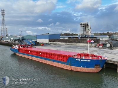
H&S BRAVERY
General Cargo
Current Trip
| Time Travelled | 15 h, 42 mins |
|---|---|
| Remaining Time | 6 h, 8 mins |
| Distance Travelled | 155.08 nm |
| Remaining Distance | 63.29 nm |
| AVG Speed | 9.9 Knots |
| MAX Speed | 13.1 Knots |
| AVG Wind | 24.2 knots |
| MAX Wind | 31 knots |
| MIN Temp | 6.6°C / 43.88°F |
| MAX Temp | 8.8°C / 47.84°F |
| Draught | 2.7 m |
| Position Received | 50 m ago |
Current Position
| Longitude | 2.56235° |
|---|---|
| Latitude | 52.48945° |
| Status | Under way using engine |
| Speed | 9.7 Knots |
| Course | 121.6° |
| Area | North Sea |
| Station | T-AIS |
| Position Received | 50 m ago |
Info
Information
The current position of H&S BRAVERY is in North Sea with coordinates 52.48945° / 2.56235° as reported on 2024-04-19 17:21 by AIS to our vessel tracker app. The vessel's current speed is 9.7 Knots and is heading at the port of ROTTERDAM. The estimated time of arrival as calculated by MyShipTracking vessel tracking app is 2024-04-20 00:20 LT
The vessel H&S BRAVERY (IMO: 9195547, MMSI: 246231000) is a General Cargo that was built in 2004 ( 20 years old ). It's sailing under the flag of [NL] Netherlands.
In this page you can find informations about the vessels current position, last detected port calls, and current voyage information. If the vessels is not in coverage by AIS you will find the latest position.
The current position of H&S BRAVERY is detected by our AIS receivers and we are not responsible for the reliability of the data. The last position was recorded while the vessel was in Coverage by the Ais receivers of our vessel tracking app.
The current draught of H&S BRAVERY as reported by AIS is 2.7 meters
Weather
| Temperature | 7.4°C / 45.32°F |
|---|---|
| Wind Speed | 31 knots |
| Direction | 342° NNW |
| Pressure | 1016.7 hPa |
| Humidity | 66 % |
| Cloud Coverage | 14 % |
Featured Company
Last Port Calls
| Port | Arrival | Departure | Time In Port |
|---|---|---|---|
| 2024-04-17 13:28 | 2024-04-19 02:30 | 1 d | |
| 2024-04-12 14:25 | 2024-04-15 16:13 | 3 d | |
| 2024-04-12 02:17 | 2024-04-12 12:49 | 10 h | |
| 2024-04-10 23:20 | 2024-04-11 22:10 | 22 h | |
| 2024-04-10 06:54 | 2024-04-10 08:29 | 1 h | |
| 2024-04-04 09:11 | 2024-04-04 21:44 | 12 h | |
| 2024-04-01 01:23 | 2024-04-02 13:54 | 1 d | |
| 2024-03-31 20:37 | 2024-04-01 00:59 | 4 h | |
| 2024-03-29 07:22 | 2024-03-30 09:01 | 1 d | |
| 2024-03-27 06:45 | 2024-03-27 19:59 | 13 h |
Most Visited Ports (Last year)
| Port | Arrivals | |
|---|---|---|
| 35 | ||
| 20 | ||
| 19 | ||
| 18 | ||
| 18 | ||
| 15 |
Last Trips
| Origin | Departure | Destination | Arrival | Distance | |
|---|---|---|---|---|---|
| 2024-04-15 18:13 | 2024-04-17 14:28 | 344.90 nm | |||
| 2024-04-12 14:49 | 2024-04-12 16:25 | 18.99 nm | |||
| 2024-04-12 00:10 | 2024-04-12 04:17 | 18.78 nm | |||
| 2024-04-10 10:29 | 2024-04-11 01:20 | 97.98 nm | |||
| 2024-04-04 22:44 | 2024-04-10 08:54 | 429.62 nm | |||
| 2024-04-02 15:54 | 2024-04-04 10:11 | 396.75 nm | |||
| 2024-04-01 02:59 | 2024-04-01 03:23 | 2.55 nm | |||
| 2024-03-30 09:01 | 2024-03-31 22:37 | 302.15 nm | |||
| 2024-03-27 20:59 | 2024-03-29 07:22 | 302.15 nm | |||
| 2024-03-27 07:35 | 2024-03-27 07:45 | 2.65 nm |
Events
| Time | Event | Details | Position / Dest | Info |
|---|---|---|---|---|
| 2024-04-19 17:27 | Status Changed | Default Under way using engine |
52.48012 / 2.58584
NLRTM
|
Speed: 9.7 kn Course: 121.6° |
| 2024-04-19 17:13 | Status Changed | Under way using engine Default |
52.50032 / 2.53206
NLRTM
|
Speed: 9.8 kn Course: 124° |
| 2024-04-19 17:12 | Status Changed | Default Under way using engine |
52.50111 / 2.52995
NLRTM
|
Speed: 10.4 kn Course: 125.8° |
| 2024-04-19 13:01 | Draught Changed | 2.7 2.4 |
52.87687 / 1.56061
NLRTM
|
Speed: 9.2 kn Course: 120.8° |
| 2024-04-19 13:01 | ETA Changed | 2024/04/20 00:00 2025/03/20 02:00 |
52.87687 / 1.56061
NLRTM
|
Speed: 9.2 kn Course: 120.8° |
| 2024-04-19 12:43 | Draught Changed | 2.4 2.7 |
52.90143 / 1.50079
NLRTM
|
Speed: 8.4 kn Course: 121.2° |
| 2024-04-19 12:43 | ETA Changed | 2025/03/20 02:00 2024/04/20 00:00 |
52.90143 / 1.50079
NLRTM
|
Speed: 8.4 kn Course: 121.2° |
| 2024-04-19 10:31 | Draught Changed | 2.7 2.4 |
53.06878 / 1.02047
NLRTM
|
Speed: 9.7 kn Course: 133° |
| 2024-04-19 10:01 | IN Coverage |
53.12398 / .92397
North Sea
NLRTM
|
Speed: 10 kn Course: 133.1° |
|
| 2024-04-19 06:35 | OUT of Coverage |
53.53660 / .23459
North Sea
NLRTM
|
Speed: 10.8 kn Course: 125.8° |