
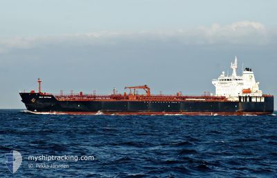
GULF MUTTRAH
Tanker
Current Trip
| Time Travelled | 16 days |
|---|---|
| Remaining Time | --- |
| Distance Travelled | 4709.13 nm |
| Remaining Distance | --- |
| AVG Speed | 10.9 Knots |
| MAX Speed | 15.9 Knots |
| AVG Wind | 10.2 knots |
| MAX Wind | 20.8 knots |
| MIN Temp | 9.1°C / 48.38°F |
| MAX Temp | 30.5°C / 86.9°F |
| Draught | 11.5 m |
| Position Received | 6 d ago |
Current Position
| Longitude | 103.60653° |
|---|---|
| Latitude | 1.18742° |
| Status | Under way using engine |
| Speed | 13.6 Knots |
| Course | 283° |
| Area | Singapore Strait |
| Station | T-AIS |
| Position Received | 6 d ago |
Info
Information
The current position of GULF MUTTRAH is in Singapore Strait with coordinates 1.18742° / 103.60653° as reported on 2024-04-12 08:39 by AIS to our vessel tracker app. The vessel's current speed is 13.6 Knots and is heading at the port of ROTTERDAM. The estimated time of arrival as calculated by MyShipTracking vessel tracking app is 2024-05-21 23:00 LT
The vessel GULF MUTTRAH (IMO: 9381835, MMSI: 311015200) is a Tanker It's sailing under the flag of [BS] Bahamas.
In this page you can find informations about the vessels current position, last detected port calls, and current voyage information. If the vessels is not in coverage by AIS you will find the latest position.
The current position of GULF MUTTRAH is detected by our AIS receivers and we are not responsible for the reliability of the data. The last position was recorded while the vessel was in Coverage by the Ais receivers of our vessel tracking app.
The current draught of GULF MUTTRAH as reported by AIS is 11.5 meters
Weather
| Temperature | 27.7°C / 81.86°F |
|---|---|
| Wind Speed | 15 knots |
| Direction | 122° ESE |
| Pressure | 1012.1 hPa |
| Humidity | 78.6 % |
| Cloud Coverage | 15 % |
Featured Company
Last Port Calls
| Port | Arrival | Departure | Time In Port |
|---|---|---|---|
| 2024-04-01 03:45 | 2024-04-03 03:25 | 1 d | |
| 2024-03-29 05:56 | 2024-03-31 09:36 | 2 d | |
| 2024-03-25 11:20 | 2024-03-27 16:44 | 2 d |
Most Visited Ports (Last year)
| Port | Arrivals | |
|---|---|---|
| 2 | ||
| 2 | ||
| 1 | ||
| 1 | ||
| 1 | ||
| 1 |
Last Trips
| Origin | Departure | Destination | Arrival | Distance | |
|---|---|---|---|---|---|
| 2024-03-31 17:36 | 2024-04-01 11:45 | 63.20 nm | |||
| 2024-03-28 00:44 | 2024-03-29 13:56 | 472.20 nm | |||
| 2024-01-21 20:23 | 2024-03-25 19:20 | 5994.74 nm |
Events
| Time | Event | Details | Position / Dest | Info |
|---|---|---|---|---|
| 2024-04-12 08:46 | Status Changed | Default Under way using engine |
1.19302 / 103.58315
NL RTM
|
Speed: 13.6 kn Course: 283° |
| 2024-04-12 08:39 | OUT of Coverage |
1.18742 / 103.60653
Singapore Strait
|
Speed: 13.6 kn Course: 283° |
|
| 2024-04-12 08:04 | Change Sea Area | Indonesian part of the Singapore Strait Singaporean part of the Singapore Strait |
1.13815 / 103.72378
Singapore Strait
|
Speed: 13.5 kn Course: 278° |
| 2024-04-12 06:28 | START Moving | 2.71 nm, South West of TANAH MERAH |
1.28972 / 103.97867
NL RTM
|
Speed: 3.1 kn Course: 141° |
| 2024-04-12 06:22 | Status Changed | Under way using engine At anchor |
1.29130 / 103.97597
NL RTM
|
Speed: 0.3 kn Course: 511° |
| 2024-04-12 05:29 | ETA Changed | 2024/05/21 23:00 2024/05/21 18:00 |
1.29168 / 103.97583
NL RTM
|
Speed: 0.1 kn Course: 511° |
| 2024-04-12 05:13 | Destination Changed | NL RTM SGSIN |
1.29142 / 103.97608
NL RTM
|
Speed: 0.1 kn Course: 511° |
| 2024-04-12 05:13 | ETA Changed | 2024/05/21 18:00 2024/04/11 18:30 |
1.29142 / 103.97608
NL RTM
|
Speed: 0.1 kn Course: 511° |
| 2024-04-11 23:48 | Status Changed | At anchor Default |
1.29245 / 103.97900
SGSIN
|
Speed: 0.1 kn Course: 262° |
| 2024-04-11 23:45 | Status Changed | Default At anchor |
1.29247 / 103.97915
SGSIN
|
Speed: Course: 262° |