
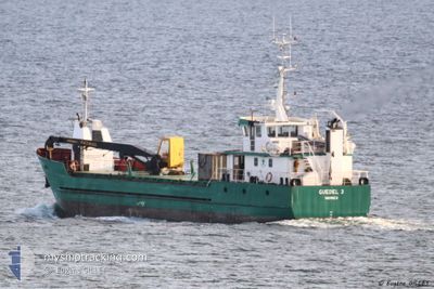
GUEDEL 3
Not available
Current Trip
PONTA DELGADA
| Trip Time | 16 h, 30 mins |
|---|---|
| Trip Distance | 145.98 nm |
| AVG Speed | 7.8 Knots |
| MAX Speed | 9.5 Knots |
| Draught | 2.6 m |
| AVG Wind | 9.3 knots |
| MAX Wind | 15.5 knots |
| MIN Temp | 10.1°C / 50.18°F |
| MAX Temp | 12.2°C / 53.96°F |
| Position Received | Now |
Current Position
| Longitude | -8.40306° |
|---|---|
| Latitude | 43.36372° |
| Status | Under way using engine |
| Speed | |
| Course | --- |
| Area | North Atlantic Ocean |
| Station | T-AIS |
| Position Received | Now |
Info
Information
The current position of GUEDEL 3 is in North Atlantic Ocean with coordinates 43.36372° / -8.40306° as reported on 2024-04-25 12:36 by AIS to our vessel tracker app. The vessel's current speed is 0 Knots and is currently inside the port of CORUNA.
The vessel GUEDEL 3 (MMSI: 227051650) is a Not available It's sailing under the flag of [FR] France.
In this page you can find informations about the vessels current position, last detected port calls, and current voyage information. If the vessels is not in coverage by AIS you will find the latest position.
The current position of GUEDEL 3 is detected by our AIS receivers and we are not responsible for the reliability of the data. The last position was recorded while the vessel was in Coverage by the Ais receivers of our vessel tracking app.
The current draught of GUEDEL 3 as reported by AIS is 2.6 meters
Weather
| Temperature | 12.2°C / 53.96°F |
|---|---|
| Wind Speed | 7 knots |
| Direction | 285° WNW |
| Pressure | 1012.3 hPa |
| Humidity | 91.3 % |
| Cloud Coverage | 84 % |
Featured Company
Last Trips
| Origin | Departure | Destination | Arrival | Distance | |
|---|---|---|---|---|---|
| 2024-04-23 18:18 | 2024-04-24 10:48 | 145.98 nm | |||
| 2024-04-18 07:20 | 2024-04-19 15:31 | 275.84 nm | |||
| 2024-03-06 09:33 | 2024-03-06 13:42 | 39.96 nm | |||
| 2024-03-05 10:18 | 2024-03-05 11:23 | 8.38 nm |
Events
| Time | Event | Details | Position / Dest | Info |
|---|---|---|---|---|
| 2024-04-24 14:58 | Destination Changed | PONTA DELGADA LA CORUNA |
43.36375 / -8.40304
[ES] CORUNA
|
Speed: Course: 511° |
| 2024-04-24 09:08 | STOP Moving |
43.36460 / -8.39695
[ES] CORUNA
|
Speed: 0.2 kn Course: 198° |
|
| 2024-04-24 08:48 | PORT ARRIVAL |
|
43.36477 / -8.37017
[ES] CORUNA
|
Speed: 4.7 kn Course: 223° |
| 2024-04-24 05:35 | IN Coverage |
43.70293 / -8.21737
North Atlantic Ocean
LA CORUNA
|
Speed: 8.8 kn Course: 238.6° |
|
| 2024-04-24 03:43 | OUT of Coverage |
43.83732 / -7.88122
North Atlantic Ocean
LA CORUNA
|
Speed: 8.8 kn Course: 246.2° |
|
| 2024-04-24 03:12 | Change Sea Area | Spanish part of the North Atlantic Ocean Spanish part of the Bay of Biscay |
43.85439 / -7.78127
North Atlantic Ocean
LA CORUNA
|
Speed: 9 kn Course: 271.5° |
| 2024-04-24 02:40 | Destination Changed | LA CORUNA GIJON |
43.84884 / -7.66917
LA CORUNA
|
Speed: 9.1 kn Course: 274.5° |
| 2024-04-24 02:40 | ETA Changed | 2024/04/24 09:00 2024/04/19 13:30 |
43.84884 / -7.66917
LA CORUNA
|
Speed: 9.1 kn Course: 274.5° |
| 2024-04-24 02:31 | IN Coverage |
43.85130 / -7.64080
Bay of Biscay
|
Speed: 8.8 kn Course: 261.3° |
|
| 2024-04-23 17:54 | OUT of Coverage |
43.71847 / -5.86913
Bay of Biscay
|
Speed: 9.5 kn Course: 269.5° |