
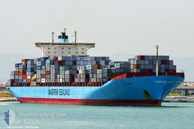
GRETE MAERSK
Container Ship
Current Trip
| Time Travelled | 12 days |
|---|---|
| Remaining Time | --- |
| Distance Travelled | 4466.04 nm |
| Remaining Distance | --- |
| AVG Speed | 15 Knots |
| MAX Speed | 19 Knots |
| AVG Wind | 17.2 knots |
| MAX Wind | 42.3 knots |
| MIN Temp | 13.6°C / 56.48°F |
| MAX Temp | 29.7°C / 85.46°F |
| Draught | 10.3 m |
| Position Received | 4 d ago |
Current Position
| Longitude | -37.29896° |
|---|---|
| Latitude | 10.54557° |
| Status | Under way using engine |
| Speed | 16.7 Knots |
| Course | 132.2° |
| Area | North Atlantic Ocean |
| Station | T-AIS |
| Position Received | 4 d ago |
Info
Information
The current position of GRETE MAERSK is in North Atlantic Ocean with coordinates 10.54557° / -37.29896° as reported on 2024-04-19 06:05 by AIS to our vessel tracker app. The vessel's current speed is 16.7 Knots and is heading at the port of COLOMBO. The estimated time of arrival as calculated by MyShipTracking vessel tracking app is 2024-05-13 09:30 LT
The vessel GRETE MAERSK (IMO: 9302889, MMSI: 220397000) is a Container Ship that was built in 2005 ( 19 years old ). It's sailing under the flag of [DK] Denmark.
In this page you can find informations about the vessels current position, last detected port calls, and current voyage information. If the vessels is not in coverage by AIS you will find the latest position.
The current position of GRETE MAERSK is detected by our AIS receivers and we are not responsible for the reliability of the data. The last position was recorded while the vessel was in Coverage by the Ais receivers of our vessel tracking app.
The current draught of GRETE MAERSK as reported by AIS is 10.3 meters
Weather
| Temperature | 27.6°C / 81.68°F |
|---|---|
| Wind Speed | 20 knots |
| Direction | 114° ESE |
| Pressure | 1012.3 hPa |
| Humidity | 73.7 % |
| Cloud Coverage | 74 % |
Featured Company
Last Port Calls
| Port | Arrival | Departure | Time In Port |
|---|---|---|---|
| 2024-04-10 08:29 | 2024-04-11 13:44 | 1 d | |
| 2024-04-07 06:05 | 2024-04-09 06:58 | 2 d | |
| 2024-03-11 04:33 | 2024-03-12 08:52 | 1 d | |
| 2024-03-07 18:37 | |||
| 2024-02-28 04:04 | 2024-02-28 23:47 | 19 h | |
| 2024-02-23 13:31 | 2024-02-24 17:56 | 1 d | |
| 2024-02-19 01:40 | 2024-02-19 22:51 | 21 h | |
| 2024-02-12 03:24 | 2024-02-13 01:43 | 22 h |
Most Visited Ports (Last year)
| Port | Arrivals | |
|---|---|---|
| 4 | ||
| 4 | ||
| 4 | ||
| 4 | ||
| 4 | ||
| 4 |
Last Trips
| Origin | Departure | Destination | Arrival | Distance | |
|---|---|---|---|---|---|
| 2024-04-09 02:58 | 2024-04-10 04:29 | 311.27 nm | |||
| 2024-03-12 17:52 | 2024-04-07 02:05 | 10234.48 nm | |||
| 2024-03-08 02:37 | 2024-03-11 13:33 | 509.09 nm | |||
| 2024-02-25 01:56 | 2024-02-28 12:04 | 1499.96 nm | |||
| 2024-02-20 04:21 | 2024-02-23 21:31 | 1615.01 nm | |||
| 2024-02-13 05:43 | 2024-02-19 07:10 | 1659.16 nm | |||
| 2024-01-18 17:36 | 2024-02-12 07:24 | 11342.02 nm |
Events
| Time | Event | Details | Position / Dest | Info |
|---|---|---|---|---|
| 2024-04-19 06:05 | OUT of Coverage |
10.54557 / -37.29896
North Atlantic Ocean
LKCMB
|
Speed: 16.7 kn Course: 132.2° |
|
| 2024-04-19 05:18 | Status Changed | Under way using engine Default |
10.69809 / -37.46018
LKCMB
|
Speed: 16.6 kn Course: 130° |
| 2024-04-19 05:18 | IN Coverage |
10.69809 / -37.46018
North Atlantic Ocean
LKCMB
|
Speed: 16.9 kn Course: 131.6° |
|
| 2024-04-19 04:05 | Status Changed | Default Under way using engine |
10.93298 / -37.71352
LKCMB
|
Speed: 16.2 kn Course: 127.1° |
| 2024-04-19 03:27 | OUT of Coverage |
11.05113 / -37.84363
North Atlantic Ocean
LKCMB
|
Speed: 16.2 kn Course: 127.1° |
|
| 2024-04-19 03:11 | IN Coverage |
11.09454 / -37.89174
North Atlantic Ocean
LKCMB
|
Speed: 16.2 kn Course: 134.2° |
|
| 2024-04-19 00:41 | Status Changed | Default Under way using engine |
11.55770 / -38.38542
LKCMB
|
Speed: 15.9 kn Course: 132.8° |
| 2024-04-19 00:33 | OUT of Coverage |
11.58271 / -38.41259
North Atlantic Ocean
LKCMB
|
Speed: 15.9 kn Course: 132.8° |
|
| 2024-04-18 23:52 | Status Changed | Under way using engine Default |
11.70845 / -38.54502
LKCMB
|
Speed: 15.5 kn Course: 132° |
| 2024-04-18 23:11 | Status Changed | Default Under way using engine |
11.82537 / -38.67916
LKCMB
|
Speed: 15.4 kn Course: 129° |