
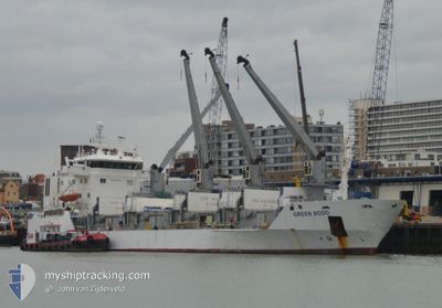
GREEN BODO
Reefer
Current Trip
BR ITJ
| Time Travelled | 8 days |
|---|---|
| Remaining Time | --- |
| Distance Travelled | 1147.15 nm |
| Remaining Distance | --- |
| AVG Speed | 12 Knots |
| MAX Speed | 17.6 Knots |
| AVG Wind | 10 knots |
| MAX Wind | 21 knots |
| MIN Temp | 15.2°C / 59.36°F |
| MAX Temp | 35.6°C / 96.08°F |
| Draught | 5.6 m |
| Position Received | 2024-03-21 13:56 |
Current Position
| Longitude | -48.58161° |
|---|---|
| Latitude | -26.90493° |
| Status | Under way using engine |
| Speed | 9.1 Knots |
| Course | 251.4° |
| Area | South Atlantic Ocean |
| Station | T-AIS |
| Position Received | 2024-03-21 13:56 |
Info
Information
The current position of GREEN BODO is in South Atlantic Ocean with coordinates -26.90493° / -48.58161° as reported on 2024-03-21 13:56 by AIS to our vessel tracker app. The vessel's current speed is 9.1 Knots
The vessel GREEN BODO (IMO: 8804555, MMSI: 311009500) is a Reefer that was built in 1990 ( 34 years old ). It's sailing under the flag of [BS] Bahamas.
In this page you can find informations about the vessels current position, last detected port calls, and current voyage information. If the vessels is not in coverage by AIS you will find the latest position.
The current position of GREEN BODO is detected by our AIS receivers and we are not responsible for the reliability of the data. The last position was recorded while the vessel was in Coverage by the Ais receivers of our vessel tracking app.
The current draught of GREEN BODO as reported by AIS is 5.6 meters
Weather
| Temperature | 15.2°C / 59.36°F |
|---|---|
| Wind Speed | 9 knots |
| Direction | 198° SSW |
| Pressure | 1013.1 hPa |
| Humidity | 87.4 % |
| Cloud Coverage | 15 % |
Featured Company
Last Port Calls
| Port | Arrival | Departure | Time In Port |
|---|---|---|---|
| 2024-04-07 11:48 | 2024-04-15 10:49 | 7 d | |
| 2024-03-21 14:27 | 2024-03-23 20:33 | 2 d | |
| 2024-02-25 16:48 | 2024-02-26 18:37 | 1 d | |
| 2024-02-10 07:29 | 2024-02-11 18:32 | 1 d | |
| 2024-02-06 23:39 | 2024-02-08 11:25 | 1 d |
Most Visited Ports (Last year)
| Port | Arrivals | |
|---|---|---|
| 4 | ||
| 2 | ||
| 2 | ||
| 2 | ||
| 2 | ||
| 1 |
Last Trips
| Origin | Departure | Destination | Arrival | Distance | |
|---|---|---|---|---|---|
| 2024-03-23 17:33 | 2024-04-07 12:48 | 3859.66 nm | |||
| 2024-02-26 18:37 | 2024-03-21 11:27 | 4299.49 nm | |||
| 2024-02-11 18:32 | 2024-02-25 16:48 | 185.11 nm | |||
| 2024-02-08 11:25 | 2024-02-10 07:29 | 11.15 nm | |||
| 2024-01-26 17:39 | 2024-02-06 23:39 | 1081.29 nm |
Events
| Time | Event | Details | Position / Dest | Info |
|---|---|---|---|---|
| 2024-04-22 07:35 | STOP Moving | 3.56 nm, North West of WALVIS BAY |
-22.88566 / 14.47328
BR ITJ
|
Speed: 0.2 kn Course: 208° |
| 2024-04-18 14:53 | START Moving | 3.36 nm, North West of SOYO |
-6.07596 / 12.28812
BR ITJ
|
Speed: 5.7 kn Course: 237° |
| 2024-04-18 05:55 | STOP Moving | 3.09 nm, North West of SOYO |
-6.07487 / 12.29552
BR ITJ
|
Speed: 0.2 kn Course: 91° |
| 2024-04-17 05:01 | STOP Moving | 3.03 nm, North West of SOYO |
-6.07601 / 12.29566
BR ITJ
|
Speed: 0.3 kn Course: 59° |
| 2024-04-16 10:43 | STOP Moving | 3.06 nm, North West of SOYO |
-6.07528 / 12.29572
BR ITJ
|
Speed: 0.1 kn Course: 85° |
| 2024-04-16 05:55 | STOP Moving | 3.04 nm, North West of SOYO |
-6.07537 / 12.29619
BR ITJ
|
Speed: 0.3 kn Course: 66° |
| 2024-04-15 17:40 | STOP Moving | 3.02 nm, North West of SOYO |
-6.07544 / 12.29644
BR ITJ
|
Speed: 0.2 kn Course: 106° |
| 2024-04-15 13:28 | START Moving | 1.92 nm, South West of BOMA |
-5.87815 / 13.02275
BR ITJ
|
Speed: 12.9 kn Course: 233° |
| 2024-04-15 13:09 | STOP Moving | 0.48 nm, South West of BOMA |
-5.86512 / 13.04339
BR ITJ
|
Speed: 0.2 kn Course: 90° |
| 2024-04-15 10:49 | PORT DEPARTURE |
|
-5.86708 / 13.42472
BR ITJ
|
Speed: 5.2 kn Course: 212° |