
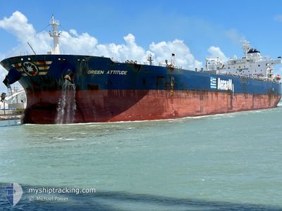
GREEN ATTITUDE
Tanker
Current Trip
| Time Travelled | 39 days |
|---|---|
| Remaining Time | --- |
| Distance Travelled | 8906.33 nm |
| Remaining Distance | --- |
| AVG Speed | 10.2 Knots |
| MAX Speed | 17 Knots |
| AVG Wind | 12.2 knots |
| MAX Wind | 40 knots |
| MIN Temp | 3°C / 37.4°F |
| MAX Temp | 26.2°C / 79.16°F |
| Draught | 9 m |
| Position Received | 5 d ago |
Current Position
| Longitude | -81.53172° |
|---|---|
| Latitude | 23.70100° |
| Status | Under way using engine |
| Speed | 12.1 Knots |
| Course | 268.5° |
| Area | North Atlantic Ocean |
| Station | T-AIS |
| Position Received | 5 d ago |
Info
Information
The current position of GREEN ATTITUDE is in North Atlantic Ocean with coordinates 23.70100° / -81.53172° as reported on 2024-04-20 05:49 by AIS to our vessel tracker app. The vessel's current speed is 12.1 Knots
The vessel GREEN ATTITUDE (IMO: 9808156, MMSI: 636018579) is a Tanker It's sailing under the flag of [LR] Liberia.
In this page you can find informations about the vessels current position, last detected port calls, and current voyage information. If the vessels is not in coverage by AIS you will find the latest position.
The current position of GREEN ATTITUDE is detected by our AIS receivers and we are not responsible for the reliability of the data. The last position was recorded while the vessel was in Coverage by the Ais receivers of our vessel tracking app.
The current draught of GREEN ATTITUDE as reported by AIS is 9 meters
Weather
| Temperature | 23.9°C / 75.02°F |
|---|---|
| Wind Speed | 15 knots |
| Direction | 128° SE |
| Pressure | 1018.2 hPa |
| Humidity | 88.8 % |
| Cloud Coverage | 2 % |
Featured Company
Last Port Calls
| Port | Arrival | Departure | Time In Port |
|---|---|---|---|
| 2024-03-14 10:39 | 2024-03-17 01:25 | 2 d | |
| 2024-03-11 06:13 | 2024-03-14 07:03 | 3 d | |
| 2024-02-21 01:41 | 2024-02-23 14:40 | 2 d | |
| 2024-02-10 04:16 | 2024-02-11 09:56 | 1 d |
Most Visited Ports (Last year)
| Port | Arrivals | |
|---|---|---|
| 5 | ||
| 2 | ||
| 2 | ||
| 2 | ||
| 1 | ||
| 1 |
Last Trips
| Origin | Departure | Destination | Arrival | Distance | |
|---|---|---|---|---|---|
| 2024-03-14 03:03 | 2024-03-14 06:39 | 27.13 nm | |||
| 2024-02-23 15:40 | 2024-03-11 02:13 | 4219.54 nm | |||
| 2024-02-11 06:26 | 2024-02-21 02:41 | 2514.20 nm | |||
| 2024-01-28 06:50 | 2024-02-10 00:46 | 2790.94 nm |
Events
| Time | Event | Details | Position / Dest | Info |
|---|---|---|---|---|
| 2024-04-24 07:01 | STOP Moving |
25.03406 / -92.87896
HOUSTON
|
Speed: 0.3 kn Course: 34° |
|
| 2024-04-20 05:51 | Status Changed | Default Under way using engine |
23.70081 / -81.54153
HOUSTON
|
Speed: 12.1 kn Course: 268.5° |
| 2024-04-20 05:49 | Detected in Sea | Cuban part of the North Atlantic Ocean |
23.70100 / -81.53172
North Atlantic Ocean
HOUSTON
|
Speed: 12.1 kn Course: 268.5° |
| 2024-04-20 05:49 | Status Changed | Under way using engine Default |
23.70100 / -81.53172
HOUSTON
|
Speed: 12.1 kn Course: 269° |
| 2024-04-20 05:49 | OUT of Coverage |
23.70100 / -81.53172
North Atlantic Ocean
HOUSTON
|
Speed: 12.1 kn Course: 268.5° |
|
| 2024-04-20 05:37 | IN Coverage |
23.70100 / -81.53172
North Atlantic Ocean
HOUSTON
|
Speed: 12.1 kn Course: 268.5° |
|
| 2024-04-19 23:40 | Status Changed | Default Under way using engine |
24.26138 / -80.44230
HOUSTON
|
Speed: 10.6 kn Course: 237° |
| 2024-04-19 23:35 | OUT of Coverage |
24.27008 / -80.42768
North Atlantic Ocean
HOUSTON
|
Speed: 10.6 kn Course: 237° |
|
| 2024-04-19 23:31 | Status Changed | Under way using engine Default |
24.27525 / -80.41894
HOUSTON
|
Speed: 10.5 kn Course: 237° |
| 2024-04-19 23:12 | Status Changed | Default Under way using engine |
24.30623 / -80.36668
HOUSTON
|
Speed: 10.5 kn Course: 237.2° |