
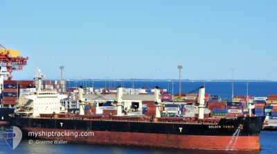
GOLDEN EAGLE
Bulk Carrier
Current Trip
| Time Travelled | 2 days |
|---|---|
| Remaining Time | --- |
| Distance Travelled | 923.54 nm |
| Remaining Distance | --- |
| AVG Speed | 12.9 Knots |
| MAX Speed | 14.4 Knots |
| AVG Wind | 12.3 knots |
| MAX Wind | 22.9 knots |
| MIN Temp | 24.9°C / 76.82°F |
| MAX Temp | 28.2°C / 82.76°F |
| Draught | 7.3 m |
| Position Received | 7 d ago |
Current Position
| Longitude | -76.40623° |
|---|---|
| Latitude | 10.28133° |
| Status | Under way using engine |
| Speed | 12.6 Knots |
| Course | 267° |
| Area | Caribbean Sea |
| Station | T-AIS |
| Position Received | 7 d ago |
Info
Information
The current position of GOLDEN EAGLE is in Caribbean Sea with coordinates 10.28133° / -76.40623° as reported on 2024-04-13 02:34 by AIS to our vessel tracker app. The vessel's current speed is 12.6 Knots and is heading at the port of LIMON. The estimated time of arrival as calculated by MyShipTracking vessel tracking app is 2024-04-14 04:00 LT
The vessel GOLDEN EAGLE (IMO: 9418731, MMSI: 538003794) is a Bulk Carrier that was built in 2010 ( 14 years old ). It's sailing under the flag of [MH] Marshall Is.
In this page you can find informations about the vessels current position, last detected port calls, and current voyage information. If the vessels is not in coverage by AIS you will find the latest position.
The current position of GOLDEN EAGLE is detected by our AIS receivers and we are not responsible for the reliability of the data. The last position was recorded while the vessel was in Coverage by the Ais receivers of our vessel tracking app.
The current draught of GOLDEN EAGLE as reported by AIS is 7.3 meters
Weather
| Temperature | 25.3°C / 77.54°F |
|---|---|
| Wind Speed | 14 knots |
| Direction | 77° ENE |
| Pressure | 1017.7 hPa |
| Humidity | 63.1 % |
| Cloud Coverage | 40 % |
Featured Company
Last Port Calls
| Port | Arrival | Departure | Time In Port |
|---|---|---|---|
| 2024-04-16 07:41 | 2024-04-17 12:15 | 1 d | |
| 2024-04-10 13:20 | 2024-04-12 02:16 | 1 d | |
| 2024-02-15 00:14 |
Most Visited Ports (Last year)
| Port | Arrivals | |
|---|---|---|
| 3 | ||
| 2 | ||
| 2 | ||
| 2 | ||
| 2 | ||
| 1 |
Last Trips
| Origin | Departure | Destination | Arrival | Distance | |
|---|---|---|---|---|---|
| 2024-04-11 21:16 | 2024-04-16 01:41 | 554.52 nm | |||
| 2024-01-29 12:37 | 2024-02-15 09:14 | 1621.15 nm |
Events
| Time | Event | Details | Position / Dest | Info |
|---|---|---|---|---|
| 2024-04-17 12:15 | START Moving | 0.99 nm, North of MOIN |
10.02377 / -83.08055
CR LIO
|
Speed: 7.7 kn Course: 9° |
| 2024-04-17 12:15 | PORT DEPARTURE |
|
10.02377 / -83.08055
CR LIO
|
Speed: 1.2 kn Course: 353° |
| 2024-04-16 07:56 | STOP Moving |
10.00460 / -83.07755
[CR] MOIN
|
Speed: 0.2 kn Course: 186° |
|
| 2024-04-16 07:41 | PORT ARRIVAL |
|
10.00670 / -83.07802
[CR] MOIN
|
Speed: 2.1 kn Course: 147° |
| 2024-04-16 06:15 | START Moving | 1.27 nm, North West of MOIN |
10.02255 / -83.09373
CR LIO
|
Speed: 3.1 kn Course: 310° |
| 2024-04-16 05:47 | STOP Moving | 1.26 nm, North West of MOIN |
10.02533 / -83.08967
CR LIO
|
Speed: 0.2 kn Course: 175° |
| 2024-04-16 05:23 | START Moving | 1.55 nm, North of MOIN |
10.03308 / -83.08138
CR LIO
|
Speed: 3.8 kn Course: 269° |
| 2024-04-16 05:04 | STOP Moving | 1.57 nm, North of MOIN |
10.03338 / -83.07590
CR LIO
|
Speed: 0.1 kn Course: 175° |
| 2024-04-16 03:36 | START Moving | 1.64 nm, North East of LIMON |
10.01182 / -83.00958
CR LIO
|
Speed: 5.2 kn Course: 87° |
| 2024-04-14 12:48 | STOP Moving | 1.19 nm, North East of LIMON |
10.00525 / -83.01328
CR LIO
|
Speed: 0.2 kn Course: 282° |