
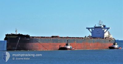
GOLDEN ARCUS
Cargo
Current Trip
| Time Travelled | 26 days |
|---|---|
| Remaining Time | --- |
| Distance Travelled | 6853.32 nm |
| Remaining Distance | --- |
| AVG Speed | 10.7 Knots |
| MAX Speed | 13.4 Knots |
| AVG Wind | 10.1 knots |
| MAX Wind | 30.7 knots |
| MIN Temp | 16.1°C / 60.98°F |
| MAX Temp | 30.3°C / 86.54°F |
| Draught | 18.1 m |
| Position Received | 4 d ago |
Current Position
| Longitude | 104.36030° |
|---|---|
| Latitude | 1.31774° |
| Status | Under way using engine |
| Speed | 11.5 Knots |
| Course | 49.3° |
| Area | South China Sea |
| Station | T-AIS |
| Position Received | 4 d ago |
Info
Information
The current position of GOLDEN ARCUS is in South China Sea with coordinates 1.31774° / 104.36030° as reported on 2024-04-21 17:52 by AIS to our vessel tracker app. The vessel's current speed is 11.5 Knots and is heading at the port of DANGJIN. The estimated time of arrival as calculated by MyShipTracking vessel tracking app is 2024-05-01 14:30 LT
The vessel GOLDEN ARCUS (IMO: 9743162, MMSI: 538007733) is a Cargo It's sailing under the flag of [MH] Marshall Is.
In this page you can find informations about the vessels current position, last detected port calls, and current voyage information. If the vessels is not in coverage by AIS you will find the latest position.
The current position of GOLDEN ARCUS is detected by our AIS receivers and we are not responsible for the reliability of the data. The last position was recorded while the vessel was in Coverage by the Ais receivers of our vessel tracking app.
The current draught of GOLDEN ARCUS as reported by AIS is 18.1 meters
Weather
| Temperature | 29.3°C / 84.74°F |
|---|---|
| Wind Speed | 11 knots |
| Direction | 174° S |
| Pressure | 1006.4 hPa |
| Humidity | 75.7 % |
| Cloud Coverage | --- |
Featured Company
Events
| Time | Event | Details | Position / Dest | Info |
|---|---|---|---|---|
| 2024-04-21 17:56 | Status Changed | Default Under way using engine |
1.32766 / 104.37168
DANGJIN S.KOREA
|
Speed: 11.5 kn Course: 49.3° |
| 2024-04-21 17:52 | OUT of Coverage |
1.31774 / 104.36030
South China Sea
DANGJIN S.KOREA
|
Speed: 11.5 kn Course: 49.3° |
|
| 2024-04-21 17:49 | Change Sea Area | Malaysian part of the South China Sea Malaysian part of the Singapore Strait |
1.31322 / 104.35513
South China Sea
DANGJIN S.KOREA
|
Speed: 11.3 kn Course: 49° |
| 2024-04-21 16:37 | Detected in Sea | Malaysian part of the Singapore Strait |
1.25915 / 104.15338
Singapore Strait
DANGJIN S.KOREA
|
Speed: 11.7 kn Course: 82.2° |
| 2024-04-21 14:43 | Change Sea Area | Indonesian part of the Singapore Strait Singaporean part of the Singapore Strait |
1.17497 / 103.81507
Singapore Strait
DANGJIN S.KOREA
|
Speed: 10.4 kn Course: 69.6° |
| 2024-04-21 14:31 | Change Sea Area | Singaporean part of the Singapore Strait Indonesian part of the Singapore Strait |
1.15880 / 103.78544
Singapore Strait
DANGJIN S.KOREA
|
Speed: 10.1 kn Course: 46.9° |
| 2024-04-21 12:04 | Change Sea Area | Indonesian part of the Singapore Strait Indonesian part of the Malacca Strait |
1.17593 / 103.42438
Singapore Strait
DANGJIN S.KOREA
|
Speed: 11.2 kn Course: 121.8° |
| 2024-04-21 11:41 | Status Changed | Under way using engine Default |
1.21872 / 103.36863
DANGJIN S.KOREA
|
Speed: 11.1 kn Course: 129° |
| 2024-04-21 11:40 | Status Changed | Default Under way using engine |
1.22003 / 103.36705
DANGJIN S.KOREA
|
Speed: 11.3 kn Course: 130.9° |
| 2024-04-21 11:31 | Change Sea Area | Indonesian part of the Malacca Strait Malaysian part of the Malacca Strait |
1.23917 / 103.34626
Malacca Strait
DANGJIN S.KOREA
|
Speed: 11.3 kn Course: 132.6° |