
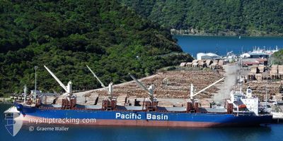
GOLD RIVER
Bulk Carrier
Current Trip
| Trip Time | 22 h, 31 mins |
|---|---|
| Trip Distance | 130.36 nm |
| AVG Speed | 10.2 Knots |
| MAX Speed | 13.2 Knots |
| Draught | 9 m |
| AVG Wind | 12.5 knots |
| MAX Wind | 28 knots |
| MIN Temp | 5.8°C / 42.44°F |
| MAX Temp | 14.1°C / 57.38°F |
| Position Received | 1 d ago |
Current Position
| Longitude | --- |
|---|---|
| Latitude | --- |
| Status | Under way using engine |
| Speed | 12.9 Knots |
| Course | 128.7° |
| Area | Philippine Sea |
| Station | T-AIS |
| Position Received | 1 d ago |
Info
Information
The current position of GOLD RIVER is in Philippine Sea with coordinates 33.98389° / 134.73913° as reported on 2024-12-13 01:14 by AIS to our vessel tracker app. The vessel's current speed is 12.9 Knots and is currently inside the port of SHINGU.
The vessel GOLD RIVER (IMO: 9251078, MMSI: 477473000) is a Bulk Carrier that was built in 2002 ( 22 years old ). It's sailing under the flag of [HK] Hong Kong.
In this page you can find informations about the vessels current position, last detected port calls, and current voyage information. If the vessels is not in coverage by AIS you will find the latest position.
The current position of GOLD RIVER is detected by our AIS receivers and we are not responsible for the reliability of the data. The last position was recorded while the vessel was in Coverage by the Ais receivers of our vessel tracking app.
The current draught of GOLD RIVER as reported by AIS is 9 meters
Weather
| Temperature | 2.1°C / 35.78°F |
|---|---|
| Wind Speed | 6 knots |
| Direction | 283° WNW |
| Pressure | 1018.4 hPa |
| Humidity | 83.1 % |
| Cloud Coverage | 7 % |
Featured Company
Last Trips
Events
| Time | Event | Details | Position / Dest | Info |
|---|---|---|---|---|
| 2024-12-13 22:58 | STOP Moving |
33.67894 / 135.98111
[JP] SHINGU
|
Speed: 0.2 kn Course: 45° |
|
| 2024-12-13 22:58 | PORT ARRIVAL |
|
33.67894 / 135.98111
[JP] SHINGU
|
Speed: 0.8 kn Course: 359° |
| 2024-12-13 19:09 | START Moving |
33.41975 / 136.36209
JP TOK
|
Speed: 3.9 kn Course: 330° |
|
| 2024-12-13 09:29 | STOP Moving | 15.85 nm, South East of UGUI |
33.48990 / 136.22084
JP TOK
|
Speed: 0.2 kn Course: 34° |
| 2024-12-13 01:21 | Status Changed | Default Under way using engine |
33.96735 / 134.76369
JP TOK
|
Speed: 12.9 kn Course: 128.7° |
| 2024-12-13 01:14 | Status Changed | Under way using engine Default |
33.98389 / 134.73913
JP TOK
|
Speed: 12.7 kn Course: 129° |
| 2024-12-13 01:14 | OUT of Coverage |
33.98389 / 134.73913
Philippine Sea
|
Speed: 12.9 kn Course: 128.7° |
|
| 2024-12-13 00:27 | Status Changed | Default Under way using engine |
34.04789 / 134.60782
JP TOK
|
Speed: 4.9 kn Course: 95° |
| 2024-12-13 00:27 | START Moving | 0.45 nm, South East of TOKUSHIMA |
34.04789 / 134.60782
JP TOK
|
Speed: 5.8 kn Course: 89° |
| 2024-12-13 00:27 | PORT DEPARTURE |
|
34.04789 / 134.60782
JP TOK
|
Speed: 4.9 kn Course: 95° |