
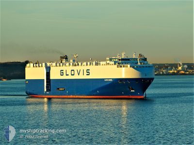
GLOVIS CARAVEL
Vehicles Carrier
Current Trip
| Time Travelled | 5 days |
|---|---|
| Remaining Time | --- |
| Distance Travelled | 1730.48 nm |
| Remaining Distance | 1666.17 nm |
| AVG Speed | 15 Knots |
| MAX Speed | 18.4 Knots |
| AVG Wind | 8.6 knots |
| MAX Wind | 26.3 knots |
| MIN Temp | 15°C / 59°F |
| MAX Temp | 29.6°C / 85.28°F |
| Draught | 8.7 m |
| Position Received | 2 d ago |
Current Position
| Longitude | 119.31559° |
|---|---|
| Latitude | 22.33532° |
| Status | Under way using engine |
| Speed | 14.9 Knots |
| Course | 205.7° |
| Area | South China Sea |
| Station | T-AIS |
| Position Received | 2 d ago |
Info
Information
The current position of GLOVIS CARAVEL is in South China Sea with coordinates 22.33532° / 119.31559° as reported on 2024-04-21 22:46 by AIS to our vessel tracker app. The vessel's current speed is 14.9 Knots and is heading at the port of GWANGYANG. The estimated time of arrival as calculated by MyShipTracking vessel tracking app is 2024-04-18 20:00 LT
The vessel GLOVIS CARAVEL (IMO: 9441594, MMSI: 311054300) is a Vehicles Carrier that was built in 2012 ( 12 years old ). It's sailing under the flag of [BS] Bahamas.
In this page you can find informations about the vessels current position, last detected port calls, and current voyage information. If the vessels is not in coverage by AIS you will find the latest position.
The current position of GLOVIS CARAVEL is detected by our AIS receivers and we are not responsible for the reliability of the data. The last position was recorded while the vessel was in Coverage by the Ais receivers of our vessel tracking app.
The current draught of GLOVIS CARAVEL as reported by AIS is 8.7 meters
Weather
| Temperature | 29.2°C / 84.56°F |
|---|---|
| Wind Speed | 3 knots |
| Direction | 83° E |
| Pressure | 1009.2 hPa |
| Humidity | 76.5 % |
| Cloud Coverage | 77 % |
Featured Company
Last Port Calls
| Port | Arrival | Departure | Time In Port |
|---|---|---|---|
| 2024-04-18 03:52 | 2024-04-18 12:40 | 8 h | |
| 2024-04-15 11:32 | 2024-04-16 11:31 | 23 h | |
| 2024-04-10 21:26 | 2024-04-11 07:53 | 10 h | |
| 2024-03-26 12:07 | 2024-03-26 22:13 | 10 h | |
| 2024-03-23 12:57 | 2024-03-24 00:50 | 11 h | |
| 2024-03-20 14:53 | 2024-03-21 04:48 | 13 h | |
| 2024-03-18 12:21 | 2024-03-18 22:32 | 10 h | |
| 2024-03-11 20:48 | 2024-03-14 03:53 | 2 d | |
| 2024-03-05 15:13 | 2024-03-06 16:38 | 1 d | |
| 2024-03-03 04:52 |
Most Visited Ports (Last year)
| Port | Arrivals | |
|---|---|---|
| 4 | ||
| 4 | ||
| 3 | ||
| 3 | ||
| 2 | ||
| 2 |
Last Trips
| Origin | Departure | Destination | Arrival | Distance | |
|---|---|---|---|---|---|
| 2024-04-16 20:31 | 2024-04-18 12:52 | 499.42 nm | |||
| 2024-04-11 16:53 | 2024-04-15 20:32 | 1191.84 nm | |||
| 2024-03-26 15:13 | 2024-04-11 06:26 | 5001.88 nm | |||
| 2024-03-23 17:50 | 2024-03-26 05:07 | 402.89 nm | |||
| 2024-03-20 21:48 | 2024-03-23 05:57 | 690.73 nm | |||
| 2024-03-18 15:32 | 2024-03-20 07:53 | 527.43 nm | |||
| 2024-03-13 21:53 | 2024-03-18 05:21 | 1333.47 nm | |||
| 2024-03-06 11:38 | 2024-03-11 14:48 | 1569.05 nm | |||
| 2024-02-21 17:37 | 2024-03-02 22:52 | 533.56 nm | |||
| 2024-02-18 19:36 | 2024-02-21 09:11 | 139.77 nm |
Events
| Time | Event | Details | Position / Dest | Info |
|---|---|---|---|---|
| 2024-04-21 22:52 | Status Changed | Default Under way using engine |
22.31331 / 119.30319
KR KAN
|
Speed: 14.9 kn Course: 205.7° |
| 2024-04-21 22:46 | OUT of Coverage |
22.33532 / 119.31559
South China Sea
|
Speed: 14.9 kn Course: 205.7° |
|
| 2024-04-21 22:46 | Status Changed | Under way using engine Default |
22.33680 / 119.31637
KR KAN
|
Speed: 15 kn Course: 208° |
| 2024-04-21 22:41 | IN Coverage |
22.33532 / 119.31559
South China Sea
|
Speed: 14.9 kn Course: 205.7° |
|
| 2024-04-21 20:12 | Status Changed | Default Under way using engine |
22.89368 / 119.63714
KR KAN
|
Speed: 14.9 kn Course: 210° |
| 2024-04-21 20:08 | Status Changed | Under way using engine Default |
22.90496 / 119.64392
KR KAN
|
Speed: 14.6 kn Course: 207° |
| 2024-04-21 20:08 | OUT of Coverage |
22.90496 / 119.64392
South China Sea
|
Speed: 14.9 kn Course: 210° |
|
| 2024-04-21 19:56 | IN Coverage |
22.90496 / 119.64392
South China Sea
|
Speed: 14.9 kn Course: 210° |
|
| 2024-04-21 19:08 | Status Changed | Default Under way using engine |
23.12529 / 119.76668
KR KAN
|
Speed: 15 kn Course: 201.1° |
| 2024-04-21 19:01 | OUT of Coverage |
23.15405 / 119.77948
South China Sea
|
Speed: 15 kn Course: 201.1° |