
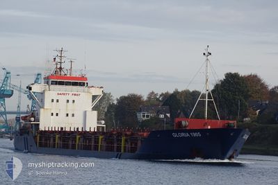
GLORIA 1905
General Cargo
Current Trip
| Time Travelled | 3 days |
|---|---|
| Remaining Time | --- |
| Distance Travelled | 453.79 nm |
| Remaining Distance | --- |
| AVG Speed | 9.1 Knots |
| MAX Speed | 11.5 Knots |
| AVG Wind | 9.3 knots |
| MAX Wind | 24.8 knots |
| MIN Temp | 15.1°C / 59.18°F |
| MAX Temp | 23.5°C / 74.3°F |
| Draught | 6.4 m |
| Position Received | 10 m ago |
Current Position
| Longitude | 23.01823° |
|---|---|
| Latitude | 36.31311° |
| Status | At anchor |
| Speed | 0.4 Knots |
| Course | 322° |
| Area | Aegean Sea |
| Station | T-AIS |
| Position Received | 10 m ago |
Info
Information
The current position of GLORIA 1905 is in Aegean Sea with coordinates 36.31311° / 23.01823° as reported on 2024-04-19 05:52 by AIS to our vessel tracker app. The vessel's current speed is 0.4 Knots and is heading at the port of BROMBOROUGH. The estimated time of arrival as calculated by MyShipTracking vessel tracking app is 2024-04-30 16:00 LT
The vessel GLORIA 1905 (IMO: 9148233, MMSI: 354854000) is a General Cargo that was built in 1997 ( 27 years old ). It's sailing under the flag of [PA] Panama.
In this page you can find informations about the vessels current position, last detected port calls, and current voyage information. If the vessels is not in coverage by AIS you will find the latest position.
The current position of GLORIA 1905 is detected by our AIS receivers and we are not responsible for the reliability of the data. The last position was recorded while the vessel was in Coverage by the Ais receivers of our vessel tracking app.
The current draught of GLORIA 1905 as reported by AIS is 6.4 meters
Weather
| Temperature | 15.5°C / 59.9°F |
|---|---|
| Wind Speed | 12 knots |
| Direction | 263° W |
| Pressure | 1011.5 hPa |
| Humidity | 71.7 % |
| Cloud Coverage | 81 % |
Featured Company
Last Port Calls
| Port | Arrival | Departure | Time In Port |
|---|---|---|---|
| 2024-04-12 17:41 | 2024-04-16 02:35 | 3 d | |
| 2024-04-09 05:51 | 2024-04-12 16:08 | 3 d | |
| 2024-04-02 11:08 | 2024-04-04 18:40 | 2 d | |
| 2024-03-25 15:50 | 2024-03-26 10:56 | 19 h | |
| 2024-03-23 14:41 | 2024-03-25 07:06 | 1 d | |
| 2024-03-09 13:06 | 2024-03-19 16:28 | 10 d | |
| 2024-03-09 03:07 | |||
| 2024-02-18 20:27 | 2024-02-27 17:05 | 8 d | |
| 2024-02-16 12:52 | 2024-02-16 22:48 | 9 h | |
| 2024-02-13 13:30 | 2024-02-15 14:40 | 2 d |
Most Visited Ports (Last year)
| Port | Arrivals | |
|---|---|---|
| 6 | ||
| 6 | ||
| 4 | ||
| 2 | ||
| 2 | ||
| 2 |
Last Trips
| Origin | Departure | Destination | Arrival | Distance | |
|---|---|---|---|---|---|
| 2024-04-12 19:08 | 2024-04-12 20:41 | 14.75 nm | |||
| 2024-04-04 20:40 | 2024-04-09 08:51 | 892.29 nm | |||
| 2024-03-26 13:56 | 2024-04-02 13:08 | 878.58 nm | |||
| 2024-03-25 10:06 | 2024-03-25 18:50 | 65.35 nm | |||
| 2024-03-19 18:28 | 2024-03-23 17:41 | 245.04 nm | |||
| 2024-03-09 05:07 | 2024-03-09 15:06 | 83.69 nm | |||
| 2024-02-16 23:48 | 2024-02-18 21:27 | 168.51 nm | |||
| 2024-02-15 15:40 | 2024-02-16 13:52 | 209.97 nm | |||
| 2024-02-09 02:20 | 2024-02-13 14:30 | 693.17 nm |
Events
| Time | Event | Details | Position / Dest | Info |
|---|---|---|---|---|
| 2024-04-19 04:43 | IN Coverage |
36.31333 / 23.01850
Aegean Sea
GB BHK
|
Speed: 0.1 kn Course: 289.8° |
|
| 2024-04-18 18:01 | OUT of Coverage |
36.76078 / 23.48933
Aegean Sea
GB BHK
|
Speed: 9.1 kn Course: 208.6° |
|
| 2024-04-18 18:01 | IN Coverage |
36.76078 / 23.48933
Aegean Sea
GB BHK
|
Speed: 9.1 kn Course: 208.6° |
|
| 2024-04-18 16:23 | OUT of Coverage |
36.98039 / 23.64810
Aegean Sea
GB BHK
|
Speed: 9.5 kn Course: 207.1° |
|
| 2024-04-18 08:23 | Status Changed | Under way using engine Default |
38.00349 / 24.62367
GB BHK
|
Speed: 10.2 kn Course: 201° |
| 2024-04-18 08:23 | IN Coverage |
38.00349 / 24.62367
Aegean Sea
GB BHK
|
Speed: 10 kn Course: 206.5° |
|
| 2024-04-18 06:41 | Status Changed | Default Under way using engine |
38.26949 / 24.76495
GB BHK
|
Speed: 10.1 kn Course: 204.7° |
| 2024-04-18 06:35 | OUT of Coverage |
38.28340 / 24.77264
Aegean Sea
GB BHK
|
Speed: 10.1 kn Course: 204.7° |
|
| 2024-04-18 05:11 | IN Coverage |
38.49222 / 24.89967
Aegean Sea
GB BHK
|
Speed: 10 kn Course: 204.6° |
|
| 2024-04-17 22:14 | OUT of Coverage |
39.45954 / 25.50221
Aegean Sea
GB BHK
|
Speed: 8.9 kn Course: 212.1° |