
GIESSENBURG
Other Type
Current Trip
VOORBURG
| Time Travelled | --- |
|---|---|
| Remaining Time | --- |
| Distance Travelled | --- |
| Remaining Distance | --- |
| AVG Speed | --- |
| MAX Speed | --- |
| AVG Wind | --- |
| MAX Wind | --- |
| MIN Temp | --- |
| MAX Temp | --- |
| Draught | 0 m |
| Position Received | 4 d ago |
Current Position
| Longitude | 5.72635° |
|---|---|
| Latitude | 51.26553° |
| Status | Under way using engine |
| Speed | 3.6 Knots |
| Course | 237.8° |
| Area | North Sea |
| Station | T-AIS |
| Position Received | 4 d ago |
Info
Information
The current position of GIESSENBURG is in North Sea with coordinates 51.26553° / 5.72635° as reported on 2024-04-13 09:47 by AIS to our vessel tracker app. The vessel's current speed is 3.6 Knots
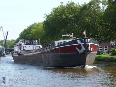
The vessel GIESSENBURG (IMO: 2309949, MMSI: 244620980) is a Other Type It's sailing under the flag of [NL] Netherlands.
In this page you can find informations about the vessels current position, last detected port calls, and current voyage information. If the vessels is not in coverage by AIS you will find the latest position.
The current position of GIESSENBURG is detected by our AIS receivers and we are not responsible for the reliability of the data. The last position was recorded while the vessel was in Coverage by the Ais receivers of our vessel tracking app.
Weather
| Temperature | 17.9°C / 64.22°F |
|---|---|
| Wind Speed | 11 knots |
| Direction | 224° SW |
| Pressure | 1025.7 hPa |
| Humidity | 74 % |
| Cloud Coverage | 100 % |
Featured Company
Last Port Calls
Most Visited Ports (Last year)
| Port | Arrivals | |
|---|---|---|
| 4 | ||
| 1 | ||
| 1 | ||
| 1 | ||
| 1 |
Last Trips
| Origin | Departure | Destination | Arrival | Distance |
|---|
Events
| Time | Event | Details | Position / Dest | Info |
|---|---|---|---|---|
| 2024-04-13 09:47 | OUT of Coverage |
51.26553 / 5.72635
North Sea
|
Speed: 3.6 kn Course: 237.8° |
|
| 2024-04-13 09:31 | START Moving | 8.21 nm, North West of THORN |
51.27259 / 5.74893
VOORBURG
|
Speed: 3.1 kn Course: 243.9° |
| 2024-04-13 09:01 | STOP Moving | 8.18 nm, North West of THORN |
51.27372 / 5.75396
VOORBURG
|
Speed: 0.3 kn Course: 511° |
| 2024-04-13 08:18 | IN Coverage |
51.23881 / 5.79406
North Sea
|
Speed: 4.4 kn Course: 328° |
|
| 2024-04-12 10:34 | OUT of Coverage |
51.23235 / 5.80021
North Sea
|
Speed: 6.3 kn Course: 148.9° |
|
| 2024-04-12 10:00 | START Moving | 8.19 nm, North West of THORN |
51.27313 / 5.75144
VOORBURG
|
Speed: 3.3 kn Course: 69.5° |
| 2024-04-12 09:31 | STOP Moving | 8.22 nm, North West of THORN |
51.27184 / 5.74637
VOORBURG
|
Speed: 0.3 kn Course: 511° |
| 2024-04-12 08:59 | IN Coverage |
51.25270 / 5.68867
North Sea
|
Speed: 5.8 kn Course: 61.6° |
|
| 2024-04-09 10:11 | OUT of Coverage |
51.25644 / 5.69972
North Sea
|
Speed: 3.5 kn Course: 242.1° |
|
| 2024-04-09 09:35 | START Moving | 8.21 nm, North West of THORN |
51.27263 / 5.74920
VOORBURG
|
Speed: 3.5 kn Course: 248.1° |