
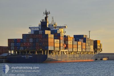
CMA CGM MONTREAL
Container Ship
Current Trip
| Time Travelled | 2 days |
|---|---|
| Remaining Time | --- |
| Distance Travelled | 895.35 nm |
| Remaining Distance | 3.86 nm |
| AVG Speed | 13.5 Knots |
| MAX Speed | 17.7 Knots |
| AVG Wind | 15.2 knots |
| MAX Wind | 29.8 knots |
| MIN Temp | 7.4°C / 45.32°F |
| MAX Temp | 18.3°C / 64.94°F |
| Draught | 9.5 m |
| Position Received | Now |
Current Position
| Longitude | 23.59974° |
|---|---|
| Latitude | 37.88627° |
| Status | Under way using engine |
| Speed | 1.1 Knots |
| Course | 6° |
| Area | Aegean Sea |
| Station | T-AIS |
| Position Received | Now |
Info
Information
The current position of CMA CGM MONTREAL is in Aegean Sea with coordinates 37.88627° / 23.59974° as reported on 2024-04-25 20:00 by AIS to our vessel tracker app. The vessel's current speed is 1.1 Knots and is heading at the port of PIRAEUS. The estimated time of arrival as calculated by MyShipTracking vessel tracking app is 2024-04-25 18:30 LT
The vessel CMA CGM MONTREAL (IMO: 9363417, MMSI: 229846000) is a Container Ship that was built in 2007 ( 17 years old ). It's sailing under the flag of [MT] Malta.
In this page you can find informations about the vessels current position, last detected port calls, and current voyage information. If the vessels is not in coverage by AIS you will find the latest position.
The current position of CMA CGM MONTREAL is detected by our AIS receivers and we are not responsible for the reliability of the data. The last position was recorded while the vessel was in Coverage by the Ais receivers of our vessel tracking app.
The current draught of CMA CGM MONTREAL as reported by AIS is 9.5 meters
Weather
| Temperature | 15.3°C / 59.54°F |
|---|---|
| Wind Speed | 18 knots |
| Direction | 294° WNW |
| Pressure | 1008.8 hPa |
| Humidity | 53.5 % |
| Cloud Coverage | --- |
Featured Company
Last Port Calls
| Port | Arrival | Departure | Time In Port |
|---|---|---|---|
| 2024-04-22 14:32 | 2024-04-23 08:28 | 17 h | |
| 2024-04-21 05:08 | 2024-04-22 08:12 | 1 d | |
| 2024-04-20 04:21 | 2024-04-20 12:46 | 8 h | |
| 2024-04-18 08:43 | 2024-04-19 10:16 | 1 d | |
| 2024-04-16 20:22 | 2024-04-17 09:40 | 13 h | |
| 2024-04-11 04:42 | 2024-04-12 21:50 | 1 d | |
| 2024-04-08 03:35 | 2024-04-08 20:30 | 16 h | |
| 2024-04-07 11:57 | 2024-04-07 16:24 | 4 h | |
| 2024-04-07 04:42 | 2024-04-07 11:55 | 7 h | |
| 2024-04-04 00:49 | 2024-04-06 10:09 | 2 d |
Most Visited Ports (Last year)
| Port | Arrivals | |
|---|---|---|
| 11 | ||
| 7 | ||
| 6 | ||
| 6 | ||
| 4 | ||
| 4 |
Last Trips
| Origin | Departure | Destination | Arrival | Distance | |
|---|---|---|---|---|---|
| 2024-04-22 10:12 | 2024-04-22 16:32 | 72.11 nm | |||
| 2024-04-20 14:46 | 2024-04-21 07:08 | 77.21 nm | |||
| 2024-04-19 12:16 | 2024-04-20 06:21 | 74.86 nm | |||
| 2024-04-17 11:40 | 2024-04-18 10:43 | 107.28 nm | |||
| 2024-04-13 00:50 | 2024-04-16 22:22 | 857.33 nm | |||
| 2024-04-08 23:30 | 2024-04-11 07:42 | 696.55 nm | |||
| 2024-04-07 19:24 | 2024-04-08 06:35 | 134.58 nm | |||
| 2024-04-07 14:55 | 2024-04-07 14:57 | 0.38 nm | |||
| 2024-04-06 12:09 | 2024-04-07 07:42 | 282.48 nm | |||
| 2024-04-01 16:45 | 2024-04-04 02:49 | 549.08 nm |
Events
| Time | Event | Details | Position / Dest | Info |
|---|---|---|---|---|
| 2024-04-25 18:26 | ETA Changed | 2024/04/25 18:30 2025/01/01 18:30 |
37.77977 / 23.69453
SI KOP > GR PIR
|
Speed: 9.9 kn Course: 335.7° |
| 2024-04-25 18:20 | ETA Changed | 2025/01/01 18:30 2024/04/25 18:30 |
37.76457 / 23.70314
SI KOP > GR PIR
|
Speed: 9.9 kn Course: 335.5° |
| 2024-04-25 12:48 | Status Changed | Under way using engine Default |
36.70021 / 23.48345
SI KOP > GR PIR
|
Speed: 15.7 kn Course: 34° |
| 2024-04-25 12:37 | Status Changed | Default Under way using engine |
36.66069 / 23.45014
SI KOP > GR PIR
|
Speed: 15.7 kn Course: 34° |
| 2024-04-25 12:27 | Change Sea Area | Greek part of the Aegean Sea Greek part of the Ionian Sea |
36.62509 / 23.42167
Aegean Sea
SI KOP > GR PIR
|
Speed: 15.6 kn Course: 31.1° |
| 2024-04-25 12:27 | Status Changed | Under way using engine Default |
36.62352 / 23.42050
SI KOP > GR PIR
|
Speed: 15.4 kn Course: 26° |
| 2024-04-25 12:17 | IN Coverage |
36.62509 / 23.42167
Aegean Sea
SI KOP > GR PIR
|
Speed: 15.6 kn Course: 31.1° |
|
| 2024-04-25 02:55 | Status Changed | Default Under way using engine |
36.94003 / 20.81488
SI KOP > GR PIR
|
Speed: 14.6 kn Course: 123.2° |
| 2024-04-25 02:53 | OUT of Coverage |
36.94423 / 20.80686
Ionian Sea
SI KOP > GR PIR
|
Speed: 14.6 kn Course: 123.2° |
|
| 2024-04-24 19:07 | Change Sea Area | Greek part of the Ionian Sea Italian part of the Adriatic Sea |
38.63052 / 19.64571
Ionian Sea
SI KOP > GR PIR
|
Speed: 15.2 kn Course: 156° |