
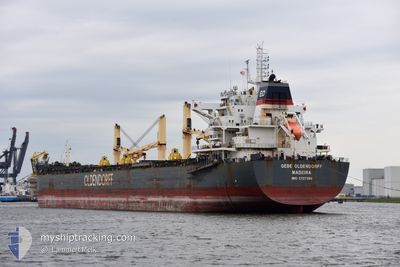
GEBE OLDENDORFF
Cargo
Current Trip
| Time Travelled | 10 days |
|---|---|
| Remaining Time | --- |
| Distance Travelled | 3252.29 nm |
| Remaining Distance | --- |
| AVG Speed | 12.1 Knots |
| MAX Speed | 16.6 Knots |
| AVG Wind | 9.6 knots |
| MAX Wind | 34.5 knots |
| MIN Temp | -0.2°C / 31.64°F |
| MAX Temp | 19.6°C / 67.28°F |
| Draught | 11.7 m |
| Position Received | 1 h, 49 m ago |
Current Position
| Longitude | 3.16366° |
|---|---|
| Latitude | 37.50439° |
| Status | Under way using engine |
| Speed | 12.9 Knots |
| Course | 73.5° |
| Area | Mediterranean Sea - Western Basin |
| Station | T-AIS |
| Position Received | 1 h, 49 m ago |
Info
Information
The current position of GEBE OLDENDORFF is in Mediterranean Sea - Western Basin with coordinates 37.50439° / 3.16366° as reported on 2024-04-16 16:49 by AIS to our vessel tracker app. The vessel's current speed is 12.9 Knots and is heading at the port of TARANTO. The estimated time of arrival as calculated by MyShipTracking vessel tracking app is 2024-04-19 14:00 LT
The vessel GEBE OLDENDORFF (IMO: 9727596, MMSI: 255805774) is a Cargo It's sailing under the flag of [PT] Portugal.
In this page you can find informations about the vessels current position, last detected port calls, and current voyage information. If the vessels is not in coverage by AIS you will find the latest position.
The current position of GEBE OLDENDORFF is detected by our AIS receivers and we are not responsible for the reliability of the data. The last position was recorded while the vessel was in Coverage by the Ais receivers of our vessel tracking app.
The current draught of GEBE OLDENDORFF as reported by AIS is 11.7 meters
Weather
| Temperature | 18°C / 64.4°F |
|---|---|
| Wind Speed | 2 knots |
| Direction | 17° NNE |
| Pressure | 1013.8 hPa |
| Humidity | 76.9 % |
| Cloud Coverage | --- |
Featured Company
Last Port Calls
| Port | Arrival | Departure | Time In Port |
|---|---|---|---|
| 2024-04-01 18:30 | 2024-04-05 20:52 | 4 d | |
| 2024-03-26 23:15 | 2024-03-28 19:52 | 1 d | |
| 2024-02-22 13:18 | 2024-02-28 15:41 | 6 d |
Most Visited Ports (Last year)
| Port | Arrivals | |
|---|---|---|
| 12 | ||
| 1 | ||
| 1 | ||
| 1 | ||
| 1 | ||
| 1 |
Last Trips
| Origin | Departure | Destination | Arrival | Distance | |
|---|---|---|---|---|---|
| 2024-03-28 20:52 | 2024-04-01 21:30 | 1303.75 nm | |||
| 2024-02-28 16:41 | 2024-03-27 00:15 | 2297.97 nm | |||
| 2024-01-23 13:45 | 2024-02-22 14:18 | 6062.11 nm |
Events
| Time | Event | Details | Position / Dest | Info |
|---|---|---|---|---|
| 2024-04-16 16:55 | Status Changed | Default Under way using engine |
37.51094 / 3.19107
ITTAR
|
Speed: 12.9 kn Course: 73.5° |
| 2024-04-16 16:49 | Status Changed | Under way using engine Default |
37.50439 / 3.16366
ITTAR
|
Speed: 12.9 kn Course: 73° |
| 2024-04-16 16:49 | OUT of Coverage |
37.50439 / 3.16366
Mediterranean Sea - Western Basin
ITTAR
|
Speed: 12.9 kn Course: 73.5° |
|
| 2024-04-16 16:17 | Status Changed | Default Under way using engine |
37.47651 / 3.02027
ITTAR
|
Speed: 13 kn Course: 78.9° |
| 2024-04-16 16:14 | Status Changed | Under way using engine Default |
37.47465 / 3.00869
ITTAR
|
Speed: 13 kn Course: 76° |
| 2024-04-16 16:14 | IN Coverage |
37.47465 / 3.00869
Mediterranean Sea - Western Basin
ITTAR
|
Speed: 13 kn Course: 78.9° |
|
| 2024-04-16 15:07 | Status Changed | Default Under way using engine |
37.41471 / 2.71385
ITTAR
|
Speed: 12.9 kn Course: 74° |
| 2024-04-16 15:03 | OUT of Coverage |
37.41095 / 2.69730
Mediterranean Sea - Western Basin
ITTAR
|
Speed: 12.9 kn Course: 74° |
|
| 2024-04-16 14:58 | Status Changed | Under way using engine Default |
37.40642 / 2.67703
ITTAR
|
Speed: 12.9 kn Course: 76° |
| 2024-04-16 14:40 | IN Coverage |
37.40642 / 2.67703
Mediterranean Sea - Western Basin
ITTAR
|
Speed: 12.9 kn Course: 75.4° |