
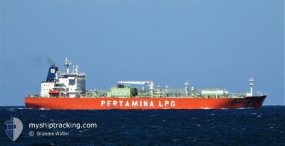
GAS WALIO
Tanker C
Current Trip
| Time Travelled | 18 days |
|---|---|
| Remaining Time | --- |
| Distance Travelled | 3545.39 nm |
| Remaining Distance | --- |
| AVG Speed | 9.9 Knots |
| MAX Speed | 14 Knots |
| AVG Wind | 13 knots |
| MAX Wind | 32 knots |
| MIN Temp | 14°C / 57.2°F |
| MAX Temp | 32.2°C / 89.96°F |
| Draught | 8.5 m |
| Position Received | 2 d ago |
Current Position
| Longitude | -70.02189° |
|---|---|
| Latitude | 18.40077° |
| Status | Under way using engine |
| Speed | 0.2 Knots |
| Course | 123° |
| Area | Caribbean Sea |
| Station | T-AIS |
| Position Received | 2 d ago |
Info
Information
The current position of GAS WALIO is in Caribbean Sea with coordinates 18.40077° / -70.02189° as reported on 2024-04-17 11:51 by AIS to our vessel tracker app. The vessel's current speed is 0.2 Knots
The vessel GAS WALIO (IMO: 9590670, MMSI: 525008072) is a Tanker C It's sailing under the flag of [ID] Indonesia.
In this page you can find informations about the vessels current position, last detected port calls, and current voyage information. If the vessels is not in coverage by AIS you will find the latest position.
The current position of GAS WALIO is detected by our AIS receivers and we are not responsible for the reliability of the data. The last position was recorded while the vessel was in Coverage by the Ais receivers of our vessel tracking app.
The current draught of GAS WALIO as reported by AIS is 8.5 meters
Weather
| Temperature | 27°C / 80.6°F |
|---|---|
| Wind Speed | 9 knots |
| Direction | 15° NNE |
| Pressure | 1015.3 hPa |
| Humidity | 62.1 % |
| Cloud Coverage | 43 % |
Featured Company
Last Port Calls
| Port | Arrival | Departure | Time In Port |
|---|---|---|---|
| 2024-03-30 13:05 | 2024-03-31 19:48 | 1 d | |
| 2024-03-25 01:48 | 2024-03-26 17:15 | 1 d | |
| 2024-03-12 03:43 | 2024-03-13 02:51 | 23 h | |
| 2024-02-29 02:45 | 2024-03-01 05:07 | 1 d | |
| 2024-02-08 08:48 | 2024-02-09 16:12 | 1 d |
Most Visited Ports (Last year)
| Port | Arrivals | |
|---|---|---|
| 3 | ||
| 2 | ||
| 2 | ||
| 2 | ||
| 2 | ||
| 1 |
Last Trips
| Origin | Departure | Destination | Arrival | Distance | |
|---|---|---|---|---|---|
| 2024-03-26 17:15 | 2024-03-30 13:05 | 384.91 nm | |||
| 2024-03-12 22:51 | 2024-03-25 01:48 | 3239.02 nm | |||
| 2024-02-09 12:12 | 2024-02-28 22:45 | 1596.24 nm | |||
| 2024-01-26 17:45 | 2024-02-08 04:48 | 1321.12 nm |
Events
| Time | Event | Details | Position / Dest | Info |
|---|---|---|---|---|
| 2024-04-17 12:21 | Status Changed | Default Under way using engine |
18.40103 / -70.02190
PTSIE
|
Speed: 0.2 kn Course: 123° |
| 2024-04-17 11:51 | OUT of Coverage |
18.40077 / -70.02189
Caribbean Sea
|
Speed: 0.2 kn Course: 329.5° |
|
| 2024-04-17 11:38 | STOP Moving | 1.09 nm, South of RIO HAINA |
18.40072 / -70.02166
PTSIE
|
Speed: 0.3 kn Course: 112° |
| 2024-04-17 10:22 | START Moving | 4.09 nm, South East of RIO HAINA |
18.36732 / -69.97121
PTSIE
|
Speed: 3.2 kn Course: 305° |
| 2024-04-17 10:06 | STOP Moving | 4.15 nm, South East of RIO HAINA |
18.36511 / -69.97235
PTSIE
|
Speed: 0.3 kn Course: 69° |
| 2024-04-17 08:29 | START Moving | 16.74 nm, South of SANTO DOMINGO |
18.19397 / -69.81440
PTSIE
|
Speed: 3.6 kn Course: 354° |
| 2024-04-17 03:23 | STOP Moving | 15.7 nm, South West of BOCA CHIKA |
18.20686 / -69.75775
PTSIE
|
Speed: 0.3 kn Course: 68° |
| 2024-04-16 21:18 | Status Changed | Under way using engine Default |
18.33970 / -69.92985
PTSIE
|
Speed: 5.7 kn Course: 183° |
| 2024-04-16 21:12 | Status Changed | Default Under way using engine |
18.34788 / -69.92923
PTSIE
|
Speed: 5.7 kn Course: 184.5° |
| 2024-04-16 20:35 | START Moving | 4.33 nm, South West of SANTO DOMINGO |
18.40292 / -69.92620
PTSIE
|
Speed: 3.2 kn Course: 182° |