
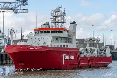
FUGRO VENTURER
Other Type
Current Trip
MORAY FIRTH SHELTER
| Time Travelled | 2 days |
|---|---|
| Remaining Time | --- |
| Distance Travelled | 188.27 nm |
| Remaining Distance | --- |
| AVG Speed | 4.6 Knots |
| MAX Speed | 9.3 Knots |
| AVG Wind | 12.7 knots |
| MAX Wind | 30 knots |
| MIN Temp | 4.7°C / 40.46°F |
| MAX Temp | 7.7°C / 45.86°F |
| Draught | 5.8 m |
| Position Received | 5 d ago |
Current Position
| Longitude | -2.35636° |
|---|---|
| Latitude | 58.77476° |
| Status | Under way using engine |
| Speed | 5.1 Knots |
| Course | 12.8° |
| Area | North Sea |
| Station | T-AIS |
| Position Received | 5 d ago |
Info
Information
The current position of FUGRO VENTURER is in North Sea with coordinates 58.77476° / -2.35636° as reported on 2024-04-13 17:32 by AIS to our vessel tracker app. The vessel's current speed is 5.1 Knots
The vessel FUGRO VENTURER (IMO: 9769051, MMSI: 311000463) is a Other Type It's sailing under the flag of [BS] Bahamas.
In this page you can find informations about the vessels current position, last detected port calls, and current voyage information. If the vessels is not in coverage by AIS you will find the latest position.
The current position of FUGRO VENTURER is detected by our AIS receivers and we are not responsible for the reliability of the data. The last position was recorded while the vessel was in Coverage by the Ais receivers of our vessel tracking app.
The current draught of FUGRO VENTURER as reported by AIS is 5.8 meters
Weather
| Temperature | 4.7°C / 40.46°F |
|---|---|
| Wind Speed | 30 knots |
| Direction | 337° NNW |
| Pressure | 1009.1 hPa |
| Humidity | 65.5 % |
| Cloud Coverage | 100 % |
Featured Company
Last Port Calls
| Port | Arrival | Departure | Time In Port |
|---|---|---|---|
| 2024-04-15 08:32 | 2024-04-16 19:21 | 1 d | |
| 2024-04-06 10:20 | 2024-04-08 16:54 | 2 d | |
| 2024-04-01 17:38 | 2024-04-04 17:58 | 3 d | |
| 2024-03-27 17:51 | 2024-03-29 18:24 | 2 d | |
| 2024-03-07 18:44 | 2024-03-20 14:33 | 12 d | |
| 2024-02-24 08:34 | 2024-02-27 19:56 | 3 d | |
| 2024-02-02 17:16 |
Most Visited Ports (Last year)
| Port | Arrivals | |
|---|---|---|
| 9 | ||
| 7 | ||
| 6 | ||
| 3 | ||
| 2 | ||
| 1 |
Last Trips
| Origin | Departure | Destination | Arrival | Distance | |
|---|---|---|---|---|---|
| 2024-04-08 17:54 | 2024-04-15 09:32 | 698.86 nm | |||
| 2024-04-04 18:58 | 2024-04-06 11:20 | 211.54 nm | |||
| 2024-03-29 18:24 | 2024-04-01 18:38 | 271.19 nm | |||
| 2024-03-20 15:33 | 2024-03-27 17:51 | 700.24 nm | |||
| 2024-02-27 19:56 | 2024-03-07 19:44 | 1191.58 nm | |||
| 2024-02-02 18:16 | 2024-02-24 08:34 | 4215.48 nm |
Events
| Time | Event | Details | Position / Dest | Info |
|---|---|---|---|---|
| 2024-04-18 14:38 | STOP Moving | 5.56 nm, West of SCALLOWAY |
60.12846 / -1.46394
MORAY FIRTH SHELTER
|
Speed: 0.3 kn Course: 286° |
| 2024-04-16 19:21 | PORT DEPARTURE |
|
60.13010 / -1.30764
MORAY FIRTH SHELTER
|
Speed: 6.5 kn Course: 258° |
| 2024-04-16 19:13 | START Moving |
60.13265 / -1.28076
[GB] SCALLOWAY
|
Speed: 4.2 kn Course: 245° |
|
| 2024-04-15 08:44 | STOP Moving |
60.13320 / -1.27569
[GB] SCALLOWAY
|
Speed: 0.3 kn Course: 101° |
|
| 2024-04-15 08:32 | PORT ARRIVAL |
|
60.12993 / -1.29407
[GB] SCALLOWAY
|
Speed: 5.7 kn Course: 111° |
| 2024-04-15 07:24 | START Moving | 6.58 nm, West of SCALLOWAY |
60.11575 / -1.49506
MORAY FIRTH SHELTER
|
Speed: 5.2 kn Course: 58° |
| 2024-04-15 02:08 | STOP Moving | 6.48 nm, West of SCALLOWAY |
60.10722 / -1.48810
MORAY FIRTH SHELTER
|
Speed: 0.2 kn Course: 196° |
| 2024-04-14 11:32 | START Moving | 8.84 nm, South East of HOLLANDSTOUN |
59.22809 / -2.29340
MORAY FIRTH SHELTER
|
Speed: 5.4 kn Course: 13° |
| 2024-04-13 21:56 | STOP Moving | 8.62 nm, East of WHITEHALL |
59.14751 / -2.32074
MORAY FIRTH SHELTER
|
Speed: 0.2 kn Course: 256° |
| 2024-04-13 17:32 | OUT of Coverage |
58.77476 / -2.35636
North Sea
|
Speed: 5.1 kn Course: 12.8° |