
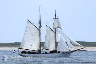
FS BELLE POULE
Not available
Current Trip
| Trip Time | 2 days |
|---|---|
| Trip Distance | 88.65 nm |
| AVG Speed | 6.7 Knots |
| MAX Speed | 7.8 Knots |
| Draught | 0 m |
| AVG Wind | 4.7 knots |
| MAX Wind | 9 knots |
| MIN Temp | 14.5°C / 58.1°F |
| MAX Temp | 24.7°C / 76.46°F |
| Position Received | 4 d ago |
Current Position
| Longitude | 5.91929° |
|---|---|
| Latitude | 43.11790° |
| Status | Moored |
| Speed | 0.1 Knots |
| Course | --- |
| Area | Mediterranean Sea - Western Basin |
| Station | T-AIS |
| Position Received | 4 d ago |
Info
Information
The current position of FS BELLE POULE is in Mediterranean Sea - Western Basin with coordinates 43.11790° / 5.91929° as reported on 2024-04-20 05:27 by AIS to our vessel tracker app. The vessel's current speed is 0.1 Knots and is currently inside the port of TOULON.
The vessel FS BELLE POULE (MMSI: 228796000) is a Not available It's sailing under the flag of [FR] France.
In this page you can find informations about the vessels current position, last detected port calls, and current voyage information. If the vessels is not in coverage by AIS you will find the latest position.
The current position of FS BELLE POULE is detected by our AIS receivers and we are not responsible for the reliability of the data. The last position was recorded while the vessel was in Coverage by the Ais receivers of our vessel tracking app.
Weather
| Temperature | 14.3°C / 57.74°F |
|---|---|
| Wind Speed | 21 knots |
| Direction | 300° WNW |
| Pressure | 1009.6 hPa |
| Humidity | 60.8 % |
| Cloud Coverage | --- |
Featured Company
Last Port Calls
| Port | Arrival | Departure | Time In Port |
|---|---|---|---|
| 2024-04-15 05:55 | |||
| 2024-04-12 12:30 | |||
| 2024-04-09 06:45 | 2024-04-12 06:12 | 2 d | |
| 2024-04-05 06:19 | 2024-04-08 06:16 | 2 d | |
| 2024-04-02 08:15 | |||
| 2024-03-08 07:52 | 2024-03-12 09:28 | 4 d | |
| 2024-02-29 10:37 | 2024-03-04 15:24 | 4 d | |
| 2024-02-22 08:30 | 2024-02-27 15:18 | 5 d | |
| 2024-02-15 13:17 |
Last Trips
| Origin | Departure | Destination | Arrival | Distance | |
|---|---|---|---|---|---|
| 2024-04-12 08:12 | 2024-04-15 07:55 | 88.65 nm | |||
| 2024-04-12 08:12 | 2024-04-12 14:30 | 40.49 nm | |||
| 2024-04-08 08:16 | 2024-04-09 08:45 | 135.24 nm | |||
| 2024-04-02 10:15 | 2024-04-05 08:19 | 242.09 nm | |||
| 2024-03-04 16:24 | 2024-03-08 08:52 | 376.15 nm | |||
| 2024-02-27 15:18 | 2024-02-29 11:37 | 260.20 nm | |||
| 2024-02-15 14:17 | 2024-02-22 08:30 | 720.70 nm |
Events
| Time | Event | Details | Position / Dest | Info |
|---|---|---|---|---|
| 2024-04-20 05:27 | OUT of Coverage |
43.11790 / 5.91929
Mediterranean Sea - Western Basin
[FR] TOULON
|
Speed: 0.1 kn Course: 511° |
|
| 2024-04-19 21:30 | IN Coverage |
43.11790 / 5.91933
Mediterranean Sea - Western Basin
[FR] TOULON
|
Speed: Course: 511° |
|
| 2024-04-19 17:24 | OUT of Coverage |
43.11788 / 5.91931
Mediterranean Sea - Western Basin
[FR] TOULON
|
Speed: Course: 511° |
|
| 2024-04-15 06:35 | Status Changed | Moored Under way using engine |
43.11788 / 5.91930
[FR] TOULON
|
Speed: Course: 511° |
| 2024-04-15 06:17 | STOP Moving |
43.11772 / 5.91915
[FR] TOULON
|
Speed: 0.2 kn Course: 511° |
|
| 2024-04-15 05:55 | PORT ARRIVAL |
|
43.10581 / 5.91926
[FR] TOULON
|
Speed: 4.7 kn Course: 22.3° |
| 2024-04-15 05:29 | START Moving | 1.16 nm, North East of SAINT MANDRIER |
43.09255 / 5.94776
|
Speed: 4.7 kn Course: 242° |
| 2024-04-15 05:21 | STOP Moving | 1.27 nm, North East of SAINT MANDRIER |
43.09403 / 5.94956
|
Speed: 0.3 kn Course: 511° |
| 2024-04-15 02:21 | IN Coverage |
43.09967 / 6.19981
Mediterranean Sea - Western Basin
|
Speed: 6.5 kn Course: 195.4° |