
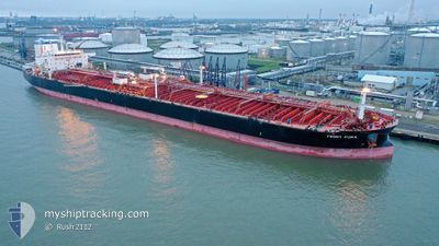
SFL PUMA
Tanker
Current Trip
| Time Travelled | 55 days |
|---|---|
| Remaining Time | 2 days |
| Distance Travelled | 12903.37 nm |
| Remaining Distance | 572.20 nm |
| AVG Speed | 12.3 Knots |
| MAX Speed | 16.5 Knots |
| AVG Wind | 13.4 knots |
| MAX Wind | 36.7 knots |
| MIN Temp | 17.1°C / 62.78°F |
| MAX Temp | 29.9°C / 85.82°F |
| Draught | 14.4 m |
| Position Received | 21 m ago |
Current Position
| Longitude | -13.54016° |
|---|---|
| Latitude | 29.89089° |
| Status | Under way using engine |
| Speed | 11.4 Knots |
| Course | 48.2° |
| Area | North Atlantic Ocean |
| Station | T-AIS |
| Position Received | 21 m ago |
Info
Information
The current position of SFL PUMA is in North Atlantic Ocean with coordinates 29.89089° / -13.54016° as reported on 2024-04-23 08:40 by AIS to our vessel tracker app. The vessel's current speed is 11.4 Knots and is heading at the port of GIBRALTAR. The estimated time of arrival as calculated by MyShipTracking vessel tracking app is 2024-04-25 09:10 LT
The vessel SFL PUMA (IMO: 9664794, MMSI: 538006030) is a Tanker It's sailing under the flag of [MH] Marshall Is.
In this page you can find informations about the vessels current position, last detected port calls, and current voyage information. If the vessels is not in coverage by AIS you will find the latest position.
The current position of SFL PUMA is detected by our AIS receivers and we are not responsible for the reliability of the data. The last position was recorded while the vessel was in Coverage by the Ais receivers of our vessel tracking app.
The current draught of SFL PUMA as reported by AIS is 14.4 meters
Weather
| Temperature | 19.3°C / 66.74°F |
|---|---|
| Wind Speed | 16 knots |
| Direction | 28° NNE |
| Pressure | 1013.7 hPa |
| Humidity | 78.6 % |
| Cloud Coverage | 5 % |
Featured Company
Last Port Calls
| Port | Arrival | Departure | Time In Port |
|---|---|---|---|
| 2024-02-26 14:53 | 2024-02-27 15:40 | 1 d | |
| 2024-02-23 08:43 | 2024-02-26 14:11 | 3 d | |
| 2024-02-20 00:44 | 2024-02-21 14:40 | 1 d | |
| 2024-02-06 05:07 | 2024-02-08 02:36 | 1 d |
Most Visited Ports (Last year)
| Port | Arrivals | |
|---|---|---|
| 6 | ||
| 3 | ||
| 2 | ||
| 2 | ||
| 1 | ||
| 1 |
Last Trips
| Origin | Departure | Destination | Arrival | Distance | |
|---|---|---|---|---|---|
| 2024-02-26 22:11 | 2024-02-26 22:53 | 1.73 nm | |||
| 2024-02-21 22:40 | 2024-02-23 16:43 | 19.02 nm | |||
| 2024-02-08 11:36 | 2024-02-20 08:44 | 2592.47 nm | |||
| 2024-01-30 18:38 | 2024-02-06 14:07 | 714.09 nm |
Events
| Time | Event | Details | Position / Dest | Info |
|---|---|---|---|---|
| 2024-04-23 08:42 | Status Changed | Default Under way using engine |
29.89335 / -13.53706
GIGIB
|
Speed: 11.4 kn Course: 48.2° |
| 2024-04-23 08:40 | Status Changed | Under way using engine Default |
29.89089 / -13.54016
GIGIB
|
Speed: 11.5 kn Course: 46° |
| 2024-04-23 08:40 | IN Coverage |
29.89089 / -13.54016
North Atlantic Ocean
GIGIB
|
Speed: 11.4 kn Course: 48.2° |
|
| 2024-04-23 06:41 | Status Changed | Default Under way using engine |
29.61961 / -13.84709
GIGIB
|
Speed: 12 kn Course: 32.7° |
| 2024-04-23 06:35 | OUT of Coverage |
29.60292 / -13.85962
North Atlantic Ocean
GIGIB
|
Speed: 12 kn Course: 32.7° |
|
| 2024-04-23 06:29 | Status Changed | Under way using engine Default |
29.58396 / -13.87400
GIGIB
|
Speed: 11.9 kn Course: 32° |
| 2024-04-23 06:16 | Status Changed | Default Under way using engine |
29.54912 / -13.90029
GIGIB
|
Speed: 11.8 kn Course: 34° |
| 2024-04-23 05:51 | Status Changed | Under way using engine Default |
29.47959 / -13.95201
GIGIB
|
Speed: 11.7 kn Course: 32° |
| 2024-04-23 05:47 | Status Changed | Default Under way using engine |
29.46771 / -13.96069
GIGIB
|
Speed: 11.7 kn Course: 34.2° |
| 2024-04-23 05:43 | Status Changed | Under way using engine Default |
29.45762 / -13.96827
GIGIB
|
Speed: 11.7 kn Course: 34° |